

Today’s Forecast:
We'll call today the "goldilocks day" of our first and second weeks of the year in southern Colorado. Storms moving away, and storms on the way...but not today. While temperatures today will only be in the mid 30s, winds will be relatively light and we'll be generally dry. A few mountain snow showers are possible but that's about it. If you're headed to the Stock Show in Denver, temperatures will be in the low 40s with lots of sunshine.
Colorado Springs forecast: High: 36; Low: 13.
Mainly sunny and cool with wind chills in the upper 20s. Northwest to southwest winds at 10-15 mph. Increasing clouds at sunset. It's a nice brisk January day - if you can get outside for a walk, take advantage!
Pueblo forecast: High: 39; Low: 15.
Partly sunny with clearing skies by afternoon. West winds at 10 mph becoming south during the afternoon. Increasing clouds tonight.
Canon City forecast: High: 42; Low: 21.
Mostly cloudy with a spot flurry during the morning, clearing during the afternoon. Northwest winds 10-15 mph. Increasing clouds tonight.
Woodland Park forecast: High: 29; Low: 10.
Mostly cloudy early with sunshine during the afternoon. Northwest winds at 10-15 mph, wind chills in the teens to low 20s. Nonetheless this is January in Colorado and this is a good day by that standard.
Tri-Lakes forecast: High: 30s; Low: Teens.
Mostly sunny with a few stray flurries during the morning. Northwest winds 10-15 mph.
Plains forecast: High: Upper 30s; Low: Teens.
Partly cloudy in the morning becoming sunny during the afternoon. West winds at 10-15 mph.
Walsenburg and Trinidad forecast: High: 33/36; Low: 17/16.
Cloudy then becoming partly sunny late in the morning, then becoming sunny during the afternoon. A few snow showers are possible during the mid afternoon and will be short lasting if you see any flakes. West winds 10-15 mph, increasing tonight to 15-20 mph with gusts to 35 mph.
Mountains forecast: High: 20s; Low: 0-10.
Increasing sunshine through the day, with scattered snow showers of little consequence. West winds at 10-15 mph. Clouds increase late tonight with patchy blowing snow after midnight as winds increase, with gusts up to 40 mph.
Extended outlook forecast:
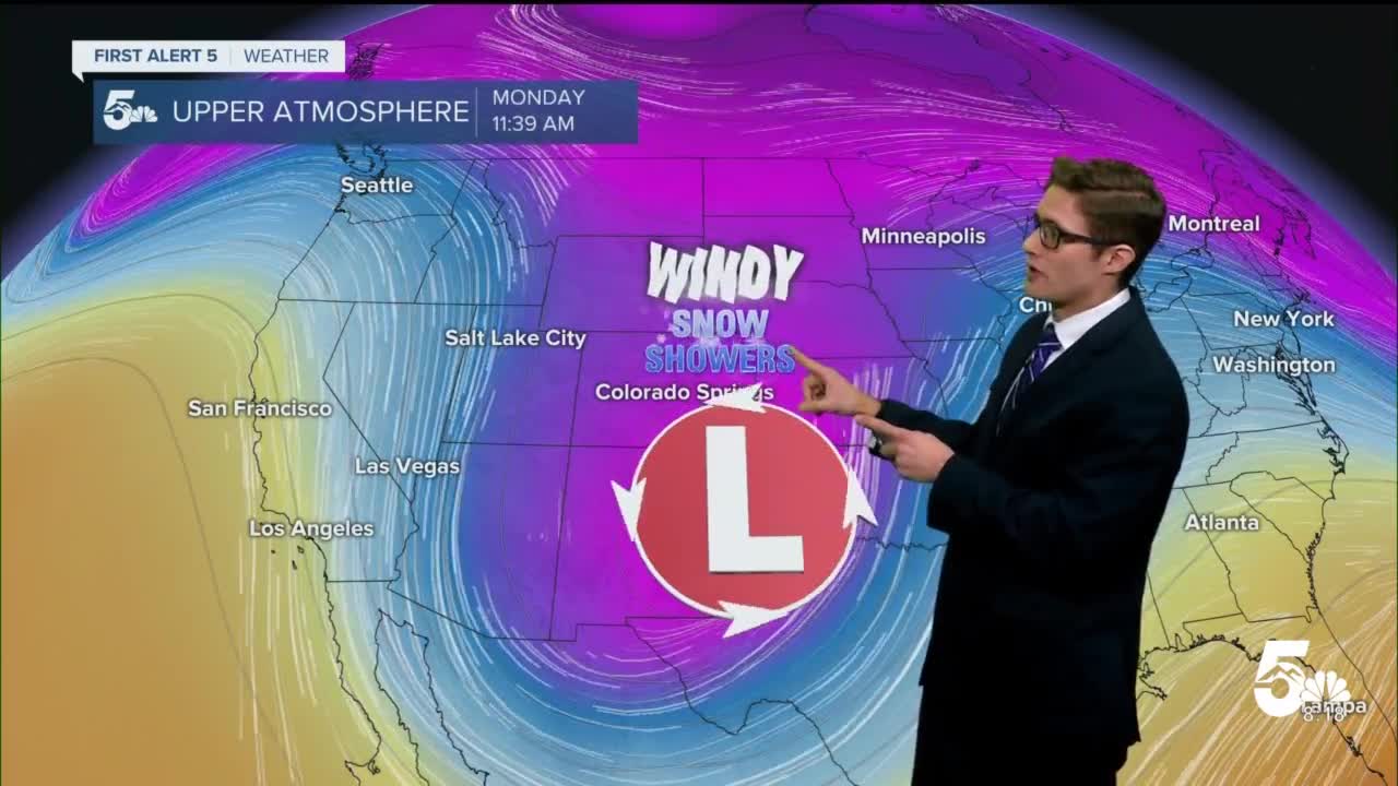
Our next winter system arrives Sunday into Monday. It will dive to the south, pulling moisture with it, before moving back toward us on Monday. The result will be very gusty winds on Monday, cold temperatures, as well as snow showers across the region. The best chance for significant snow will favor the southern tier, however snow showers will still be likely along the Front Range corridor due to upslope influences. In sum, Monday won't be a good outside day whether you see the snow, the wind, or both.
We'll get a break Tuesday and Wednesday, with Wednesday breezy due to mountain wave related downslope winds - which will also make Wednesday the mildest day of the week. Our active pattern resumes Thursday with another winter system disrupting your plans. An active pattern then continues into next weekend.
____
Curious about the First Alert 5 Weather Storm Impact Scale? Check out our cheatsheet explainer.
Watch KOAA News5 on your time, anytime with our free streaming app available for your Roku, FireTV, AppleTV and Android TV. Just search KOAA News5, download and start watching.
