


Tonight's Forecast:
Blizzard like conditions are expected to persist from northern El Paso County up the I-25 corridor to the Wyoming state line through very early Monday morning.
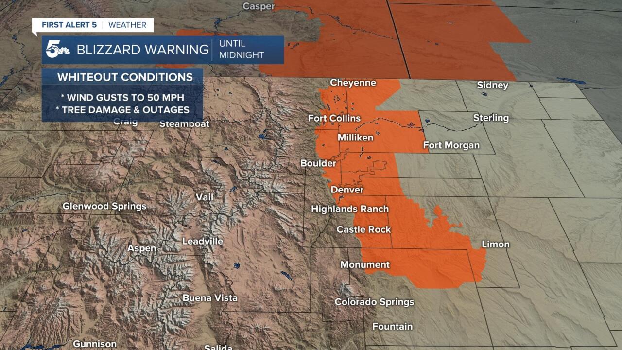
At the same time, a Winter Storm Warning will remain in effect until midnight for the rest of El Paso and Teller counties. With I-25 and many of the major highways shut down coming in and out of the Pikes Peak Region, we strongly urge that you stay home and safe, and do not attempt to drive in this weather. By Monday morning the snow will be gone, but for some areas, we could be left with an icy and snowy mess.

COLORADO SPRINGS: Low: 22; High: 41. Both the snow and super strong wind should taper off before midnight. By Monday morning, the big story will be what's leftover on the roadways and/or what ices over and how that affects the morning commute.
PUEBLO: Low: 24; High: 48. Dry, but gusty in Pueblo through midnight. Monday could be a little icy in the morning, but the afternoon should be nice and pleasant, with upper 40s for daytime highs.
CANON CITY: Low: 23; High: 47. Dry skies on Monday and a lot less windy for Fremont County. Under partly cloudy skies, highs will top out in the upper 40s.
WOODLAND PARK: Low: 10; High: 36. Most of the snow should clear out of Teller County by midnight, with a dry and chilly day to follow for the area on Monday.
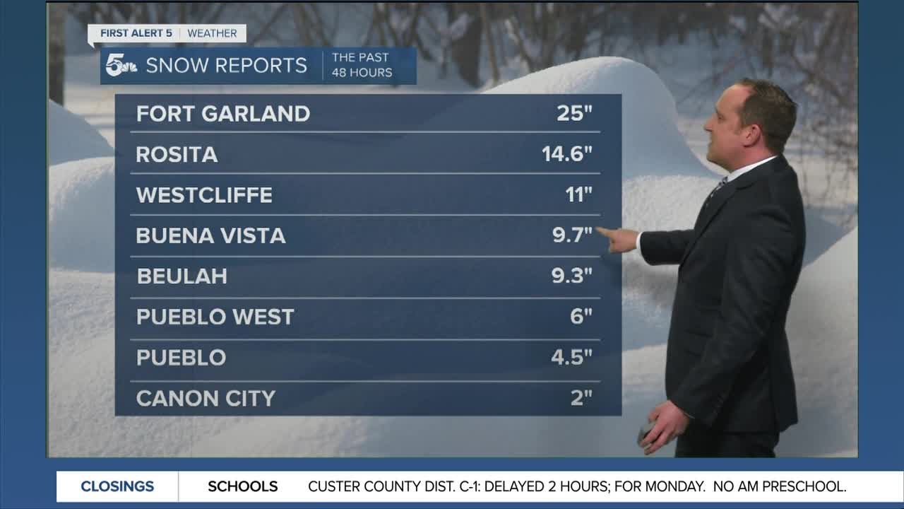
TRI-LAKES: Low: 10s; High: 30s. A Blizzard Warning should be allowed to expire at midnight, but the snow could linger a little past that. With 15-20" of snow reported from the storm, some treated roads may be passable by the morning. Others, not so much!
PLAINS: Low: 20s; High: 40s/50s. It will remain windy across the Plains through Monday morning, and as the storm pulls away, we could see light accumulations of snow of 1-2" in some spots.
WALSENBURG/TRINIDAD: Low: 10s; High: 40s/50s. Lingering snow showers and wind this evening will give way to a brighter and more mild day on Monday as the storm moves out of Southern Colorado.
MOUNTAINS: Low: 0s/10s; High: 20s/30s. A Winter Storm Warning is in effect for the mountains through 6 am Monday, with a few more inches of accumulation still possible before the storm moves on. The rest of the forecast will feature dry skies and sunshine for the first day of the week.
Extended Outlook:
After a brief period of dry weather, our next storm will spread moisture back into Southern Colorado beginning Tuesday afternoon. As the storm moves in, we should see a light accumulation of snowfall across the Pikes Peak Region, with a rain/snow mix from Canon City east to Pueblo and the Plains. The storm also looks windy, with strong gusts possible Tuesday night through Wednesday morning. Behind the storm, a big warm up will bring sunshine and above average temperatures as we head towards next weekend.
KOAA News5 on your time, streaming on your Roku, FireTV, AppleTV and AndroidTV.
News5 App | First Alert 5 Weather App | Youtube | Facebook | Instagram | Twitter
