


Tonight's Forecast:
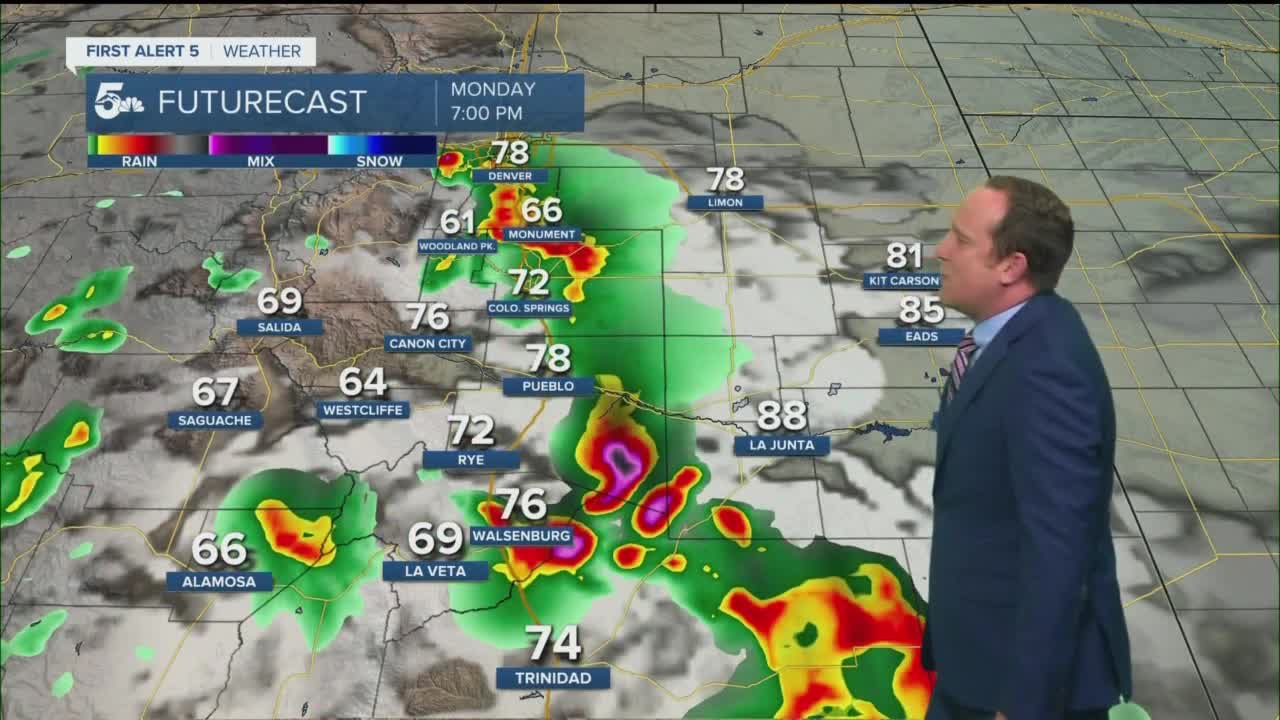
A line of storms over the mountains will move east into I-25 corridor and the northeast Plains of Colorado this evening, but with such dry air at the surface, we're looking at a better chance of wind producing storms than rain for the lower elevations. In the mountains, a small threat of flash flooding will continue through sunset for any recent burn scars.
After midnight, the rain should move out of our region, with dry skies expected by Monday morning.
Colorado Springs forecast: Low: 63; High: 84; A cold front will move through El Paso County Monday morning, and it will provide a nice cool down compared to the weekend as we shave off around 15 degrees from our daytime highs. With growing moisture and instability, rain and thunderstorms are likely across the Pikes Peak Region tomorrow afternoon and evening.
Pueblo forecast: Low: 65; High: 91; After a record-setting high of 107° on Sunday, a cold front Monday will offer up a nice amount of cooling as highs return to the lower 90s. By the afternoon, scattered showers and thunderstorms can be expected, some on the strong to severe side.
Canon City forecast: Low: 66; High: 89; A cooler, but much more unsettled start to the week for Fremont County, with afternoon and evening showers and thunderstorms likely to return to our forecast.
Woodland Park forecast: Low: 54; High: 75; A cooler, more comfortable start to the work week temperature wuse, but also much wetter as widespread showers and thunderstorms can be expected during the afternoon and early evening hours.
Tri-Lakes forecast: Low: 50s/60s; High: 70s/80s; After a hot, but calmer weekend, stormy skies will return this week as the monsoon flow pumps moisture back into Southern Colorado. Look for scattered showers and thunderstorms Monday afternoon and evening, with a repeat of this on Tuesday.
Plains forecast: Low: 60s; High: 90s; Thankfully we'll see a break from the triple digits on Monday. Late afternoon and evening showers and thunderstorms will be possible, with the potential for some storms to turn severe.
Walsenburg and Trinidad forecast: Low: 50s/60s; High: 80s/90s; After a relatively calm, but hot weekend, active weather is expected to return early this week to the southern I-25 corridor. Some storms on Monday could be on the strong to severe side.
Mountains forecast: Low: 40s/50s; High: 60s/70; A quiet start to what's expected to be a super stormy afternoon for the mountains and mountain valleys on Monday. If you're planning time in the high country, try to get that done before the storms begin to build by early afternoon.
Extended outlook forecast:
More widespread showers and thunderstorms can be expected through Tuesday before the monsoon moisture retreats back west towards the mountains on Wednesday. In the high country, daily afternoon storm chances will continue throughout the work week and into next weekend. For the I-25 corridor and Plains, we should be drier for a least a few days, and hotter as high pressure expands back into Southern Colorado. Highs late this week will be quite hot, but not as toasty as what we saw this past weekend.
____
Curious about the First Alert 5 Weather Storm Impact Scale? Check out our cheatsheet explainer.
Watch KOAA News5 on your time, anytime with our free streaming app available for your Roku, FireTV, AppleTV and Android TV. Just search KOAA News5, download and start watching.
