


COLORADO SPRINGS, Colo. (KOAA) — Today’s Forecast:
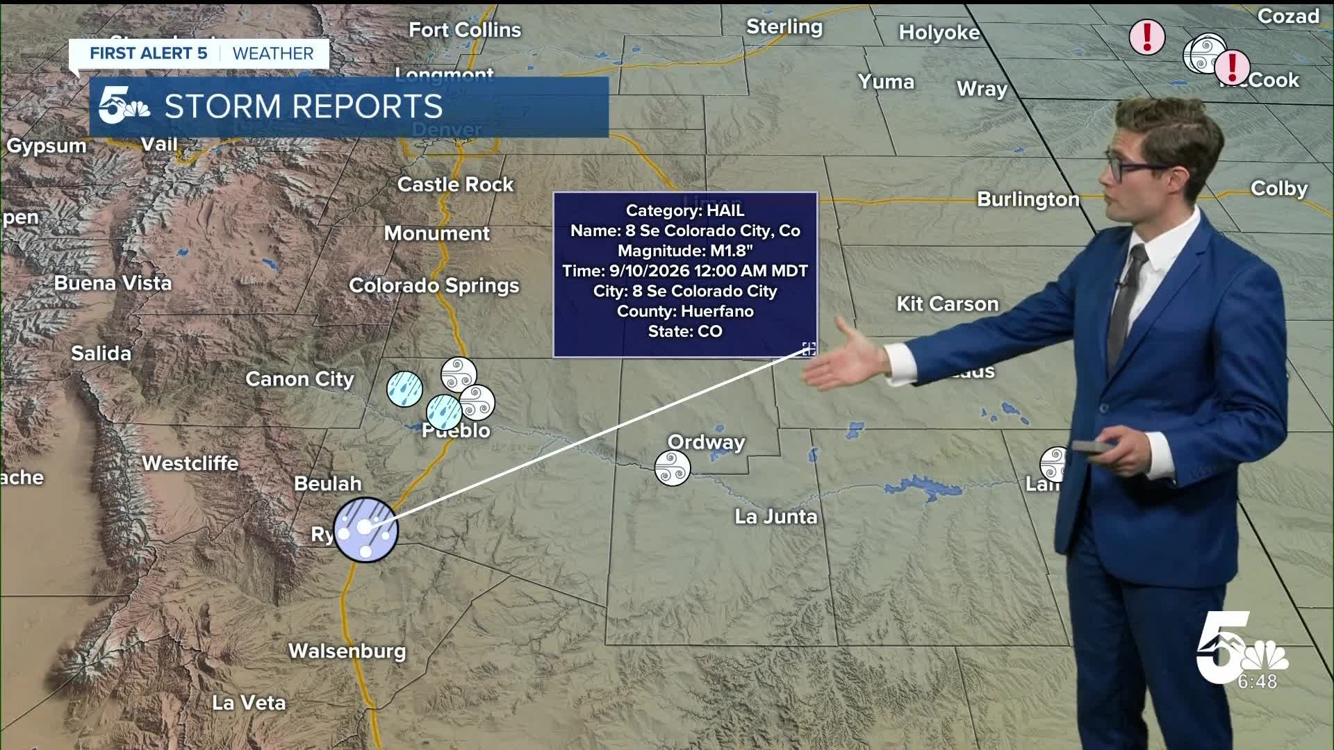
It was active overnight in southern Colorado with a front pushing north from New Mexico and sparking off a complex of storms along the U.S. 50 corridor overnight. Some of these storms produced hail and strong wind, atypical overnight in our area. But, a good drink of water for our friends south of La Junta and Lamar, where radar estimated rainfall totals of 2-3"+ of rainfall fell.
Today, as Meteorologist Alan Rose likes to say, the "Big Blue H" - high pressure - becomes more dominant again, with northwesterly dry air flow in the mid atmosphere leading to much drier conditions statewide.
Expect decreasing clouds this morning and a beautiful September day. Morning temperatures in the 60s climb to the 80s this afternoon across most of the I-25 corridor. You'll notice an upslope breeze develop during the evening rush hour east of the Front Range with some 15-20 mph gusts...noticeable but not impactful.
Colorado Springs forecast: High: 83; Low: 55.
Mostly sunny, crisp, and dry following the sporadic and mostly east of town activity last night. It'll be breezy east of I-25 this afternoon with southeasterly winds at 10-15 mph with a few 20 mph gusts sprinkled in. Overall - nice.
Pueblo forecast: High: 86; Low: 57.
Decreasing clouds and quickly becoming mostly sunny and remaining that way for most of the day. A few late afternoon high clouds are the only break in an otherwise bluebird sky day. Southeasterly afternoon breezes that will eventually ramp to 10-15 mph in the PM commute period.
Canon City forecast: High: 85; Low: 59.
Sunny and pleasant with southeasterly winds this afternoon that should remain light. But the wind direction is important in keeping temperatures down today. Generally with upslope flow you're slightly cooler than Pueblo. With downslope, you're often slightly warmer.
Woodland Park forecast: High: 77; Low: 48.
Sunny, crisp, quiet - hard to ask for much more from a September day. A light south afternoon breeze with a few late afternoon and evening clouds on an otherwise dry day.
Tri-Lakes forecast: High: 70s; Low: 50s.
Mostly sunny - get outside and enjoy the beautiful day! It won't be particularly breezy, with a light south wind...all around a top tier September day.
Plains forecast: High: 80s; Low: 50s.
Mostly sunny, a stray PM storm south - mainly initiating over the Raton Mesa and progressing through Las Animas county. The rest of the plains should stay dry and activity should be limited.
Walsenburg and Trinidad forecast: High: 81/84; Low: 56/55.
Mostly sunny this morning, patchy clouds in the PM that may try to build up, but a mid-level cap in the atmosphere will literally try to keep a lid on any actual storm chances. In short, a nice day.
Mountains forecast: High: 70s; Low: 50s.
A perfect fall day. Winds should be pretty light...westerly winds in the mid-levels, which you would notice if you're above about 13,000 feet, and easterly to southeasterly upslope flow in the low levels. Mostly clear this morning, an isolated PM storm in the Sangres.
Extended outlook forecast:
We warm up further on Friday with fairly zonal (west-to-east) airflow and partly cloudy skies. Highs will be about 5-10 degrees above average. Here in the mid-latitudes, our weather is defined by clashes between the cold air to our north, and warm air to our south. That fuels most of our storm systems. In the summer, the heat typically wins and we see a bit less variability. September is when the jet stream "wakes up" again, and that's what your seeing in the extended forecast.
Our next disturbance will graze the area Saturday leading to minor cooling and closer to average highs. We stay mainly dry, with isolated afternoon high summit showers and storms.
On Sunday, the high shifts east, and subtropical moisture will increase around it. Isolated high-country storms will be possible in the afternoon once again and it will be hot again. The increased moisture could also lead to a couple storms over the Palmer Divide.
From Monday through Wednesday next week, the high will continue to nose east and combine with another area of high pressure over the gulf. Moisture will remain plentiful across the state. As a result, we'll see at least some chance of PM thunderstorms each day.
____
Curious about the First Alert 5 Weather Storm Impact Scale? Check out our cheatsheet explainer.
Watch KOAA News5 on your time, anytime with our free streaming app available for your Roku, FireTV, AppleTV and Android TV. Just search KOAA News5, download and start watching.
