

Today’s Forecast:
A truly beautiful weekend is in store across Colorado - the type of conditions that make it hard to not want to go outside. We've had plenty of sunny and mild to warm days in the last few months, but rarely without a significant amount of wind. This weekend you'll get to enjoy highs in the 60s & 70s in southern Colorado, full sunshine, and light winds today (a bit breezier tomorrow...more on that in a minute).
Lows overnight did drop into the 20s and teens for many spots - which is a good reminder that we're not yet through the climatological period in which we typically see freezing low temperatures! If you've been thinking about de-winterizing your sprinklers due to the warmth and lack of precipitation...don't. On average, the last freeze in Colorado Springs is in early May. It's in mid-April in Pueblo.
Today's UV index peaks between 8-9, so although you'll enjoy classic spring weather...don't forget the sunscreen. With a UV index of 8, average skin burn times are between 15-30 minutes. It won't feel like summer - but you can still end up looking like a roasted tomato if you forget it!
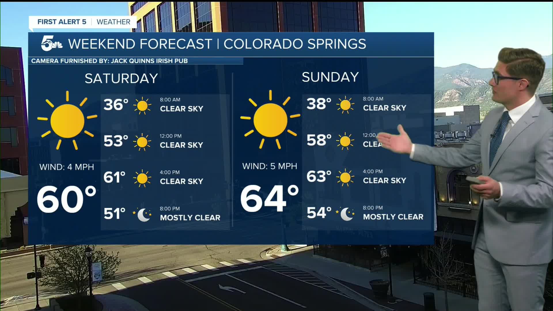
Colorado Springs forecast: High: 60; Low: 31.
Sunny - arguably the nicest weekend weather so far this year as winds stay very light. Winds shift from north to southeast from morning to afternoon, remaining in the 5-10 mph range.
Pueblo forecast: High: 65; Low: 30.
Sunny and comfortable - hard to write much beyond that. Southeast winds, 5-10 mph or less, really beautiful conditions.
Canon City forecast: High: 64; Low: 33.
Sunny, bright, dry, and comfortably warm. Variable wind that will eventually turn east at 5-10 mph.
Woodland Park forecast: High: 55; Low: 27.
Sunny and tranquil. Northwest winds at 5-15 mph.
Tri-Lakes forecast: High: 50s; Low: 20s.
Sunny with north winds, generally less than 10 mph. Be prepared for some muddy patches in shaded zones on trails west of I-25 such as Raspberry Mountain.
Plains forecast: High: 60s; Low: 30s/20s.
Sunny and comfortable. Northwest/north winds at 5-10 mph.
Walsenburg and Trinidad forecast: High: 62/64; Low: 31/29.
Sunny with light winds from the west in the AM, east in the PM.
Mountains forecast: High: 40s/50s; Low: 20s/30s.
Sunny with relatively light winds - variable in the AM, east in the PM.
Extended outlook forecast:
It will be a bit breezier on Sunday with upslope return flow in place. Practically speaking though, Easter Sunday is nice once again. If you are attending a service in the morning, it will be fairly chilly with temperatures in the 30s early on the plains, but it will be sunny and the wind will be light. In the afternoon, highs will warm to the mid-60s to low 70s, again with full sunshine. While sustained winds will remain weak between 5-10 mph from the southeast, gusts of 20-25 mph will occasionally mix in during the afternoon. You're most likely to feel those if you're over the Palmer Divide or up in the mountain areas west of I-25.
On Monday, skies will be partly cloudy as our ridge of high pressure flattens and temperatures will be a bit warmer. A few afternoon showers are possible in the mountains and foothills, including in Woodland Park. A cold front will brush the region early Tuesday and provide upslope flow. At the same time, an upper level system will move overhead from the west, and moisture will stream in from the south. The blend of conditions will provide support for showers on Tuesday, with some rumbles of thunder possible. The storms start in the mountains and then will move off into the plains. Temperatures will be slightly cooler than Monday but still in the 60s/70s.
Wednesday will be breezy with elevated fire potential - and quite warm, more typical of the setups we've seen over the last seveal weeks.
A cold front arriving early Thursday will provide more upslope flow, and another chance for showers and thunderstorms. These chances continue on Friday.
____
Curious about the First Alert 5 Weather Storm Impact Scale? Check out our cheatsheet explainer.
Watch KOAA News5 on your time, anytime with our free streaming app available for your Roku, FireTV, AppleTV and Android TV. Just search KOAA News5, download and start watching.
