



Today’s Forecast:
After record breaking heat on Monday, we're tracking some big changes on Tuesday thanks to the passage of a potent, early morning cold front. Behind the front, the wind has been gusty early this morning, with 30-40 mph wind gusts noted in Colorado Springs, Pueblo, and across the eastern Plains. These stronger gusts should weaken between now and the lunch hour.
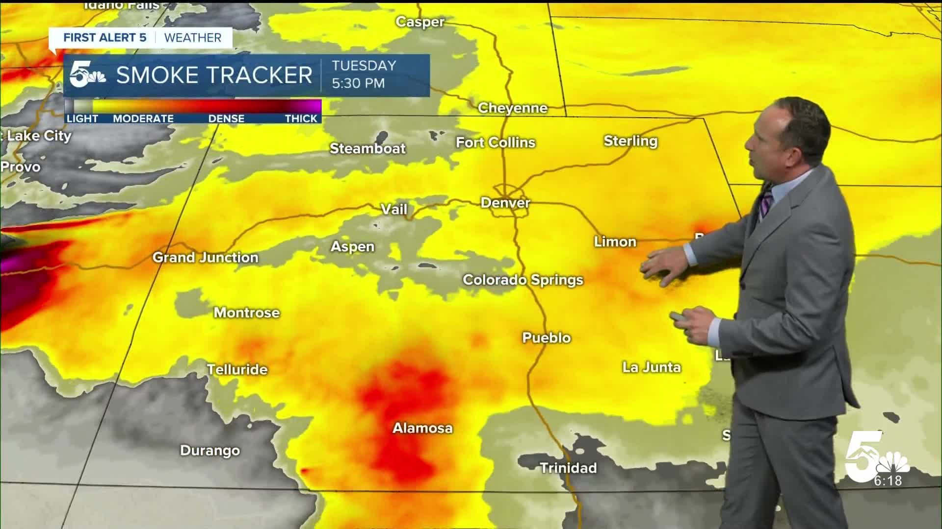
The northerly flow has also pushed away some of the thicker smoke that we saw on Monday. This smoke is not coming from fires burning in our state, but rather from larger fires burning in Utah, Washington and the western U.S.
This afternoon, we're also looking at the potential for scattered showers and thunderstorms. Outdoor plans could be impacted between 2-6 pm. If heavier rain impacts the Aspen Acres burn scar today (it's possible), there could be some issues, especially if stronger storms impact flood prone areas within the burn scar.
Colorado Springs forecast: High: 80; Low: 55. After a near record-breaking high of 98 degrees on Monday, highs today will be considerably cooler, topping out near 80 degrees. Scattered showers and thunderstorms will be possible this afternoon, mainly between 2-6 pm.
Pueblo forecast: High: 85; Low: 55. After hitting 107 yesterday in Pueblo, temperatures today will be more than 20 degrees cooler. Our high in the middle 80s will be our coolest day since mid June.
Canon City forecast: High: 84; Low: 61. From triple digits on Monday to 80s today, I like to call this a case of "weather whiplash", and it's going to nice! On top of the cool down, scattered thunderstorms will be possible this afternoon.
Woodland Park forecast: High: 75; Low: 49. Cooler, with less smoke in Teller County on Tuesday, and a better chance for afternoon showers and thunderstorms.
Tri-Lakes forecast: High: 70s; Low: 50s. A much appreciated cool down will be realized today as we swap out yesterday's 90s for highs in the 70s. On top of the cool down, scattered showers and thunderstorms will be possible this afternoon.
Plains forecast: High: 70s/80s; Low: 50s/60s. A HUGE cool down is expected today on the Plains, with temperatures more than 20-30 degrees cooler than yesterday. The wind that we're seeing this morning should die down towards the lunch hour, with only a slight chance of thunderstorms this afternoon.
Walsenburg and Trinidad forecast: High: 70s/80s; Low: 50s/60s. Hazy skies and cooler temperatures will make for a much better Tuesday across the southern I-25 corridor. This afternoon, there could be a few thunderstorms that pop up across the southern I-25 corridor.
Mountains forecast: High: 60s/70s; Low: 40s. Thunderstorm development will be slightly better today before dropping out late this week. With the potential for stronger storms and heavier downpours in the Aspen Acres burn scar, flash flooding may become a concern.
Extended outlook forecast:
We will continue to see hazy skies on Wednesday, with areas of smoke still possible across Southern Colorado and the Pikes Peak Region. As drier air moves into the state in the mid-week period, we'll see a mostly sunny to partly cloudy day in Colorado Springs, with a near average high in the mid 80s.
Highs in the 90s will return late this week. By the weekend, daytime highs will soar back towards the upper 90s in Colorado Springs and triple digits in Pueblo, putting heat records at risk once again across Southern Colorado.
____
Curious about the First Alert 5 Weather Storm Impact Scale? Check out our cheatsheet explainer.
Watch KOAA News5 on your time, anytime with our free streaming app available for your Roku, FireTV, AppleTV and Android TV. Just search KOAA News5, download and start watching.
