

Tonight's Forecast:
After red flag warnings expire tonight at 9 pm, humidity will rise, and winds will ease up. Temperatures will be chilly tonight.
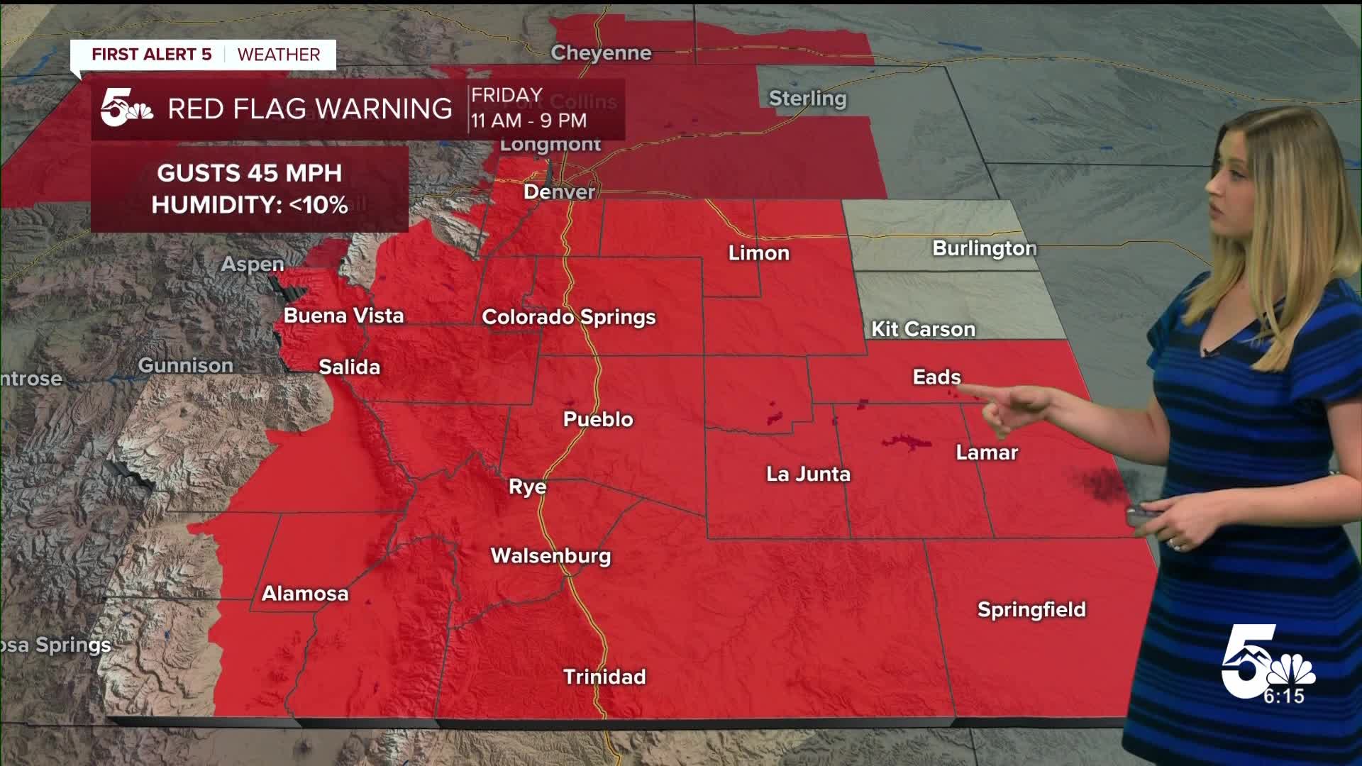
Friday Fire Danger:
Unfortunately, the humidity will rapidly fall again on Friday afternoon to less than 10% for much of the region. Plus, the wind will pick up, gusting 25-45 mph. Another RED FLAG WARNING will be in effect from 11 am until 9 pm.

Colorado Springs forecast: Low: 35; High: 70;
RED FLAG WARNING 11 am until 9 pm. It will be mostly sunny with dry conditions. Wind will be out of the WSW at 10 mph gusting to 30 mph.
Pueblo forecast: Low: 33; High: 76;
RED FLAG WARNING 11 am until 9 pm. It will be dry and gusty on Friday with WSW wind at 10 mph gusting to 30 mph.
Canon City forecast: Low: 37; High: 73;
RED FLAG WARNING 11 am until 9 pm. Another day and gusty day on Friday with W wind at 10-15 mph gusting to 35 mph.
Woodland Park forecast: Low: 28; High: 60;
RED FLAG WARNING 11 am until 9 pm. Remaining dry and gusty on Friday with W wind at 15 mph gusting to 40 mph.
Tri-Lakes forecast: Low: 31; High: 65;
RED FLAG WARNING 11 am until 9 pm. It will be dry and breezy on Friday with WSW wind at 10 mph gusting to 30 mph.
Plains forecast: Low: 30s; High: 70s;
RED FLAG WARNING 11 am until 9 pm. Humidity will drop, and wind will increase on Friday afternoon, coming from the WSW at 10 mph gusting 25-35 mph.
Walsenburg and Trinidad forecast: Low: 32/34; High: 71/73;
RED FLAG WARNING 11 am until 9 pm. Another dry and gusty day is expected on Friday with W wind at 10-15 mph gusting to 30 mph.
Mountains forecast: Low: 20s-30s; High: 60s;
RED FLAG WARNING 11 am until 9 pm. It will be dry and windy on Friday with W wind at 10-20 mph gusting 30-45 mph.
Extended outlook forecast:
Humidity increases over the weekend, which thankfully decreases the fire danger. A stray sprinkle or spotty shower is possible on Saturday, west of and up to I-25. On Sunday afternoon, there is a better chance of an afternoon/evening shower or thunderstorm making it to the plains.
On Monday, we could also see an isolated afternoon shower or thunderstorm in the region.
We are keeping a close eye on the middle of next week, from Wednesday into Thursday. We are seeing early signs of a large-scale weather system set to impact Colorado. This would bring beneficial moisture with its current track! Stay tuned as the forecast gains confidence in the days to come.
____
Curious about the First Alert 5 Weather Storm Impact Scale? Check out our cheatsheet explainer.
Watch KOAA News5 on your time, anytime with our free streaming app available for your Roku, FireTV, AppleTV and Android TV. Just search KOAA News5, download and start watching.
