

Today’s Forecast:
It's last week's heat wave sequel as a large ridge of high pressure returns to the southwestern U.S., bringing us more record heat. While the calendar may say March, it will again feel like June today. On Saturday, we set all-time March high temperature records across Southern Colorado. Today, we will again challenge all-time records in some areas. We're also tracking gustier conditions in some areas.
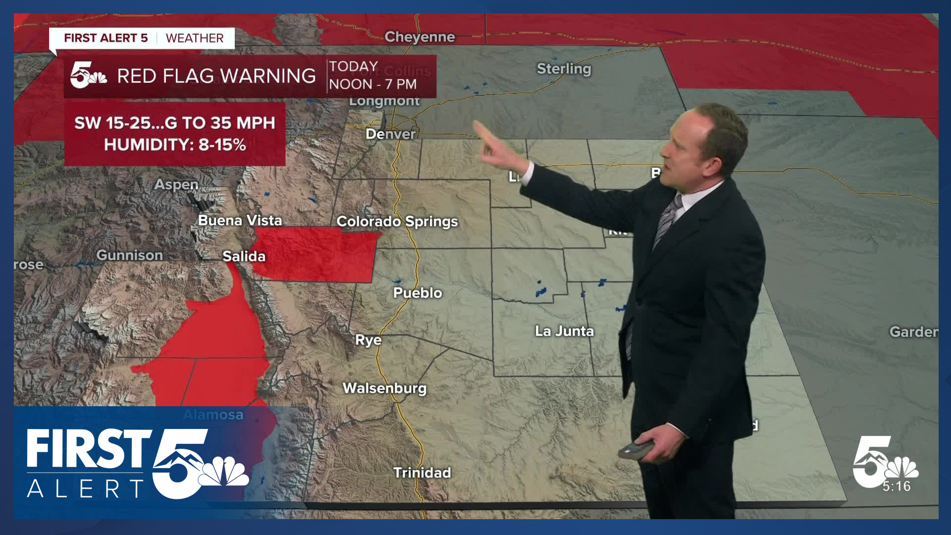
With today's heat, as we've seen over the last few weeks, fire danger will be elevated. Red Flag Warnings are in place today in Fremont County and the San Luis Valley. But it's important to avoid outdoor burning across Southern Colorado and be mindful of anything that could produce a spark.
There may be a few elevated showers that evaporate into dry air this evening that develop in the Front Range mountains and then drift eastward to the plains, which will lead to pockets of gusty wind during the dinner time hours. Lows tonight will remain very mild once again.
Colorado Springs forecast: High: 86; Low: 53. After setting the all-time March record high on Saturday at 86 degrees, it's possible that we could tie that record once again this afternoon. Today's daily record is 75 degrees, last set in 2012.
Pueblo forecast: High: 91; Low: 48. After breaking the all-time March record this past Saturday at 93 degrees, we are expecting to make another run at that record today, topping out at 91 degrees. Today's daily record is 81 degrees, set at 2004.
Canon City forecast: High: 89; Low: 55. Record-breaking heat and high fire danger will return on Wednesday to Fremont County, where a Red Flag Warning will be in effect today from noon to 7 pm.
Woodland Park forecast: High: 77; Low: 46. Unbelievable March heat will return to Teller County on Wednesday, with our high this afternoon soaring into the upper 70s. That's more than 30 degrees above average for this time of the year!
Tri-Lakes forecast: High: 80s; Low: 50s. Our latest heat wave, the second of the month, will deliver another round of sizzling March warmth to northern El Paso County on Wednesday. Highs today will warm into the 80s. The average high this time of the year is around 51-52 degrees.
Plains forecast: High: 80s/90s; Low: 40s/50s. Hot, summer-like temperatures will be widespread across the Plains on Wednesday, with today's highs soaring into the upper 80s and 90s.
Walsenburg and Trinidad forecast: High: 80s; Low: 40s/50s. Hot, dry and breezy on Wednesday, with highs this afternoon warming well into the 80s. Tomorrow's highs will be similar to today.
Mountains forecast: High: 60s/70S; Low: 40s/50s. What little snow is leftover in the southeastern mountains after last week's heat wave will melt further today as highs soar into the 60s and 70s. A few isolated showers will be possible this afternoon, but most look to generate wind over precipitation due to dry air at the surface.
Extended outlook forecast:
Fire Weather Watches will be widespread on Thursday. It will be breezy to gusty across Southern Colorado, and hot in the first half of the day. Highs once again Thursday will run 25+ degrees above average, with temperatures soaring into the 80s and lower 90s. Records are likely to fall once again.
A cold front will arrive on Thursday afternoon. Behind the front, upper level energy arrives out of the southwest providing a low chance of showers on Thursday night with the best chances close to and in the mountains. That chance continues into Friday morning - if you see anything, impacts will be low. Temperatures are much colder Friday behind the front only topping out in the 40s and lower 50s on the Plains. Fog is likely over the Palmer Divide and into portions of El Paso County Friday morning due to upslope flow.
Friday's cool down will be short lived, as we return to the 70s and 80s Saturday through Monday. A few mountain showers are possible in the afternoons on Sunday and Monday, with a small chance of rain closer to I-25.
____
Curious about the First Alert 5 Weather Storm Impact Scale? Check out our cheatsheet explainer.
Watch KOAA News5 on your time, anytime with our free streaming app available for your Roku, FireTV, AppleTV and Android TV. Just search KOAA News5, download and start watching.
