



Today’s Forecast:
Grab an umbrella before heading out the door today as calm skies this morning will give way to numerous showers and thunderstorms this afternoon and evening. Compliments of the monsoon, showers and thunderstorms will form by early afternoon in the mountains, valleys and Pikes Peak Region. Some storms will continue on the Plains past midnight and into early Saturday morning.
Although the best chance for heavier rain today will push north of Highway 50, all it takes is one good downpour on a fresh burn scar to lead to flash flooding. The National Weather Service sees this potential and has issued another Flash Flood Watch today in the Aspen Acres burn scar.
Other threats on Friday will include 1" hail and 60 mph wind gusts as the Storm Prediction Center has much of Southern Colorado back under a Marginal Risk (1/5) of severe weather this afternoon.
Colorado Springs forecast: High: 84; Low: 58. Skies will be most unsettled in the Pikes Peak Region between 3-9 pm, and storm risks today could include 1" hail, strong wind gusts, frequent lightning and heavy rainfall.
Pueblo forecast: High: 88; Low: 61. Our weather this week went from extreme heat to unsettled skies, and today's forecast will lean into additional threats of strong to severe thunderstorms. Keep an eye on the sky anytime after 3 pm for thunderstorms.
Canon City forecast: High: 86; Low: 61. Dry skies and sunshine early will give way to another unsettled afternoon as scattered showers and thunderstorms return to our forecast.
Woodland Park forecast: High: 75; Low: 52. Plan for outdoor activities this morning in Teller County. Buy as early as 12-1 pm, storms will begin to pulse up in Teller County, with multiple rounds of rain possible through this evening.
Tri-Lakes forecast: High: 70s/80s; Low: 50s. Don't forget the rain gear this morning, because if you're outside this afternoon in northern El Paso County, there's a pretty good chance that you will get wet. Storms will be capable of gusty winds, hail and heavy rain.
Plains forecast: High: 80s/90s; Low: 50s/60s. Storms will east into the Plains late this afternoon and evening, and could continue past midnight in the eastern counties. Severe threats will be low, but still possible, with 1" hail, 60 mph gusts, and heavy rain the main threats.
Walsenburg and Trinidad forecast: High: 80s/90s; Low: 50s/60s. Rain chances will be up around 50% today from just south of Highway 50 to the Raton Mesa. Storms will wind down this evening after sunset as storms push east into the Plains.
Mountains forecast: High: 60s/70s; Low: 40s/50s. Monsoonal moisture will continue to bring beneficial moisture into the state on Fridya, with the heaviest rain today east of the Continental Divide. Storms could pulse up as early as 12-1 pm in the high country. A FLASH FLOOD WATCH will remain in effect today from noon to 8 pm for the Aspen Acres burn scar.
Extended outlook forecast:
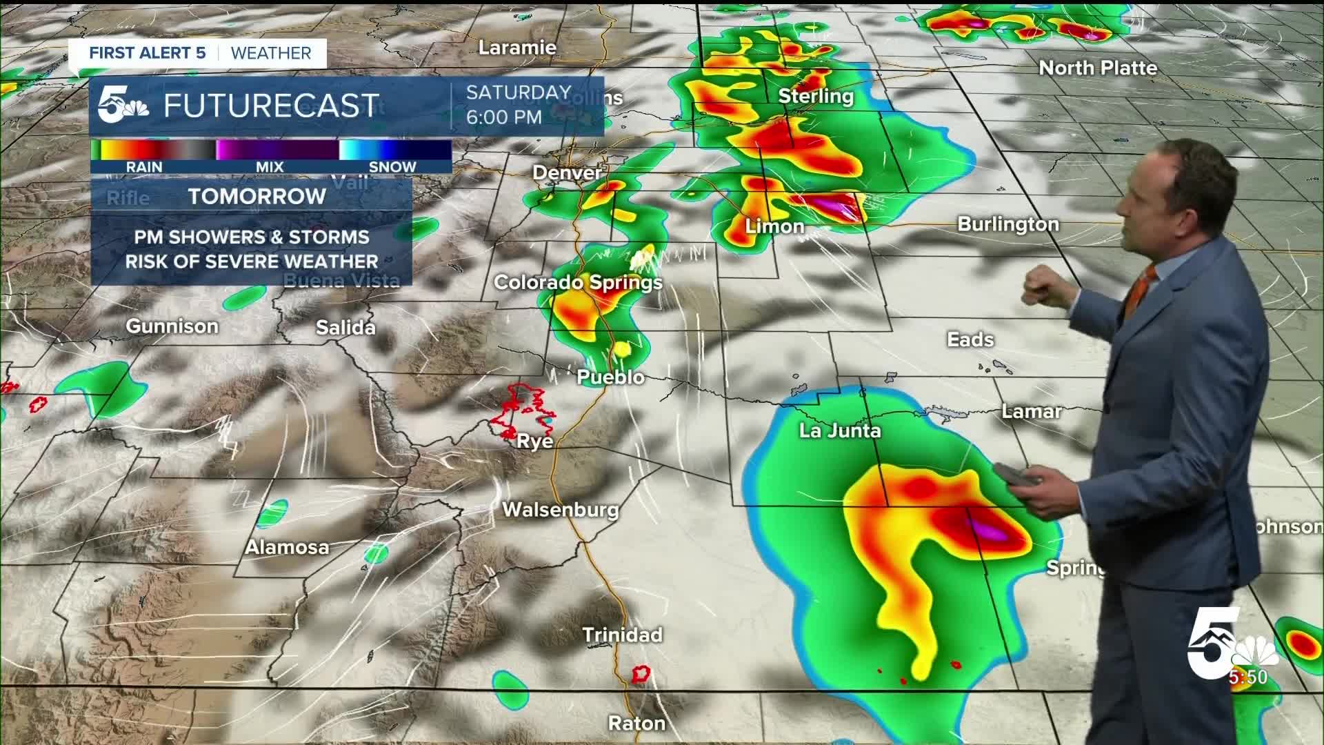
The surge of monsoon moisture will remain active into the weekend, and our afternoons could be quite stormy. A stronger disturbance will increase the threat of severe weather on Saturday in the Pikes Peak Region, with large hail and damaging wind gusts possible. Our high on Saturday will warm into the lower 80s.
Storms on Sunday look wetter, with an ongoing threat of heavy rain and flooding from the Pikes Peak Region to the Aspen Acres burn scar. Sunday will be our coolest day of the next 7, with a high of 79 degrees in Colorado Springs.
Lingering moisture Monday will allow for additional chances for afternoon thunderstorms ahead of a drier and hotter day on Tuesday.
____
Curious about the First Alert 5 Weather Storm Impact Scale? Check out our cheatsheet explainer.
Watch KOAA News5 on your time, anytime with our free streaming app available for your Roku, FireTV, AppleTV and Android TV. Just search KOAA News5, download and start watching.
