

Today’s Forecast:
Our spring storm is currently impacting the Pikes Peak Region and parts of Southern Colorado this morning. Winter Storm Warnings and Winter Weather Advisories are in place across the mountains and higher elevation zones of Southern Colorado. A Winter Storm Warning is in effect through Midnight in Teller County, and until 6:00 PM in N. El Paso County.
ROAD CONDITIONS
Per CDOT: I-25 northbound: Two left lanes closed. Between CO 105 and Exit 163: County Line Road (Woodmoor) at Mile Point 162.
According to News5 Meteorologist Casey Dorn, who is out across Colorado Springs this morning, he is primarily seeing wet roads, there are icy patches, but so far, no snow is sticking to the roads. Take a look at the conditions in the video player below.
WEATHER BLOG
5:30 A.M. Updates: Snow impacts will be greatest this morning, particularly over the Palmer Divide, into Teller County, and the southern mountains. You can expect visibility impacts at times across the Pikes Peak Region as a whole, with snow rates occasionally reaching 1" per hour. The roads will generally stay clear in town, becoming snow-covered above 6500-7000 feet. Grassy surfaces and roofs will accumulate snow within Colorado Springs. This afternoon, northerly air flow will cut off the snow tap.
Highs today will be above freezing across most of the Pikes Peak Region.
A Freeze Warning is in effect tonight for El Paso County - and most of Southern Colorado - from midnight - 8 AM. Temperatures will fall to the 10s and 20s behind this system.
Colorado Springs forecast: High: 39; Low: 25. Mother Nature's taste of winter will be felt this morning across the Pikes Peak Region, with snow this morning giving way to clearing skies late this afternoon and evening. Additional snow amounts of 1-4" will be possible today.
Pueblo forecast: High: 43; Low: 24. This morning with colder air in place will be our best chances for snow, with accumulations up to 1" on some grassy surfaces. Roads should stay wet, but expect commute times to be slower than usual. A changeover to rain this afternoon will be followed by a hard freeze later tonight.
Canon City forecast: High: 42; Low: 27. Snow and rain showers this morning will give way to mostly rain this afternoon before the storm moves out of Colorado this evening. Snow totals from a trace to 2" in eastern Fremont County.
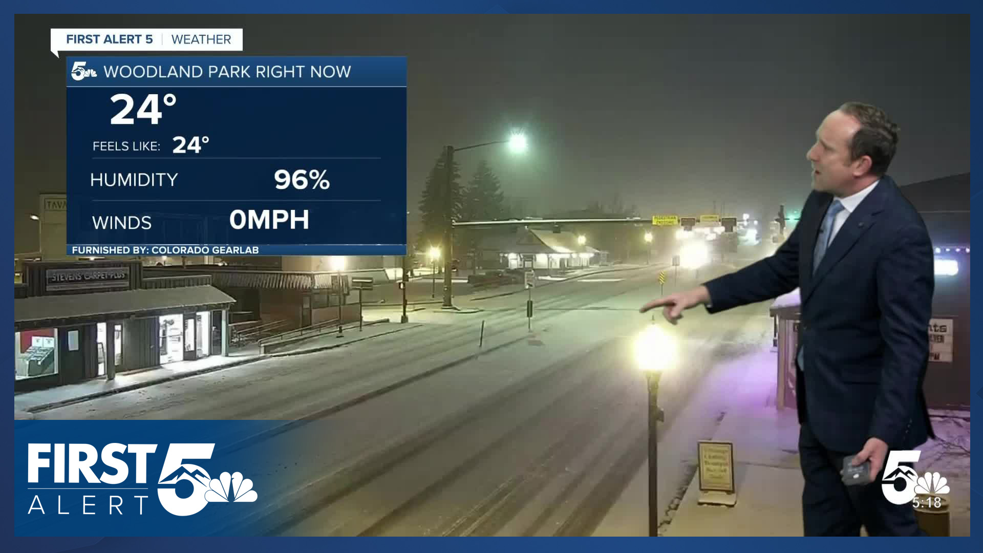
Woodland Park forecast: High: 32; Low: 18. Cold, with periods of an snow this morning and breezy to gusty N/NE winds. Additional snow amounts of 2-4" will be possible through this afternoon, with snow tapering off this evening. WINTER STORM WARNING will remain in effect until midnight tonight.
Tri-Lakes forecast: High: 30s; Low: 20s. It has been a snowy start to our Wednesday, with periods of snow expected to continue through the afternoon hours. Additional snow totals of 2-4" will be possible throughout the day. A WINTER STORM WARNING will remain in effect until midnight tonight.
Plains forecast: High: 30s/40s; Low: 20s. Snow showers this morning could be heavy at times along and south of the Arkansas River Valley, with some models showing some isolated 2-5" totals in Las Animas and Otero counties. A changeover to rain is likely this afternoon as temperatures warm into the 40s.
Walsenburg and Trinidad forecast: High: 30s/40s; Low: 10s/20s. Snow will increase this morning, with periods of heavy snow possible at times through the afternoon to early evening hours. Snow totals of 2-5" for parts of Huerfano County, with lesser amounts for Trinidad.
Mountains forecast: High: 20s/30s; Low: 10s. Our mountain zones will remain under WINTER STORM WARNINGS and WINTER WEATHER ADVISORIES until midnight tonight. Travel into and out of the high country today will be hazardous. Expect slower than normal travel times over high mountain passes.
Extended outlook forecast:
WATCH LIVE COVERAGE
Track this storm through the morning, including snow totals and updated forecasts, on the First Alert 5 Weather stream, which can be viewed on the KOAA News5 app for your Roku, FireTV, AppleTV or AndroidTV.
RADAR
Resources:
- Get your latest First Alert 5 Weather Forecast
- Find the current school closing and delay list
- Keep track of flight delays at Denver International Airport or the Colorado Springs Airport
- Watch KOAA News5 LIVE newscasts and updated content throughout the day in your browser, the News5 App, or your favorite streaming device.
- Download the free News5 App for your iOS or Android device to get the latest headlines and news across Colorado.
- Download the free First Alert 5 Weather App for your iOS or Android device to get the latest headlines and news across Colorado.
- You can find us on social media with KOAA on Youtube, Facebook, Instagram, and Twitter
____
Curious about the First Alert 5 Weather Storm Impact Scale? Check out our cheatsheet explainer.
Watch KOAA News5 on your time, anytime with our free streaming app available for your Roku, FireTV, AppleTV and Android TV. Just search KOAA News5, download and start watching.