

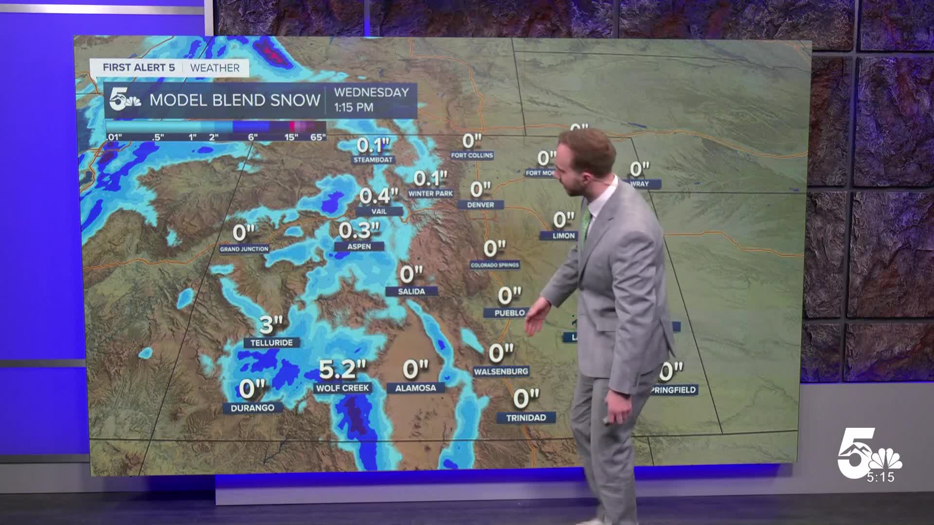

Tonight's Forecast: A quick-moving storm system will cross Colorado tonight, bringing mountain snow showers and gusty winds across the region. Winds will peak before midnight with gusts reaching 45 to 50 mph in spots, especially out toward the Kansas border and across the San Luis Valley. While the southwest mountains pick up a few inches of snow, lower elevations will remain dry. Overnight lows will fall into the 20s and 30s across the plains, with teens and 20s in the high country.
Tomorrow's Forecast: The storm system exits quickly to the east on Wednesday, bringing mountain snow showers to an early end and allowing winds to gradually calm down. Slightly cooler air settles in behind the system, trimming afternoon temperatures down by a few degrees. Even so, conditions stay bright and pleasant with highs reaching the low to mid-60s across the plains and the 40s and 50s in the valleys.
Colorado Springs forecast: Low: 31; High: 56; Gusty winds will peak before midnight before gradually easing toward morning as skies partially clear. Lows will drop to around freezing overnight. Wednesday brings plenty of sunshine, lighter breezes, and comfortable afternoon highs in the mid 50s.
Pueblo forecast: Low: 37; High: 60; Breezy evening winds will calm down overnight under partly cloudy skies, with temperatures dipping into the mid-30s. Wednesday will be bright, dry, and mild with afternoon highs climbing into the low-60s.
Canon City forecast: Low: 34; High: 64; Expect a breezy evening before winds taper off overnight and lows fall into the mid-30s. Sunshine dominates on Wednesday with pleasant afternoon temperatures reaching the upper 50s.
Woodland Park forecast: Low: 29; High: 44; Gusty winds and passing clouds will move through Teller County tonight, with chilly overnight lows dropping into the mid 20s. Skies clear out for a bright, crisp Wednesday with afternoon highs reaching the mid 40s.
Extended outlook forecast: A brief break in the weather arrives Thursday before another gusty mountain snow system moves in to end the workweek.
Thursday: Mild and dry conditions return with decreasing cloud cover and lighter winds. Highs will reach the 50s and 60s across most of Southern Colorado.
Friday – Saturday: Another storm system moves in late Thursday night and lasts into Saturday, bringing 3 to 6 inches of snow to the San Juan Mountains and gusty winds across the region. Lower elevations will stay mostly dry, though noticeably cooler air moves in by the weekend. There is a very slim chance of a few flakes across the high country and western part of the Spring. It will all depend on the storm track. Right now it does not look likely. More details to come as the event gets closer.
Sunday – Early Next Week: Expect a quiet, cool stretch of weather to wrap up the weekend and start next week, with mild temperatures holding steady across the area.
____
Curious about the First Alert 5 Weather Storm Impact Scale? Check out our cheatsheet explainer.
Watch KOAA News5 on your time, anytime with our free streaming app available for your Roku, FireTV, AppleTV and Android TV. Just search KOAA News5, download and start watching.
