

Tonight's Forecast:
While snow moves through the high country tonight, southeastern Colorado will stay dry. Temperatures will generally drop to the 20s and 30s. Before sunrise, a strong cold front will begin to move through our area and bring snow along with it.
Winter Weather Advisory Friday:
A winter weather advisory has been issued for the zones in purple, including N El Paso County, Teller County, W Fremont County, the Wet Mountains and Wet Mountain valley, the Sangre De Cristo Mountains, and Raton Pass from 6 am until midnight.

Scroll to the bottom of this page for the expected snow total map.
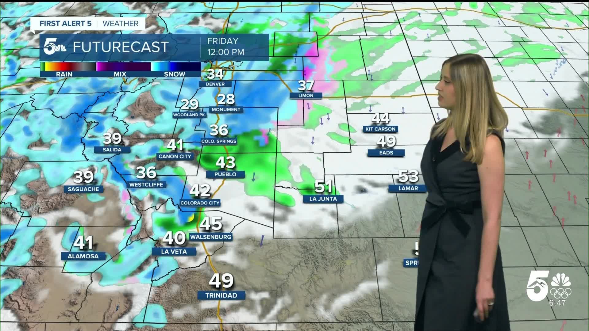
Colorado Springs forecast: Low: 30; High: 39;
It will be windy on Friday with N wind at 10-20 mph gusting to 35 mph. Snow showers will be possible all day, with the heaviest snowfall expected in the morning.
Pueblo forecast: Low: 31; High: 46;
It will be blustery with N wind at 15-20 mph gusting to 35 mph. Expect a mix of rain and snow showers throughout the day.
Canon City forecast: Low: 33; High: 43;
It will be cloudy with a wintry mix and snow showers possible throughout the day. Wind will be out of the SE at 5-10 mph, gusting to 20 mph.
Woodland Park forecast: Low: 23; High: 29;
WINTER WEATHER ADVISORY from 6 am until midnight. It will be blustery and snowy on Friday. Wind will be out of the N at 15 mph gusting to 25 mph. Snow will be possible all day, with the heaviest precipitation expected in the morning hours.
Tri-Lakes forecast: Low: 28; High: 34;
WINTER WEATHER ADVISORY from 6 am until midnight. Snow will be heaviest in the morning and continue off and on through the evening.
Plains forecast: Low: 30s; High: 40s-50s;
It will be a blustery day with N wind at 15-20 mph gusting to 35 mph. Spotty showers are possible, with rain during the day and a wintry mix or snow in the evening.
Walsenburg and Trinidad forecast: Low: 30/30; High: 47/51;
It will be a windy and colder day with N wind at 10-20 mph gusting to 30 mph. Periodic, spotty snow showers will be possible throughout the day and into the evening.
Mountains forecast: Low: teens-20s; High: 20s-40s;
WINTER WEATHER ADVISORY from 6 am until midnight for the zones highlighted in purple above. Snow will be possible all day and night, varying in intensity throughout the day.
Snow total forecast from Friday 6 am through Saturday 6 am:

____
Curious about the First Alert 5 Weather Storm Impact Scale? Check out our cheatsheet explainer.
Watch KOAA News5 on your time, anytime with our free streaming app available for your Roku, FireTV, AppleTV and Android TV. Just search KOAA News5, download and start watching.
