

Today’s Forecast:
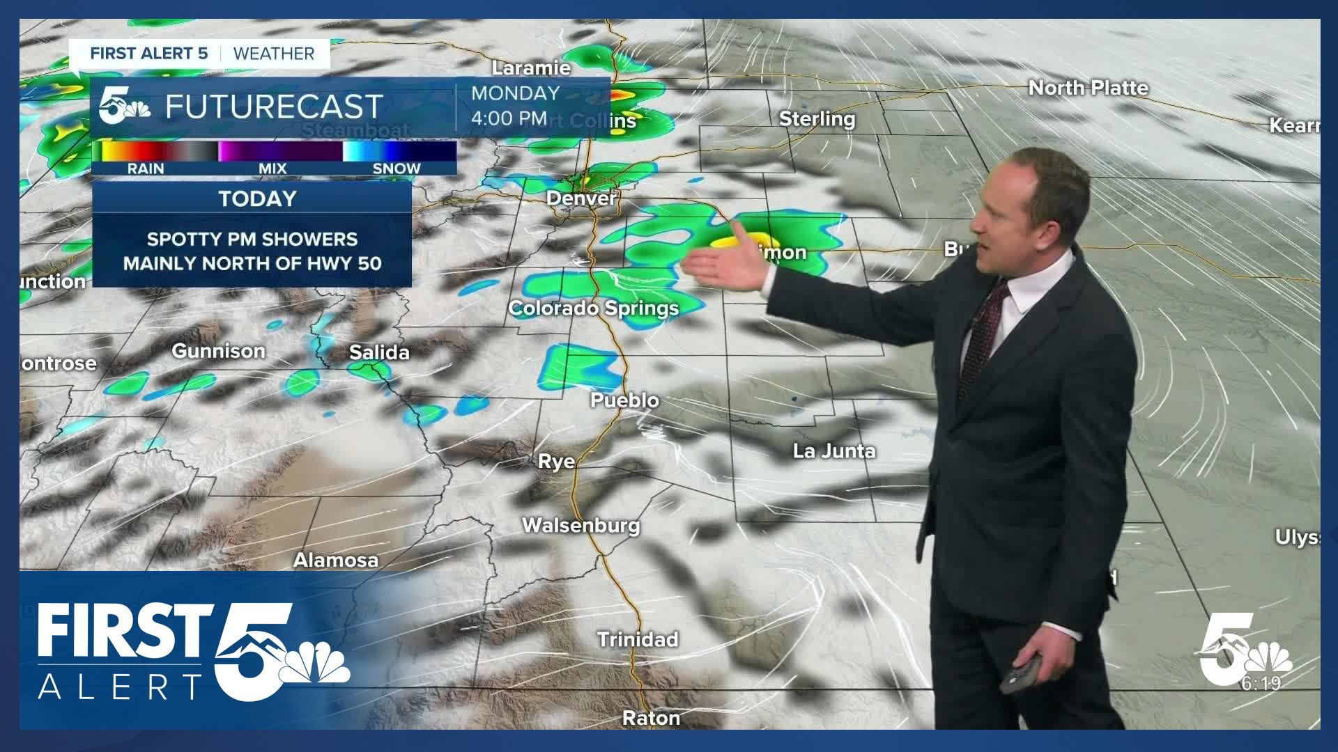
As April comes to an end in a few short days, we'll swap out high fire danger for much needed moisture with a near daily shot at showers and thunderstorms across Southern Colorado. On Monday, showers and thunderstorms will heavily favor areas along and north of the Highway 50 corridor, with the best chances for rain from the Pikes Peak Region northward. While severe storms are not likely today, a few stronger storms will be possible near the Palmer Divide.
Highs today will be comfortable, and near average for this time of the year. Highs will warm into the 60s and lower 70s on the Plains, with a mix of 50s and 60s in the mountains and mountain valleys. Snow levels today should stay at or above 9,000 feet.
Colorado Springs forecast: High: 62; Low: 35. Skies will be nice and bright early this morning. As a disturbance moves into the state this afternoon, it will increase our chances for rain and a thunderstorm. A few stronger storms will be possible today in El Paso County, but severe weather is not expected.
Pueblo forecast: High: 71; Low: 36. We'll see near average highs with temperatures down a few degrees from yesterday. Although an isolated shower can't be ruled out late this afternoon, most of the rain today should be north of Highway 50.
Canon City forecast: High: 68; Low: 39. Highs today will warm into the upper 60s, with sunshine early giving way to a mostly cloudy afternoon. Thunderstorm chances will be on the lower end today, with drier skies on Tuesday.
Woodland Park forecast: High: 54; Low: 28. Monday's forecast will be cool and unsettled, with showers, thunderstorms and a wintry mix possible this afternoon and evening. Snow levels should stay at around 9,000 feet, with 1-2" of accumulation possible for higher terrained areas.
Tri-Lakes forecast: High: 50s; Low: 30s. Bright and sunny skies this morning will turn mostly cloudy and unsettled this afternoon as showers and thunderstorms begin to develop after the lunch hour. Any storms that do form today could be on the stronger side, with small hail and gusty winds our main storm threats.
Plains forecast: High: 60s/70s; Low: 30s. The far southern Plains should stay dry today while areas along and north of Highway 50 could see a few thunderstorms and rain showers this afternoon. Severe weather is not expected early this week.
Walsenburg and Trinidad forecast: High: 60s/70s; Low: 30s. Our work week will begin with dry skies and near average highs. Temperatures this afternoon will warm into the 60s and lower 70s. For the southern I-25 corridor, it will be a breezy to gusty start to the week, with SW winds sustained at 10-25 mph, with higher gusts possible.
Mountains forecast: High: 40s/50s; Low: 20s/30s. Breezy to gusty and unsettled, with a chance for rain, snow and thunderstorms this afternoon and evening. Snow levels will hover at around 9,000 feet today, with 1-2" of accumulation possible for the northern Sangres, Pikes Peak and the Wet Mountains.
Extended outlook forecast:
Tuesday's weather looks quieter, with less overall showers and storms expected locally, as most of the rain on Tuesday should develop along and north of the Palmer Divide. Highs Tuesday will remain in the lower 60s in Colorado Springs and the lower 70s in Pueblo.
Shower and thunderstorm chances will increase starting Wednesday before the atmosphere turns really soupy late this week. All signs are pointing towards some beneficial moisture, i.e., a spring soaker. Rain will increase in coverage Thursday afternoon before tapering off Friday afternoon. With cooler air moving in, snow levels late this week will fall to between 7,000-8,000 feet. Roads in Teller County and across the Palmer Divide could be difficult to navigate Thursday night into Friday morning.
Highs in the Springs late this week will only warm into the upper 40s. Highs in Teller County will warm into the lower to middle 40s.
____
Curious about the First Alert 5 Weather Storm Impact Scale? Check out our cheatsheet explainer.
Watch KOAA News5 on your time, anytime with our free streaming app available for your Roku, FireTV, AppleTV and Android TV. Just search KOAA News5, download and start watching.
