

Today’s Forecast:
New Year's Eve will start out bright, with a wide range of temperatures this morning. Some of the colder spots are again seeing single digits and teens, while some foothill and mountain zones are starting out in the 30s and 40s. This afternoon will be warm, with highs climbing by as much as 5-10 degrees from yesterday. Afternoon highs will top out in the 50s and 60s, which is well above our average highs in the 40s.
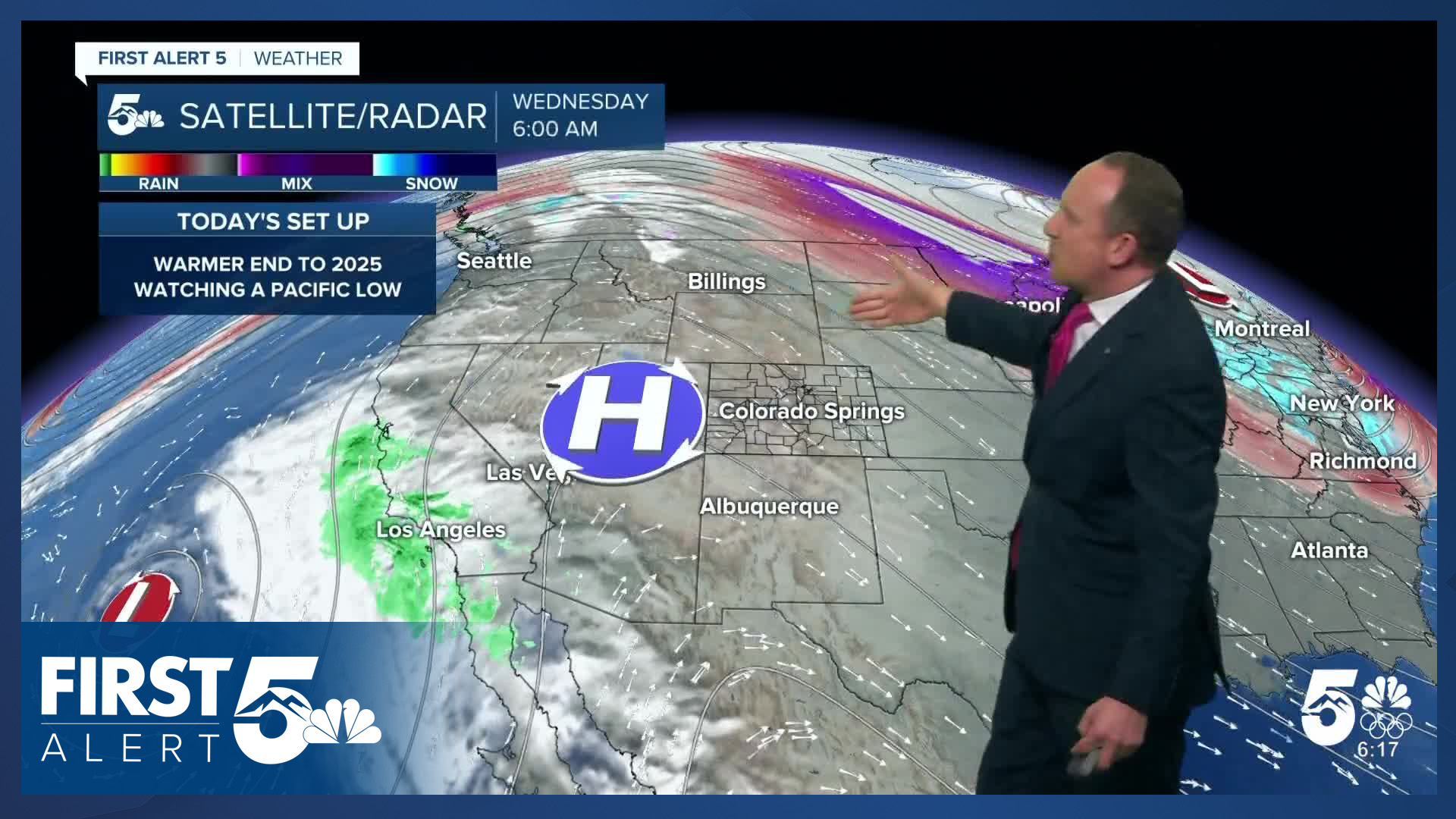
Clouds will be on the increase tonight from a Pacific storm that moves eastward towards Colorado. For now, mid and high level clouds should be thin enough and high enough to allow for decent viewing of the Pikes Peak fireworks, but this could change. Stay tuned throughout the day for updates from First Alert 5.
Colorado Springs forecast: High: 62; Low: 31. After a cold start to the week, highs today will rebound into the lower 60s, with sunshine early giving way to increasing clouds this afternoon and evening.
Pueblo forecast: High: 64; Low: 25. Yesterday's high in the 50s will give way mid 60s this afternoon, with sunshine most of the day today ahead of increasing clouds this evening.
Canon City forecast: High: 65; Low: 36. The final day of December will look and feel a lot like what we've seen so many times this month so far, with dry skies and above average temperatures.
Woodland Park forecast: High: 55; Low: 30. New Year's Eve will feel a lot like October this year, with mid 50s for highs and upper 20s to lower 30s for overnight lows.
Tri-Lakes forecast: High: 50s/60s; Low: 30s. High pressure to our west will keep our weather dry on Wednesday. Temperatures in the 50s and lower 60s this afternoon will give way to 30s tonight, with increasing clouds.
Plains forecast: High: 60s; Low: 20s/30s. December will end warm and dry on the Plains, with highs this afternoon climbing into the 60s.
Walsenburg and Trinidad forecast: High: 60s; Low: 30s. Although the calendar says that it's New Year's Eve, our weather today will be warm and dry. Skies will turn mostly cloudy tonight, but rain or snow is not expected.
Mountains forecast: High: 40s/50s; Low: 20s/30s. Sunshine in the mountains this morning will give way to increasing clouds this afternoon and evening, with temperatures today warming into the 40s and 50s.
Extended outlook forecast:
Most of the action from the California storm system will impact the mountains on Thursday, with light snow, and accumulations of around 1-3" for the Continental Divide. In the Pikes Peak Region, skies will be cloudy on Thursday, with a small chance of drizzle or a few showers. High temperatures will still be warm tomorrow in Colorado Springs, topping out near 60 degrees. Our high in Pueblo on New Year's Day will warm into the lower to middle 60s.
The clouds should start to thin out by Friday afternoon, leaving us partly cloudy and mild. Highs on Friday will warm into the upper 50s, with 60s returning once again to Colorado Springs this weekend. Looking ahead to the first week of 2026...after a warm and dry start to the week, we may see the potential for cooler and unsettled changes late in the week.
____
Curious about the First Alert 5 Weather Storm Impact Scale? Check out our cheatsheet explainer.
Watch KOAA News5 on your time, anytime with our free streaming app available for your Roku, FireTV, AppleTV and Android TV. Just search KOAA News5, download and start watching.
