


Tonight's Forecast:
Light rain showers will impact mainly southern parts of the forecast area through late this evening as sub-tropical moisture pushes into the state from New Mexico. Mountain showers will also be possible, with dry skies for almost everyone else.
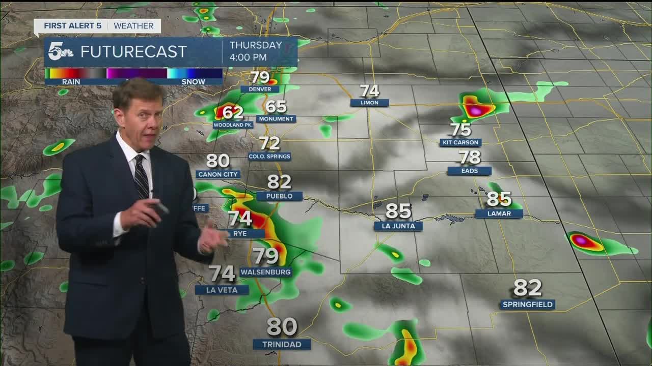
COLORADO SPRINGS: Low: 54; High: 76. Warming by another couple of degrees on Wednesday, with our next disturbance delivering a slightly better chance of late afternoon and evening thunderstorms.
PUEBLO: Low: 57; High: 83. Wednesday will be a little sunnier and a little warmer across Pueblo County, with around a 30% chance of late afternoon and evening showers and thunderstorms.
CANON CITY: Low: 57; High: 82. We'll see a warmer mix of sun and clouds on the final day of June as highs return to the lower 80s for the first time since last Friday. Keep the umbrellas handy as we'll see a slightly better chance of a passing afternoon shower or thunderstorm.
WOODLAND PARK: Low: 44; High: 69. Mostly cloudy and warmer, with scattered afternoon thunderstorms likely across Teller County
TRI-LAKES: Low: 40s/50s; High: 70s. With temperatures rebounding into the 70s on Wednesday, it'll be a comfortable day across northern El Paso County, but keep an eye out for a passing late afternoon shower and thunderstorm.
PLAINS: Low: 50s/60s; High: 80s. Partly to mostly cloudy skies during the day, with increasing chances for rain and thunderstorms by Wednesday evening.
WALSENBURG/TRINIDAD: Low: 40s/50s; High: 70s/80s. Even though we'll see a small warm-up on Wednesday, skies will remain fairly cloudy throughout the day, with about a 40% chance of afternoon and evening thunderstorms.
MOUNTAINS: Low: 40s; High: 50s/60s. Warming up a bit across the mountains on Wednesday. Along with the warm-up will come the chance for scattered afternoon showers and thunderstorms.
Extended Outlook:
A better supply of moisture and the upslope flow will combine to bring our area more widespread rain chances late this week, and the potential for stronger thunderstorms. Severe potential for now looks fairly low, but we'll keep you posted on that throughout the week. Storm chances will lower somewhat by the holiday weekend, but won't disappear from the forecast. There's no need to cancel your plans, but you should have a "Plan B" just in case Mother Nature brings her own round of fireworks to your area this weekend.
KOAA News5 on your time, streaming on your Roku, FireTV, AppleTV and AndroidTV.
News5 App | First Alert 5 Weather App | Youtube | Facebook | Instagram | Twitter
