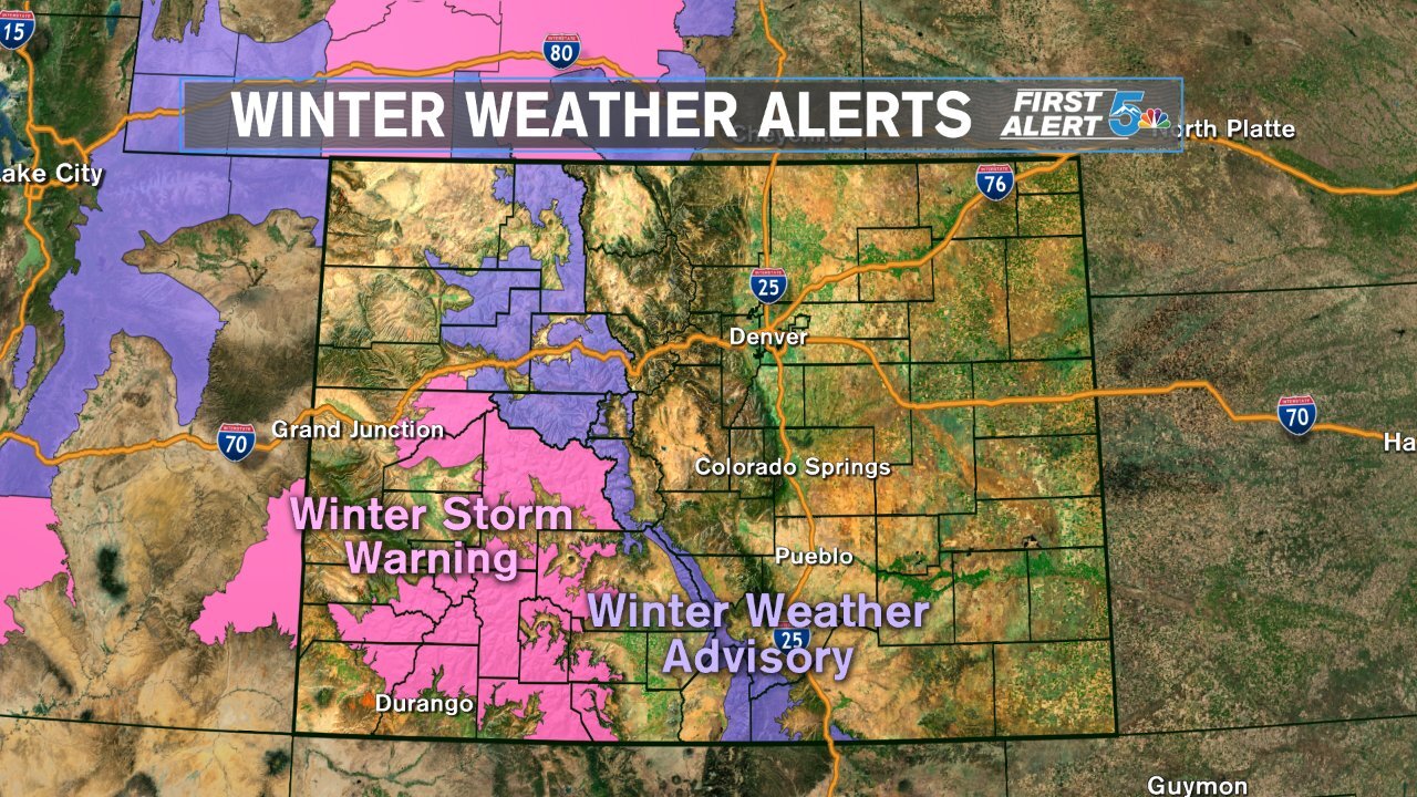


Tonight’s Forecast: The rain and snow should hold off until Wednesday, except for across the mountains of southwestern Colorado. We'll see mostly cloudy skies tonight, with increasing west/southwest winds over the mountains. Overnight lows will remain above freezing for the Springs and Pueblo, and slightly below freezing in Woodland Park. Look for lower elevation rain/mountain snow to pick up by late morning to early afternoon Wednesday.
COLORADO SPRINGS: Low: 36; High: 49. Much colder on Wednesday, but not cold enough for snow. Rain showers will start to develop by mid to late morning, changing over to light snow late Wednesday night.
PUEBLO: Low: 36; High: 53. Increasing clouds during the morning in Pueblo with rain developing by mid to late morning. Liquid precipitation with highs in the 50s will turn to cold and snowy weather on Thursday.
CANON CITY: Low: 38; High: 52. Pack the umbrellas and rain gear on Wednesday as you head out for the day. Periods of rain will continue on Wednesday, with a changeover to snow not expected until late Wednesday night.
WOODLAND PARK: Low: 31; High: 41. A cold, raw day for the Teller County high country on Wednesday. Morning rain showers should transition to snow by mid to late afternoon, and continue at times through Thursday evening.
TRI-LAKES: Low: 30s; High: 40s. Morning rain showers will likely changeover to snow by mid to late afternoon, possibly with impacts for Wednesday evening's commute. Initial amounts of snow will be light through Wednesday night, perhaps 1-2".
PLAINS: Low: 30s/40s; High: 60s. After a dry start to November, the first in a series of storms rolls into the Plains on Wednesday. Rain showers will increase during the day. Snow isn't expected here until midday Thursday.
WALSENBURG/TRINIDAD: Low: 30s/40s; High: 50s/60s. A rainy and cooler day for southern regions. Snow returns here on Thursday, with several inches likely.
Extended Outlook: The bigger storm arrives early Thursday, with much colder air and more widespread snow in the forecast. Snow will end early Friday, with dry skies returning for the weekend. Snow totals through Friday morning will range from a trace to 2" for the Springs and Pueblo. Areas around the Wet Mountains could see between 3-6" of snow, with more than a half of foot of snow for the Sangre de Cristo mountains. Another shot of snow is possible early next week.
