

Today’s Forecast:
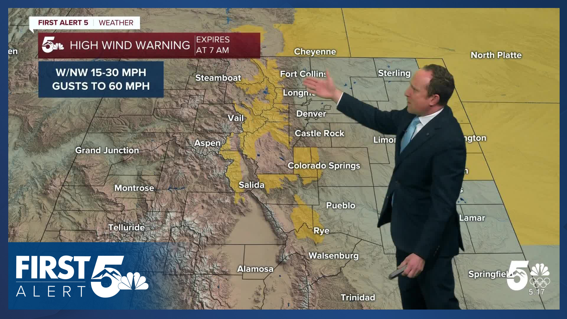
High Wind Warnings that were previously in effect until 7:00 AM have been canceled for much of Southern Colorado early this morning. They remain in effect until 7:00 AM for Teller County, as well as some of our high southern mountain zones. A cold front pushed through the state Colorado Wednesday evening, and this will bring some changes to our forecast today.
It will remain breezy early Thursday, with winds steadily decreasing in the places where they're still gusty early today (mainly right next to and in the mountains). It will also be windy and dry on the Plains, where a Red Flag Warning will remain in effect from 11 am until 5 pm. This afternoon winds turn southeasterly at 5-10 mph. Highs will climb into the 40s and 50s - near seasonal - so you will want lightweight winter attire today. It will be mostly sunny, with clouds increasing this evening. Today's average high is 44 in Colorado Springs.
Colorado Springs forecast: High: 47; Low: 28. For today, we are not expecting any wind or fire warnings. Temperatures will be cooler by as much as 20 degrees from yesterday, with northerly wind gusts around 20-30 mph.
Pueblo forecast: High: 51; Low: 24. After multiple days in the 70s this week so far, highs today will be around 20 degrees cooler. While the wind won't be as strong as yesterday, northerly wind gusts to 30 mph can be expected.
Canon City forecast: High: 54; Low: 35. Thursday's forecast will feature a one day departure from what's been a warm week for eastern Fremont County. Highs this afternoon will warm into the lower 50s.
Woodland Park forecast: High: 44; Low: 28. Some pretty strong gusts have continued this morning across Teller County, but the worst of it should be behind us, with W/NW wind gusts this afternoon around 35 mph.
Tri-Lakes forecast: High: 40s; Low: 20s. Gusts to 40 mph early this morning will give way to weaker gusts and cooler temperatures on Thursday. Highs this afternoon will top out in the lower to middle 40s.
Plains forecast: High: 40s/50s; Low: 20s/30s. Red Flag Warnings will go into effect today at 11 am, lasting until 5 pm. NW wind gusts could top 40-50 mph in some areas, strongest for the far eastern counties. Areas of blowing dust will be possible.
Walsenburg and Trinidad forecast: High: 40s/50s; Low: 20s/30s. Today's weather will remain gusty, with peak gusts in Huerfano County up around 40 mph. The other story is the cool down, with highs today down as much as 20 degrees from yesterday.
Mountains forecast: High: 30s/40s; Low: 10s/20s. High Wind Warnings will be allowed to expire at 7 am in the Wet Mountains, with a general lull in the winds for the high country through the afternoon hours. Gusts to 35 mph during the day will increase to 50-55 mph tonight.
Extended outlook forecast:
If you're hoping for snow...unfortunately this is not the forecast for you. We continue to see largely above average temperatures for Southern Colorado, along with many gusty days and dry air leading to high fire danger in the extended forecast. We also have the potential to break more record highs.
Upper-level ridging returns Friday. This will warm temperatures back up, and another round of downslope winds will contribute. Highs will be in the 60s and 70s on the Plains. This will be another downslope wind event, with particularly strong gusts in the northern mountains. In the Pikes Peak Region, wind gusts of 30-40 mph are possible, with stronger gusts west of I-25 during the early afternoon. It will be very dry, with humidity in the teens. Fire Weather Watches are in place for Friday, and these are very likely to be upgraded to Red Flag Warnings.
A backdoor front will move in on Saturday. It will stay breezy, highs will be a bit cooler in the upper 50s and 60s, and it will be partly cloudy. It will still be dry in the morning, leading to a period of potentially elevated fire danger. Snow showers are possible in the northern mountains.
Sunday looks relatively calm, and cooler still with light southeast winds and highs in the middle 50s and mostly sunny skies.
Downslope breezes return again Monday, with highs back to the 60s and fire danger elevated.
We'll keep above average temperatures throughout the week, with highs remaining in the 60s in Colorado Springs. A massive ridge of high pressure centered over the southern part of the U.S will lead to above average temperatures across the vast majority of the country and keep us snow-free in Colorado leading up to Christmas.
____
Curious about the First Alert 5 Weather Storm Impact Scale? Check out our cheatsheet explainer.
Watch KOAA News5 on your time, anytime with our free streaming app available for your Roku, FireTV, AppleTV and Android TV. Just search KOAA News5, download and start watching.
