


Tonight's Forecast:
Scattered rain and snow showers will remain possible through midnight, mostly for the Plains. Lingering moisture behind the storm will bring areas of fog to the forecast late tonight. Temperatures will be cold across the region. With the threat of sub-freezing temperatures in some locations, precautions should be taken to protect sensitive crops from the cold.
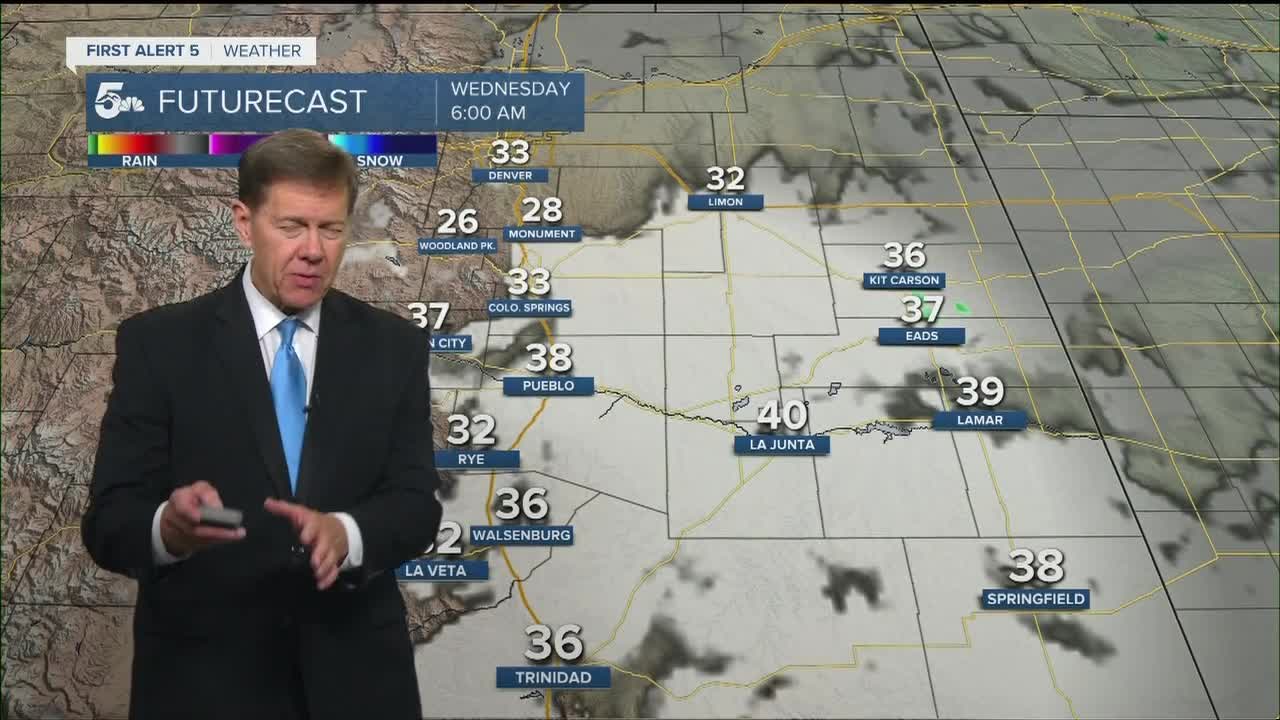
COLORADO SPRINGS: Low: 29; High: 54. Areas of low clouds and fog Wednesday morning will give way to a mostly sunny afternoon across the Pikes Peak Region. An isolated afternoon thunderstorm can't be ruled out, but widespread precipitation is not expected.
PUEBLO: Low: 31; High: 59. Early morning clouds and fog will give way to a mix of sun and clouds by the afternoon. Highs will be warmer than what we've seen so far this week, but still below average.
CANON CITY: Low: 34; High: 58. Patchy morning fog will be followed by partly cloudy skies and upper 50s for afternoon highs.
WOODLAND PARK: Low: 22; High: 47. After a cold and snowy start to the week, sunshine will finally stage a comeback on Wednesday. Highs will warm into the upper 40s, with only a weak chance of an isolated afternoon thunderstorm.
TRI-LAKES: Low: 20s; High: 40s/50s. Clouds and fog in the morning, with some sunshine expected to mix in by the afternoon. We should stay mostly dry, with only a slight chance of an isolated afternoon thunderstorm.
PLAINS: Low: 30s; High: 50s/60s. Morning clouds and fog will be tough to clear across the Plains on Wednesday, with mostly cloudy skies expected to linger through the afternoon.
WALSENBURG/TRINIDAD: Low: 30s; High: 50s/60s. Cloudy skies, with areas of fog will give way to a partly cloudy and warmer afternoon. A few isolated showers or thunderstorms may also develop in some areas on Wednesday.
MOUNTAINS: Low: 10s/20s; High: 30s/40s. Cold weather will persist across the mountains on Wednesday, but the snow will be gone. Expect a warmer late week forecast as skies should remain dry through Thursday.
Extended Outlook:
Our weather will turn much warmer by the end of the week thanks to a building ridge of high pressure. Rain showers and isolated afternoon thunderstorms will be possible on Friday and Saturday, with better chances for rain and thunderstorms from Sunday to Monday. The more active weather will cool us back down to the 60s late this weekend across the Pikes Peak Region.
KOAA News5 on your time, streaming on your Roku, FireTV, AppleTV and AndroidTV.
News5 App | First Alert 5 Weather App | Youtube | Facebook | Instagram | Twitter
