

Tonight's Forecast:
It will be mostly clear and mild tonight with overnight lows about 3 to 5 degrees above average.
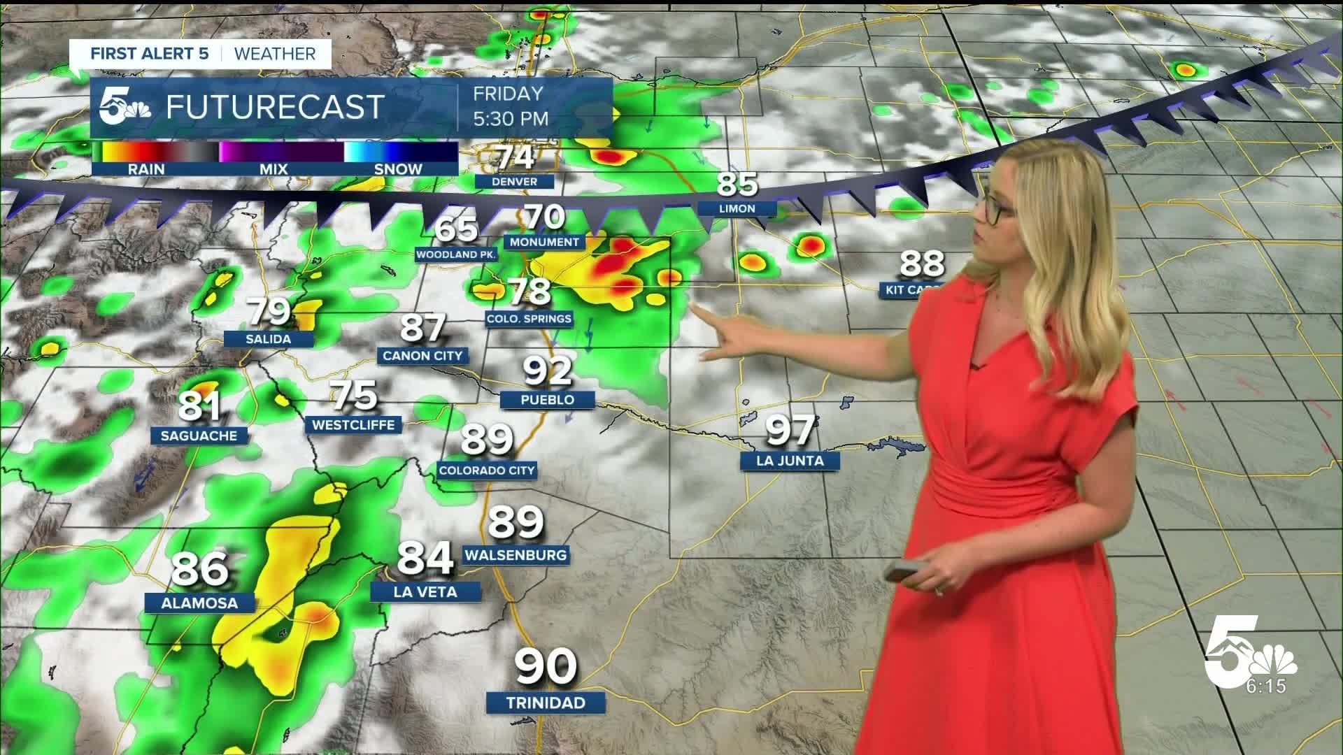
Friday Forecast:
A cold front will move through southern Colorado on Friday, moving through the Pikes Peak region and areas north of HWY 50 in the late afternoon, eventually moving south overnight and clearing the state by early Saturday morning. This front will help to enhance thunderstorm chances on Friday afternoon and evening, especially for the mountains and the Pikes Peak region, and the plains north of HWY 50. Hazards from thunderstorms may include hail, gusty wind, heavy rain, and lightning.
Colorado Springs forecast: Low: 61; High: 87;
Partly cloudy on Friday with a chance of afternoon and evening thunderstorms, some storms may be strong.
Pueblo forecast: Low: 61; High: 95;
It will be mostly sunny in the morning with an increase in clouds during the day. Spotty thunderstorms will be possible in the evening.
Canon City forecast: Low: 65; High: 92;
Partly cloudy on Friday with a chance of afternoon thunderstorms to cool you down.
Woodland Park forecast: Low: 52; High: 76;
Partly cloudy with afternoon and evening thunderstorms likely on Friday. Storms may contain hail and heavy rain.
Tri-Lakes forecast: Low: 60; High: 81;
Partly cloudy with afternoon and evening thunderstorms likely. Storms may be strong with hail, strong winds, and heavy rain.
Plains forecast: Low: 50s-60s; High: 90s;
It will be mostly sunny in the morning, with scattered evening and overnight thunderstorms possible.
Walsenburg and Trinidad forecast: Low: 61/61; High: 90/92;
It will be partly cloudy on Friday with a low chance of an evening thunderstorm.
Mountains forecast: Low: 40s-50s; High: 70s-80s;
The mountain valleys will start out sunny, then the clouds increase as thunderstorms develop in the afternoon. Expect widely scattered rain and thunderstorms through the evening.
Extended outlook forecast:
Into the weekend, temperatures will be closer to average in the 70s and 80s. There will be partly to mostly cloudy conditions over the weekend with thunderstorm chances each afternoon and evening. If you hear thunder, it is time to head inside.
Next week will be much cooler than average, with highs generally in the 60s and 70s, with Tuesday being the coolest day. Each day brings a chance of rain, with the heaviest rain likely on Monday and Tuesday. Flooding may become a problem with multiple days of rain. It is important to never drive through a flooded road, especially if the water depth is unknown.
____
Curious about the First Alert 5 Weather Storm Impact Scale? Check out our cheatsheet explainer.
Watch KOAA News5 on your time, anytime with our free streaming app available for your Roku, FireTV, AppleTV and Android TV. Just search KOAA News5, download and start watching.
