

Tonight's Forecast:
Showers will continue tonight across the region, with rain in the plains and a wintry mix or snow in the mountains.
Winter alerts will go into effect at 6 am on Thursday for the mountains, with WINTER WEATHER ADVISORIES (purple) and WINTER STORM WARNINGS in effect through Friday. They will expire at noon on Friday for Teller County and the Wet Mountain Valley. They expire at midnight on Friday night for the Wet Mountains and Sangre De Cristo Mountains.
The expected snow totals can be found at the bottom of this article.

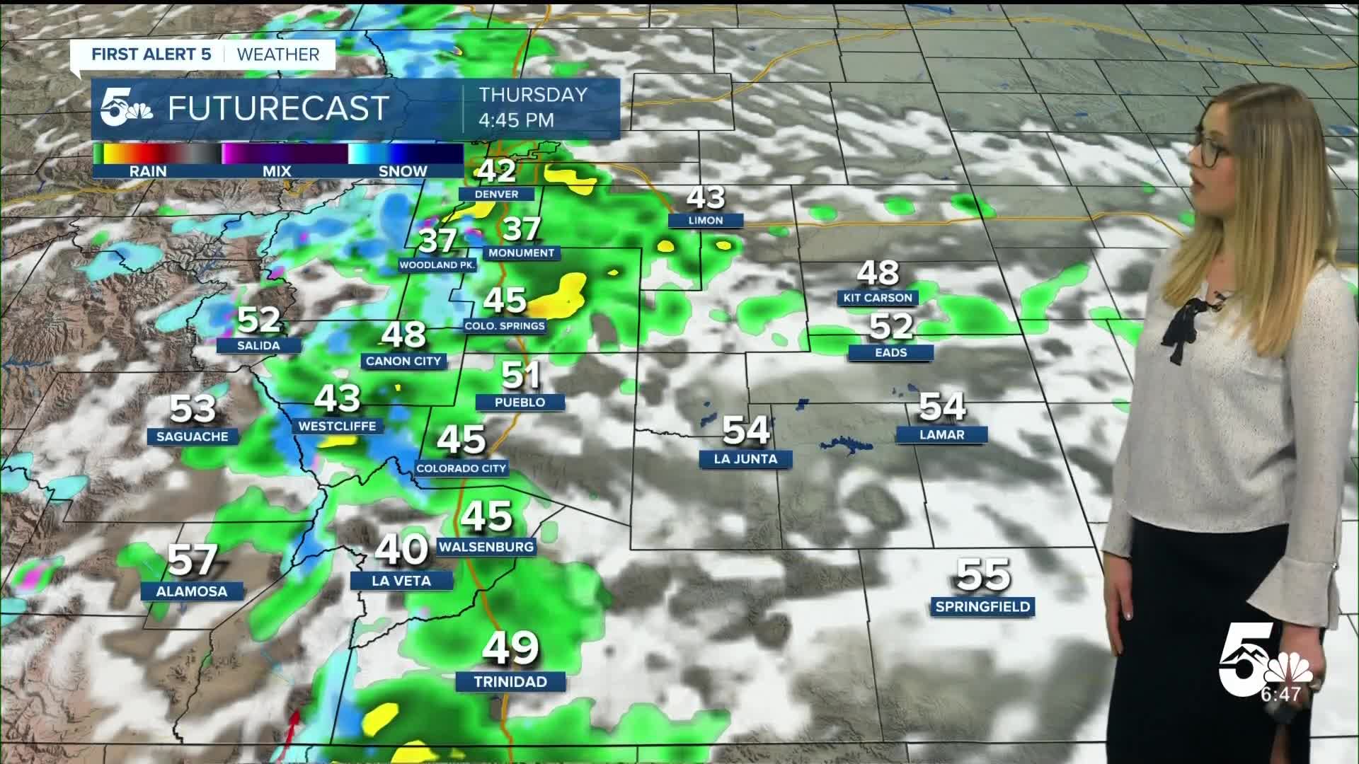
Colorado Springs forecast: Low: 35; High: 47;
Thursday will be cloudy and cool with on-and-off rain showers and thunderstorms. A transition to a wintry mix or snow is possible overnight.
Pueblo forecast: Low: 38; High: 51;
Thursday will be cloudy with the chance of rain showers all day and into the evening. Isolated thunderstorms are possible as well.
Canon City forecast: Low: 39; High: 50;
It will be mostly cloudy with on and off rain showers on Thursday. Isolated thunderstorms are possible as well.
Woodland Park forecast: Low: 28; High: 39;
WINTER STORM WARNING from 6 am Thursday until noon Friday. Snow showers are expected throughout the day, with wet roads during daylight hours. Roads will become snow-covered at night and during periods of heavy snowfall.
Tri-Lakes forecast: Low: 33; High: 39;
It will be cloudy and rainy on Thursday afternoon. A wintry mix is possible in the morning and again in the evening, with a full transition to snow showers on Thursday night. Roads may become snow-covered or icy at night.
Plains forecast: Low: 30s-40s; High: 40s-50s;
It will be mostly cloudy with scattered rain showers and isolated thunderstorms on Thursday.
Walsenburg and Trinidad forecast: Low: 37/35; High: 45/50;
Thursday will be cloudy with rain showers during the day. A transition to a wintry mix or snow is possible at night, with light accumulation on the grass.
Mountains forecast: Low: 20s-30s; High: 30s-50s;
WINTER STORM WARNING from 6 am Thursday until midnight Friday night for the Wet Mountains and Sangre De Cristos Mountains. WINTER WEATHER ADVISORY from 6 am Thursday until noon Friday for the Wet Mountain Valley.
Snow total forecast through Friday:

____
Curious about the First Alert 5 Weather Storm Impact Scale? Check out our cheatsheet explainer.
Watch KOAA News5 on your time, anytime with our free streaming app available for your Roku, FireTV, AppleTV and Android TV. Just search KOAA News5, download and start watching.
