

Tonight's Forecast:
A RED FLAG WARNING remains in effect until 11 pm for the majority of our region. Winds will remain gusty overnight, from 20 to 35 mph.

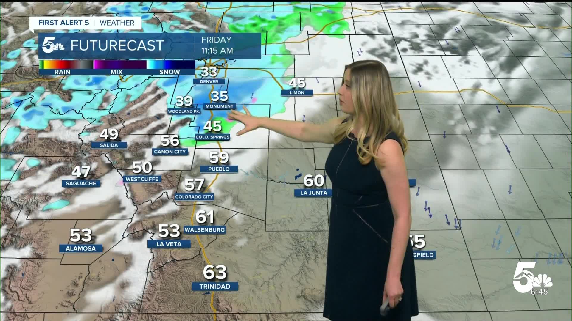
The winds will shift out of the N, and the humidity will spike early on Friday morning in the Pikes Peak region as a cold front arrives.
Colorado Springs forecast: Low: 38; High: 48;
It will be chilly and breezy on Friday with N wind at 15-25 mph gusting to 40 mph. There is a chance of showers from late morning to early evening, with a quick transition from rain to snow.
Pueblo forecast: Low: 40; High: 58;
It will be partly cloudy, chilly, and blustery on Friday. Wind will be out of the NE at 15-30 mph, gusting to 40 mph. There is a chance of rain or a wintry mix in the afternoon to early evening.
Canon City forecast: Low: 42; High: 57;
It will be a gusty and chilly Friday. Wind will be variable in direction, at 10-20 mph gusting to 30 mph. There is a chance of afternoon rain or wintry mix showers.
Woodland Park forecast: Low: 30; High: 43;
It will be mostly cloudy with snow showers possible on Friday from late morning until the evening. Wind will be out of the N at 10-15 mph, gusting to 30 mph.
Tri-Lakes forecast: Low: 32; High: 40;
It will be mostly cloudy with snow showers possible from late morning until the early evening on Friday. Wind will be strong from the N at 10-20 mph, gusting to 35 mph.
Plains forecast: Low: 30s-40s; High: 40s-60s;
It will be a windy and chilly Friday. Wind will turn out of the N as a cold front arrives in the morning, bringing gusts of 35-45 mph. There is a chance of rain showers in the afternoon.
Walsenburg and Trinidad forecast: Low: 41/42; High: 61/67;
It will be a windy Friday with W wind in the morning, turning out of the N in the afternoon as a cold front arrives, gusting 30-40 mph. There is a low chance of afternoon and evening snow with the cold front.
Mountains forecast: Low: 30s; High: 40s-50s;
It will be a cool and gusty day in the mountain valleys. Wind will be out of the W or NW, gusting 30-50 mph. There is a chance of spotty snow showers, favoring NE-facing slopes, with only light accumulations.
Snow total forecast through Friday night:

Spring freeze on Friday night into Saturday morning:
A FREEZE WARNING is in effect from midnight until 8 am on Saturday, when temperatures will fall into the 20s for several hours. Sensitive plants need to be covered. Do not run sprinklers and irrigation.

____
Curious about the First Alert 5 Weather Storm Impact Scale? Check out our cheatsheet explainer.
Watch KOAA News5 on your time, anytime with our free streaming app available for your Roku, FireTV, AppleTV and Android TV. Just search KOAA News5, download and start watching.
