

Today’s Forecast:
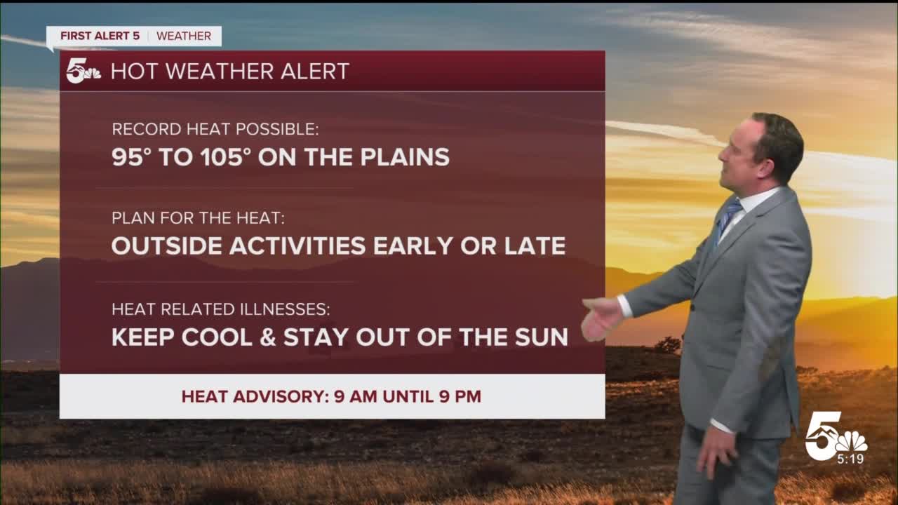
The heat remains the big story on Tuesday across Southern Colorado as 90s and 100s will return to the Plains this afternoon. Another Heat Advisory will go into effect starting at 9 am, with the worst of the heat today expected to be along and south of the Arkansas River Valley.
A few high-based storms may provide some temporary relief this afternoon/evening to areas that are lucky enough to see the rain. Drier air at the surface near the I-25 corridor won't allow for much rainfall today, but out east, a few severe thunderstorms will be possible near the Kansas border.
Colorado Springs forecast: High: 94; Low: 63. Another scorcher this afternoon for the Pikes Peak Region, with a high of 94° in Colorado Springs. A few high-based showers this afternoon may bring a few sprinkles and some cooler air to areas that see it, but with such dry air at the surface, we're likely to see more wind today than rain.
Pueblo forecast: High: 103; Low: 64. Triple digit heat and the threat of a new record high temperature this afternoon in Pueblo. Current record: 105° (2022).
Canon City forecast: High: 99; Low: 67. Another really hot day for eastern Fremont County, where we'll be under a Heat Advisory until 9 pm. A few isolated gusty thunderstorms, with little rainfall, will be possible this afternoon.
Woodland Park forecast: High: 85; Low: 54. The heat will stick around this afternoon for Teller County, with highs expected to warm well into the 80s. A few isolated thunderstorms will be possible anytime after 2 pm, but severe is not expected.
Tri-Lakes forecast: High: 80s/90s; Low: 50s/60s. Whew! It will be another hot one today across northern El Paso County as highs look to climb into the 80s and lower 90s. A quick passing shower will be possible during the afternoon or evening hours, with more wind than rain from today's storms.
Plains forecast: High: 90s/100s; Low: 60s. We'll be feeling the heat again this afternoon across the Plains as highs look to soar into the 90s and 100s. Energy moving out of the mountains will encounter more unstable air this afternoon out east, with a few marginally severe storms possible. Main threats will be wind damage and large hail.
Walsenburg and Trinidad forecast: High: 90s/100s; Low: 60s. We're looking at another scorching day, with highs this afternoon around 10 degrees above average. A Heat Advisory will remain in effect from 9 am until 9 pm.
Mountains forecast: High: 70s/80s; Low: 50s. Warm, with scattered afternoon showers and thunderstorms across the high country today. While severe weather is not anticipated, be prepared to take cover if thunder can be heard.
Extended outlook forecast:
A healthy drop in temperatures on Wednesday will bring us back to near average for this time of the year. With the cooler weather will come a much better chance of scattered afternoon showers and thunderstorms across Southern Colorado.
Cooling trends will continue from Thursday to Friday, with highs by Friday only warming into the 70s and 80s. The cold front responsible for the cooler weather will also bring us a more unsettled end to the week. Thursday will need to be watched closely for an increased risk of severe weather.
____
Curious about the First Alert 5 Weather Storm Impact Scale? Check out our cheatsheet explainer.
Watch KOAA News5 on your time, anytime with our free streaming app available for your Roku, FireTV, AppleTV and Android TV. Just search KOAA News5, download and start watching.
