The forecast is locked down and we’re still forecasting rain turning to snow across southern Colorado. Under heavy cloud cover and behind a cold front that moved through overnight, temperatures will stay chilly, or down right cold through the day. Here’s the forecast highs for the region.
It won’t feel warm out there, but these high temperatures are making the snow forecast tough. We’ll have to cool very quickly to see those higher snow fall totals, I bet quite a bit of the snow melts on the pavement in the lower elevation spots! pic.twitter.com/no122OrUBy
— Sam Schreier (@SamASchreier) October 30, 2018
When is this happening:
Rain and snow will start falling up up by Monument Hill and some of the Front Range mountains around 3 pm. Rain will quickly turn to snow over Monument Hill and Woodland Park from 3 to 5 pm. Colorado Springs will see rain first around 4 to 5pm but we should see a turn over to snow across the whole city by 7 to 8 pm, keeping in mind the change over will happen first on the north half of the city. Pueblo will see rain around 5 to 6 pm, but we won’t see a change over to snow until sometime after 11 pm tonight.
Snow will spread down the Front Range into the Sangre and Wet mountains through the late day, mainly after 3pm and continue snowing well into Wednesday morning with snow leaving the southern mountains and Raton rise areas last by Wednesday late morning.
How much is coming:
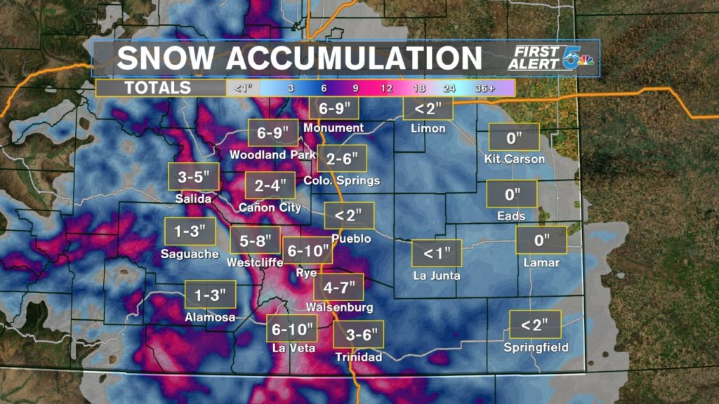
Snow totals have gone up from yesterday, especially over the mountains and Monument Hill area, mainly due to the colder air we’ve swept into the area. Colorado Springs should expect a range of 3 to 6 inches from Woodman road up through the north side of the city, while Garden of the Gods road and south towards Fountain will be in that 3 to 1 inch range.
The biggest snow will fall over the Front Range, Sangres and Wet mountains. Sangres should expect snow accumulation between 8 to 15 inches over 10,000 feet while the Wet mountains will be in that 7 to 11 inch range. The Front Range, areas in and around Teller county for instance, should grab over 6 inches fairly easily.
Pikes Peak Area:

Monument Hill and Woodland Park (really most of Teller county) will see the biggest snowfall across the Pikes Peak region, not including the Peak itself. From Woodman road up through the north side of the city, Springs should see between 3 to 6 inches, while Garden of the Gods road south through Fountain will see between 3 to 1 inches of snow. Black Forest will likely grab over 4 inches of snow.
Arkansas River Valley:
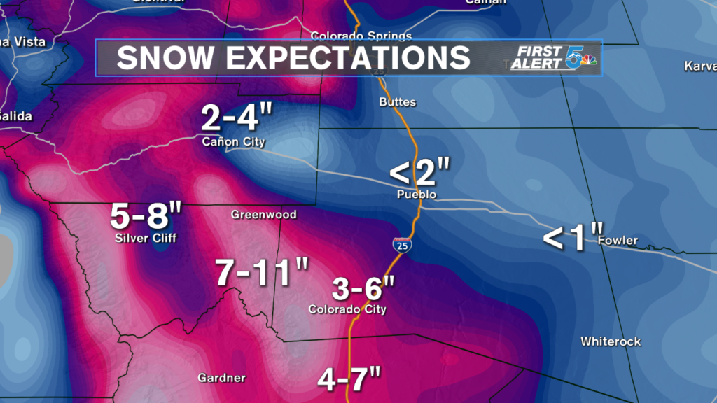
It’s just too warm for Pueblo to grab much snow, low temperatures tonight are 32 at the lowest, so we’ll have trouble getting snow to stick to any pavement. The drive south through Colorado City and Walsenburg will be slicker in the morning as snow over 3 to 4 inches is expected. The Wet Mountains and Sangres should see very heavy snowfall all night.
Southern I-25 Corridor:

Walsenburg will probably be a pretty nasty stretch of road to drive through late tonight and Wednesday morning with 4 to 7 inches expected. Trinidad is in that 3 to 6 inch range with higher totals expected south around and through Raton Pass. La Veta Pass is looking like a very treacherous drive tonight and Wednesday morning. Snowfall totals through Las Veta Pass will come very close to hitting a foot, so treat that drive carefully.
Plains:
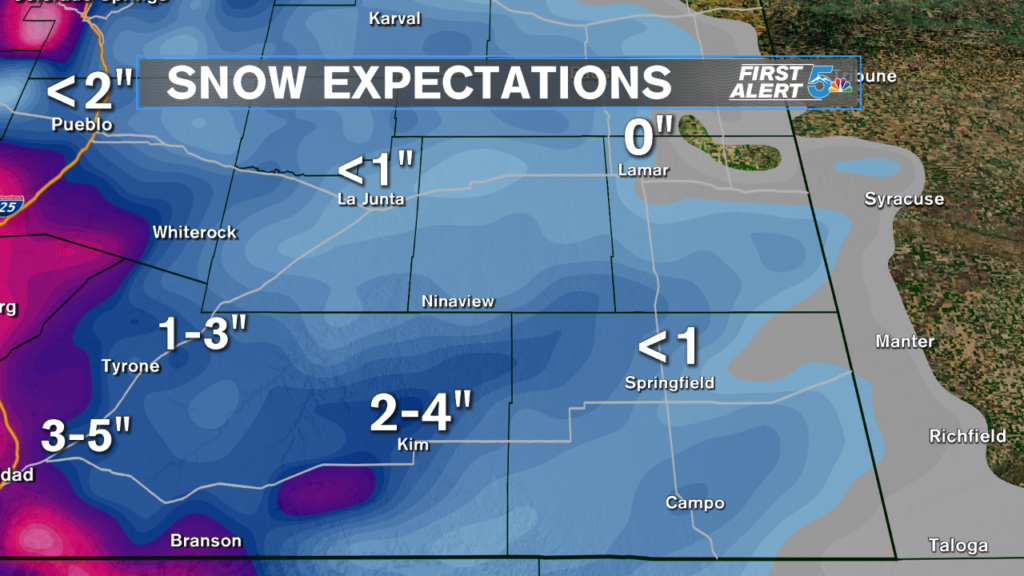
Rain is the biggest weather impact for the plains but there will be a slow switch over to snow very late tonight and early Wednesday morning. Little to no snow is expected to stick to the pavement east of the interstate until you get closer to the Raton Mesa.
