COLORADO – In late Summer and Autumn, we were in the midst of a moderate La Nina, which is a cooling of surface waters off the north west coast of South America into the mid-Pacific. That trend came to an end, gradually last Fall. And now, it has reversed to the point of a developing El Niño. The overall is expected to be a weak one, in the scope of things.
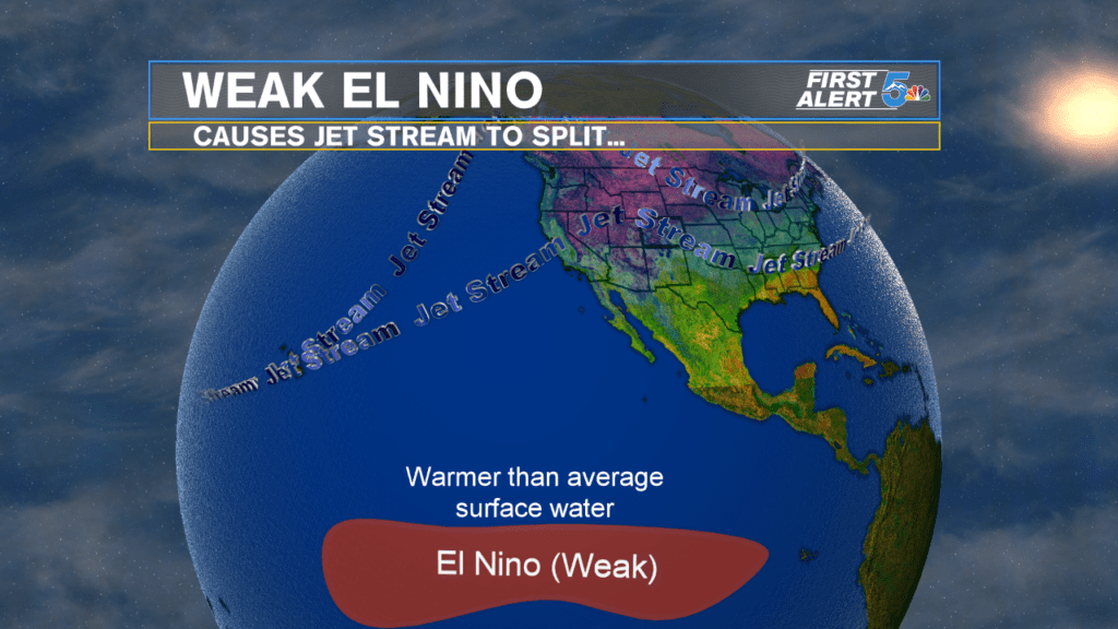
For the States, this new pattern takes the Pacific jet stream, and split it into two streams near the West Coast. (Actually, more specifically, it gives energy to the southern branch, which comes and goes each year, to the point of making it more relevant.) The northern branch moves so far north into Western Canada, that it can’t loop down towards Colorado to bring prolonged cold outbreaks. But the increased presence of the southern Branch enhances moisture over southern Colorado, and pulls enough cold air from above, over mountainous areas that are already usually cold enough to support snow, to ensure more snow there.
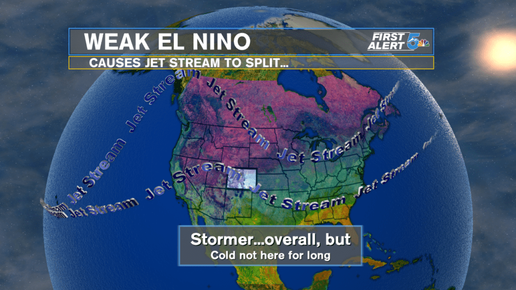
This is good news for the southern Colorado drought, for snow-pack, for southern skiers and snowboarders. It also ensures that our KOAA 5 Winter Weather Outlook, calling for big southern snows this Winter and was already doing well is in the bag, from here on out.
The more snow-pack that can be built up now, the whiter the terrain (higher albedo) which lowers temperatures…longer, ensuring slower snow-melt in Spring, and carries that available moisture longer, into Summer. So, the building snow-pack not only creates a moisture source, longer, but also results in lower temperatures…until the snow cover is melted.
