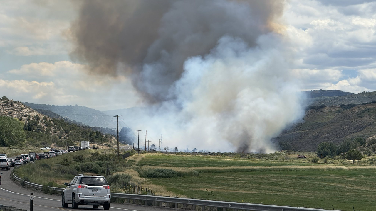


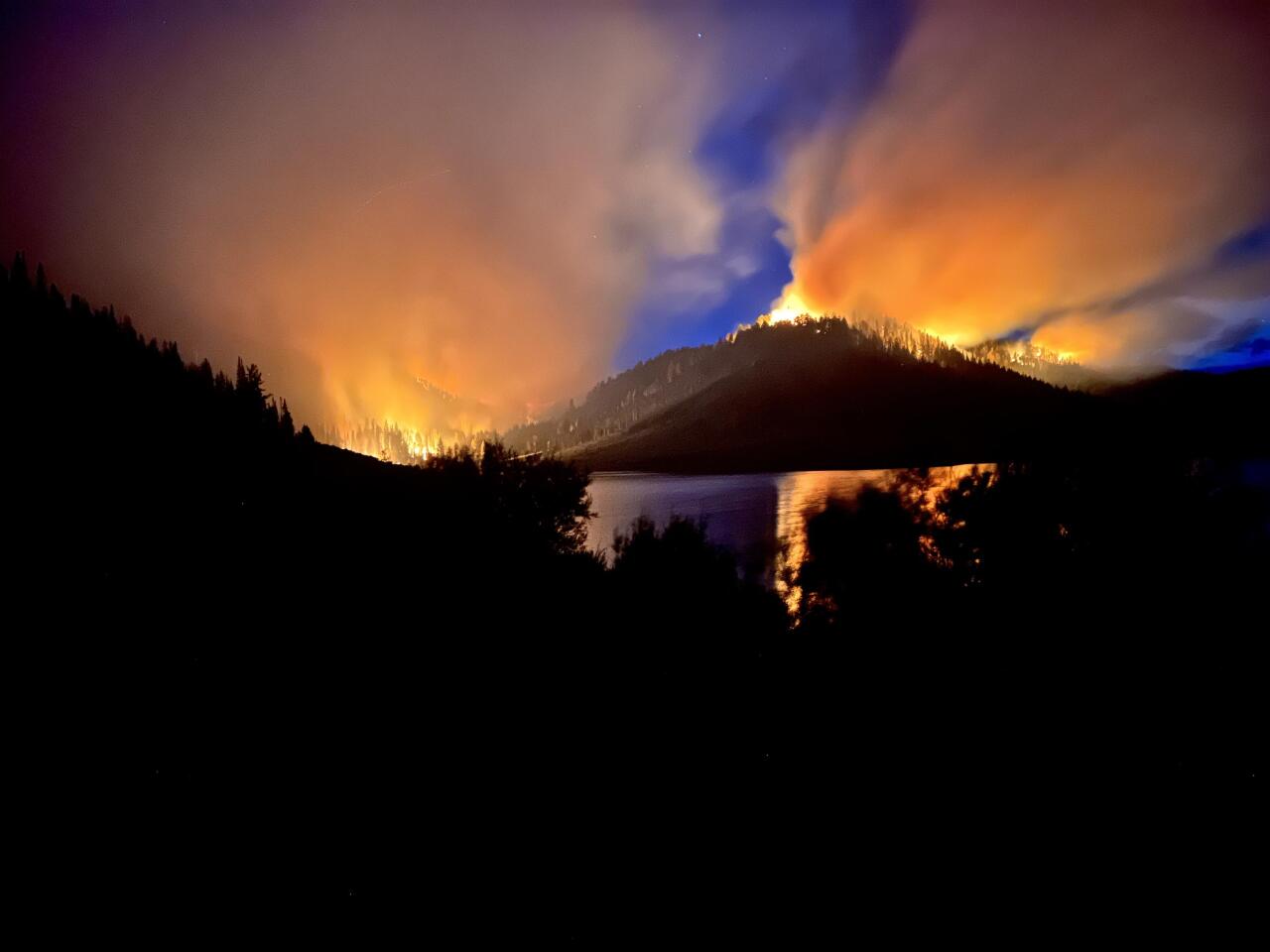
DENVER — A small fire flared up near the more than 4,000-acre South Rim Fire in Black Canyon National Park on Sunday. The fire, burning in Montrose County, forced the closure of U.S. Highway 50 at Finnegan.
Crews and resources from the South Rim Fire were dispatched to assist local agencies in battling the blaze.
Meanwhile, fire containment continues to increase in most of the wildfires burning on Colorado’s Western Slope as firefighters get a handle on the multiple blazes that have charred thousands of acres and damaged infrastructure.
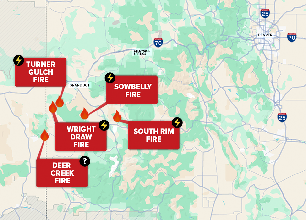
More than 30,000 acres are burning in at least five separate wildfires in Delta, Mesa, and Montrose counties, as well as in parts of eastern Utah.
At least four of the fires were sparked by lightning from one single weather event on July 10. Most of the Western Slope is under extreme or severe drought conditions, according to the U.S. Drought Monitor.
No lives have been lost, but several structures, including national park infrastructure, have been damaged or destroyed.
Gov. Jared Polis verbally declared a disaster declaration for the fires on July 13, which frees up state and federal resources.
South Rim Fire
Size: 4,220 acres
Contained: 41%
First reported: July 10
Cause: ⚡️
Location: Black Canyon of the Gunnison National Park
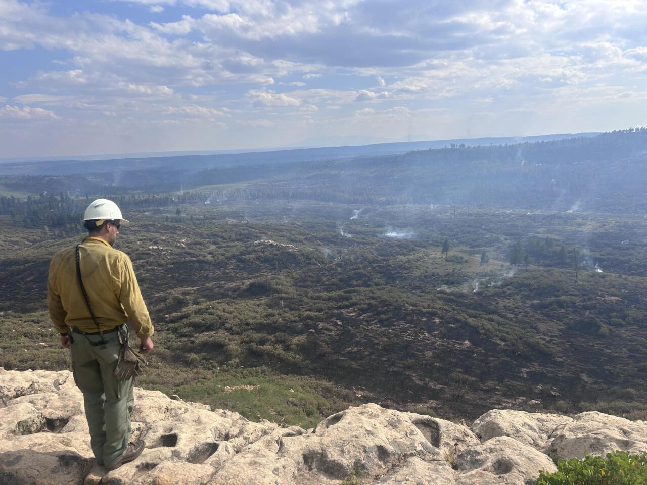
The South Rim Fire, burning inside Black Canyon of the Gunnison National Park, has damaged or destroyed multiple buildings and facilities, including the South Rim Campground and numerous bathrooms and overlooks throughout the park.
However, park officials stated that initial assessments have determined that the South Rim Visitor Center, the administration building, and the entrance booth were spared from the fire.
The lightning-sparked South Rim Fire has led to evacuations of the national park and nearby areas, including Bostwick Park and residents on N73, N74, and O74 roads. Highway 437 is closed at Highway 50.
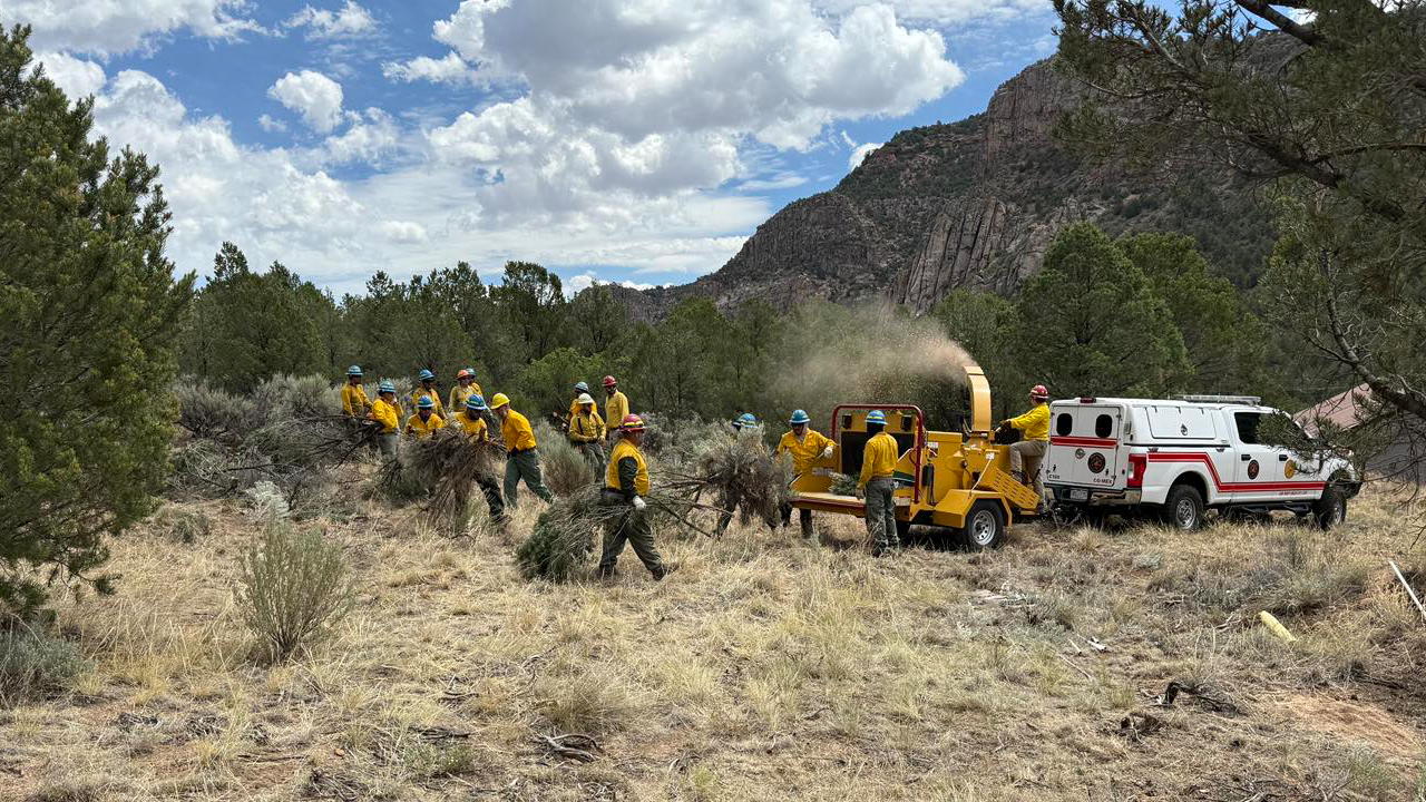
The national park remains closed as more than 300 firefighters continue the battle against the blaze with a variety of resources, including two aircraft, five crews, eight engines, two dozers, and four water tenders.
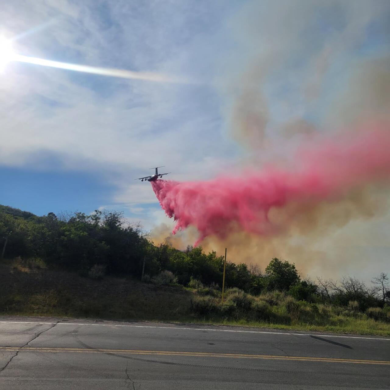
Aircraft filling from Blue Mesa Reservoir has forced the closure of the reservoir to both motorized and non-motorized boats west of Middle Bridge.
The north rim of the park will reopen to the public on Wednesday, July 30. Visitors will be able to access trails and overlooks along the north rim, as well as the campground.
The South Rim, where the visitor center is located, remains closed.
Black Canyon of the Gunnison National Park, located primarily in Montrose County, is situated nine miles east of the city of Montrose.
Updates posted to:
Montrose County Sheriff’s Office Facebook
Black Canyon of the Gunnison National Park Facebook
InciWeb
Sowbelly Fire
Size: 2,274 acres
Contained: 95%
First reported: July 10
Cause: ⚡️
Location: Dominguez-Escalante National Conservation Area
The 2,274-acre Sowbelly Fire is burning in the Dominguez Canyon Wilderness Area in Delta and Mesa counties.
Progress has been made in securing the fire perimeter, which helped firefighters reach near full containment. The fire continues to smolder in place, and crews are utilizing direct tactics in the wilderness and continue to mop up hot spots and patrol fireline.
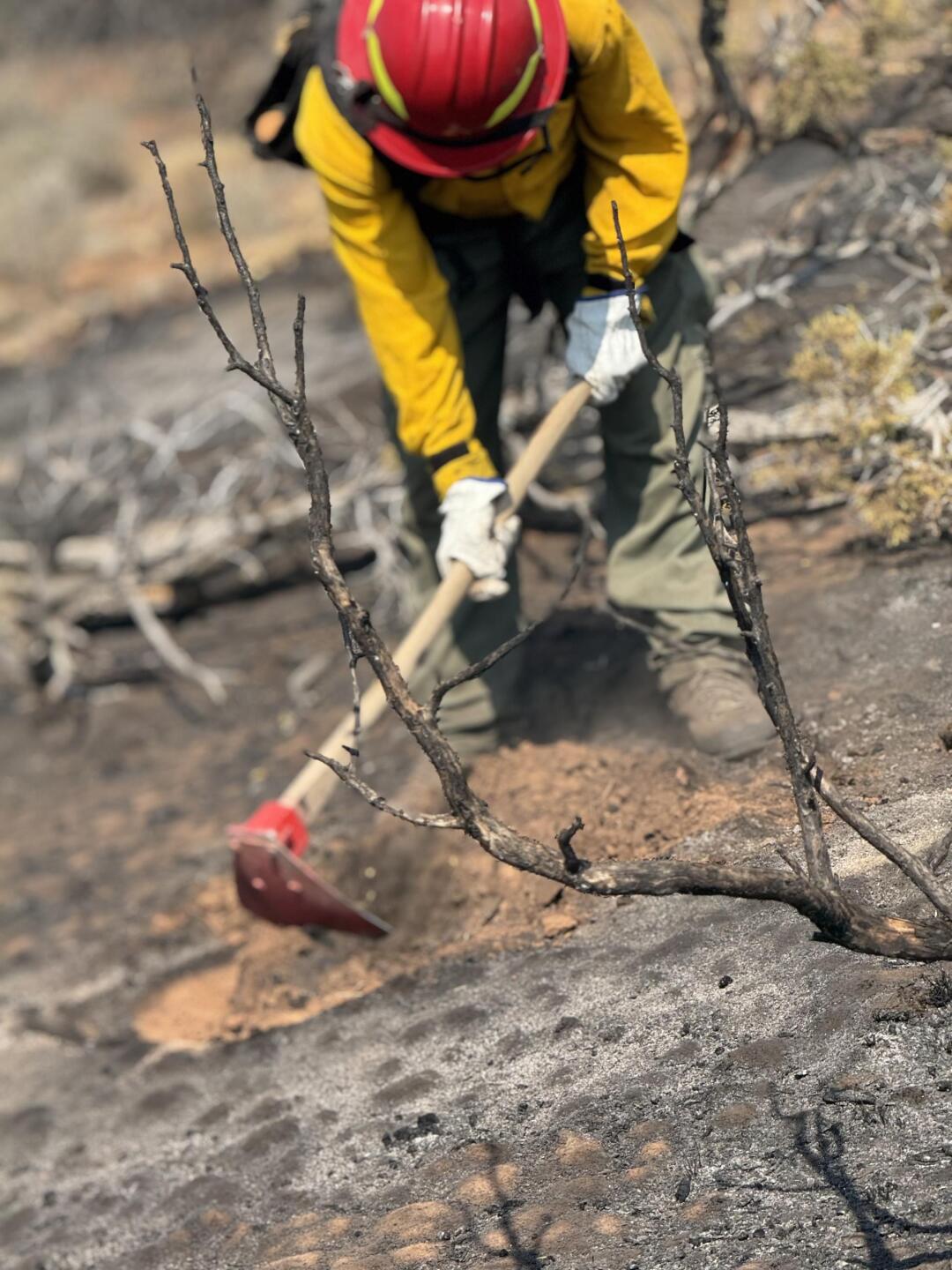
Firefighters will continue to use indirect and direct tactics to keep fire north of the ZS road and limit fire spread further into Escalante Canyon as they identify potential holding features to the north while limiting impacts to the Dominguez Canyon Wilderness.
There are currently no evacuations in place, and no structures have been reported lost.
Updates posted to:
InciWeb
Delta County Sheriff’s Office Facebook
Mesa County Sheriff’s Office Facebook
BLM Colorado Fire Facebook
Wright Draw Fire
Size: 466 acres
Contained: 94%
First reported: July 10
Cause: ⚡️
Location: 8 miles northeast of Gateway
The 466-acre Wright Draw Fire is burning off Highway 141, northeast of the town of Gateway in Mesa County.
Evacuations were issued on land along Highway 141, between mile markers 120-124. An evacuation center has been set up at the Clifton Community Center.
No injuries have been reported, and no structures have been lost.
Fire officials said fighters and bulldozers have been able to bring fire lines around the north side of the fire and are looking to capitalize on opportunities to continue back to the southeast, but added firefighters are unable to hike up the North Fork West Creek drainage, limiting containment options from the southeast.
Crews have also been completing structure protection measures in the surrounding area and have nearly completed structure preparation north of the fire on Piñon Mesa.
Updates posted to:
Upper Colorado River Interagency Fire Management Unit Facebook
Mesa County Sheriff’s Office Facebook
InciWeb
Turner Gulch Fire
Size: 19,139 acres
Contained: 54%
First reported: July 10
Cause: ⚡️
Location: 8 miles northeast of Gateway
The Turner Gulch Fire, burning off Highway 141 northeast of the town of Gateway in Mesa County, is the largest of the Colorado wildfires at nearly 16,000 acres.
No injuries have been reported, and no structures have been lost.
Evacuations were issued on land along Highway 141, between mile markers 120-124 and 128-131.
An evacuation center has been set up at the Clifton Community Center.
In a Sunday update, officials said that critical fire weather conditions in the region will increase fire behavior and continue to test containment lines.
Fire officials said bulldozer operations and direct line construction were progressing along from NFSR 403 across a patch of private land to connect with improved roads and trails near Gill Creek.
Updates posted to:
InciWeb
Mesa County Sheriff’s Office Facebook
Upper Colorado River Interagency Fire Management Unit Facebook
Deer Creek Fire
Size: 17,724 acres
Contained: 77%
First reported: July 10
Cause: Under investigation
Location: 1 Mile North of Old La Sal
Nearly 600 firefighters are battling the Deer Creek Fire, which is primarily burning in eastern Utah but has also extended into parts of Montrose County.
Areas of San Juan County, Utah, and Montrose County are under an evacuation order.
However, some residents who were previously evacuated are returning to their homes, as additional cloud cover and isolated wet rain provided firefighters with favorable conditions on Friday.
Officials said that firefighters have gained additional containment on the fire in the past couple of days.
Crews will continue to secure line in the east and southeast sides of the fire. Attention to extinguishing smoldering debris and hot spots will continue around the east, west, and north sides of the fire
There is no information available on any structural loss at this time.
Updates posted to:
InciWeb
Montrose County Sheriff’s Office Facebook
