


Southern Colorado saw very heavy rain at the beginning of this week, with much of the fallout being flooding from Manitou Springs to Pueblo and back west into the Wet Mountains.
Meteorologist Alex O'Brien covered just how much rain fell across the region earlier this week, and you can read that story here.
When we talk about flooding in Colorado, we usually bring up something called burn scars.
Burn Scars are the scorched earth left behind a large wildfire.
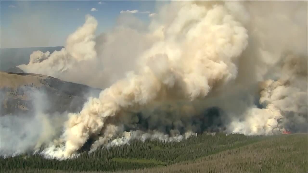
2020 was a particularly bad year for wildfires, with the Cameron Peak fire pictured above burning over 200,000 acres of land in northern Colorado!
The reason burn scars get so much more attention to flooding is that the soil is literally cooked by the fire and cannot absorb heavy rainwater.
Water simply builds up on the surface and carries away excess dirt and burned vegetation around the scar downhill and downstream.
Burned soil debris flowing with floodwaters will carry more weight and can lead to increased damage to roads, bridges, and any structures in the way of that water.
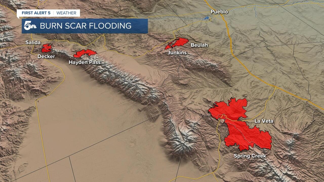
Here in southern Colorado, there are 4 high-risk burn scars we monitor closely.
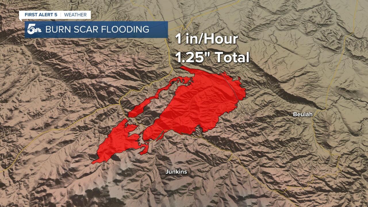
The Junkins and Hayden Pass are the two oldest burn scars, and the Decker and Spring Creek are the newest.
Newer burn scars are the most prone to flooding, as there hasn't been any regrowth of vegetation or mitigation by humans.
In late July of 2020, a large storm dumped around 2 inches of rain in a very short time on portions of the Decker fire burn scar.
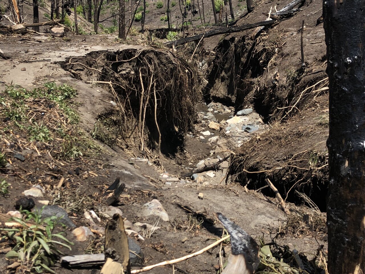
From this event, portions of county road 101 washed out, temporarily blocking the road to residents coming in or out.
Surveyors from the National Weather Service in Pueblo found scoured out channels 5 to 10 feet deep. They also found mass amounts of boulders that were swept up in the flow.
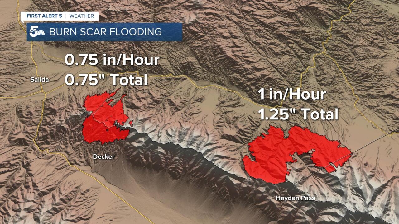
The current flood thresholds for the Decker burn scar are 0.75 inches of rain per hour, or a storm total of 0.75 inches.
Obviously, 2 inches was more than enough to cause a significant flooding event in and around the burn scar.
The Hayden Pass burn scar started in the summer of 2016 and burned around 16,000 acres.
The Junkins burn scar is incredibly simiar to the Hayden Pass scar as they both burned in 2016 and both are roughly 16,000 acres.
Current flood thresholds for both the Junkins and Hayden Pass burn scars are either 1 inch per hour rains or a storm total of 1.25 inches.
Regrowth on the burn scar and mitigation by residents of the area have significantly lowered flooding risks in and around the Junkins burn scar in particular.
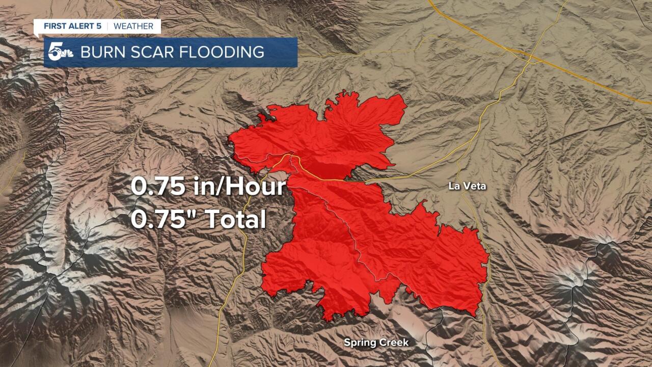
The most recent high risk burn scar in Colorado came from the Spring Creek fire back in 2018.
That fire, the 5th largest in Colorado history, burned just over 100,000 acres only a few miles west of La Veta.
Due to how recently the fire burned, there isn't much regrowth on the burn scar, and little to no mitigation has been done in or near the area.
Current flooding thresholds for the fire are 0.75 inches of rain per hour or 0.75 inches in total.
