

It's been a busy 24 hours for southern Colorado with snow overnight and more snow on the way later today.
I-25 is snow covered south of downtown pic.twitter.com/yufDvEHlQ8
— Sam Schreier (@SamASchreier) January 26, 2021
Many roadways in the region are still covered in snow from Monday morning, but more are now covered again from snow that fell last night.
Some of the heaviest snow overnight seemed to fall in the Teller County area, as well as the south half of El Paso County back into Fremont County. Cold temperatures overnight have allowed untreated roads to form a thin layer of ice and snow, making the commute even more difficult.
Quick Forecast:
Snow in the Pikes Peak Region from last night will move northeast out of the way through the early morning hours, but we will have areas of fog develop behind the snow.
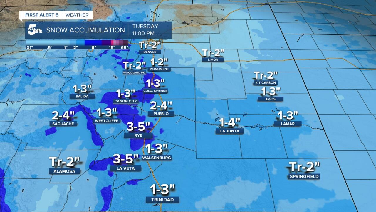
A second wave of snow will move in from the southwest, spreading first through the southern mountains and then up into the Pueblo and Pikes Peak Region by 7 to 8 am. This second wave of snow could dump another 1 to 3 inches in the Pikes Peak Region, and another 2 to 4 inches from Pueblo down to Trinidad.
The snow will stop falling this evening, but we will have a very rough night of temperatures as lows fall into the single digits by early Wednesday morning.
Travel Recommendations:
Most roadways that had snow on them last night when you drove home from work still have snow on them today, especially in the Pikes Peak Region where snow fell overnight.
Leave early and try to stick to the larger roads like I-25, Highway 50, Powers Blvd, etc. Those will be hit first by snowplows.
Track road and travel conditions here.
See a complete school closing and delay list by clicking here: School Closings & Delays
Watch News5 LIVE newscasts
KOAA Facebook / KOAA Twitter / KOAA_5 Instagram
Latest First Alert 5 Weather forecast
DIA Delays / FlyCOS Delays
