Summer in Southern Colorado is typically associated with monsoon thunderstorms and lots of rain, but this year has been different.
This summer's monsoon never really showed up, and it all has to do with the placement of a semi-permanent high pressure system.

Before we dive into that, I can tell you that August is typically our wettest month of the year in both Colorado Springs and Pueblo.
Both areas this year have been dry. Pueblo has been bone dry with hardly any measurable rainfall this month at the airport.

This year's monsoon has failed to reach its full potential because high pressure settled too far west this summer, which has kept those beneficial monsoonal thunderstorms out of reach.
In a typical monsoon year, high pressure would be closer to Texas, Oklahoma and Kansas, which would send a consistent fetch of tropical moisture our way.

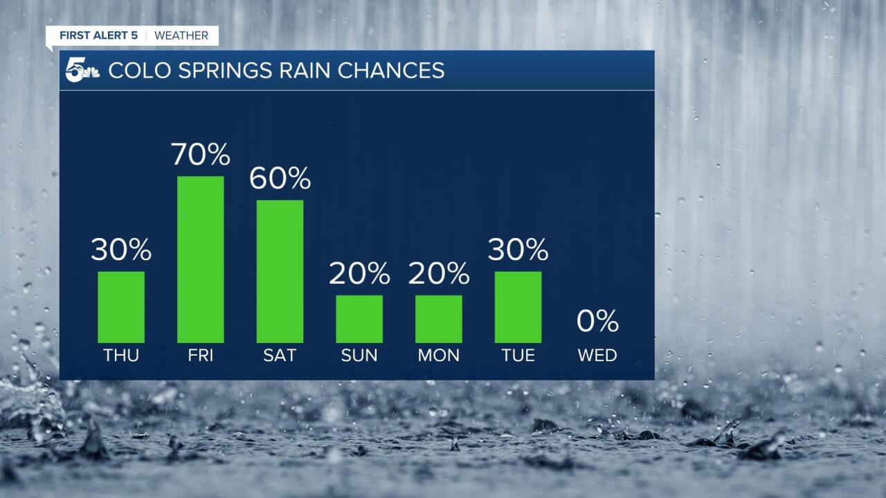
The sub-tropical high over the Four-Corners is expected to weaken and shift east over the next few days. This will allow for a cold front to move through Southern Colorado on Friday, with better chances for rain through the start of the weekend.
After that, rain chances trend back down, and stay pretty low through the middle of next week.

Unfortunately, the outlook for September doesn't look much better. According to the latest from the Climate Prediction Center, the outlook next month calls for a good chance of below average rainfall over Colorado.
Climatologically, we go from an average of 3.34" of rain in August to an average of 1.19" of rain in September.
Finally, with La Nina expected to develop this fall, below average rain and snowfall are likely for Colorado through the winter.

