


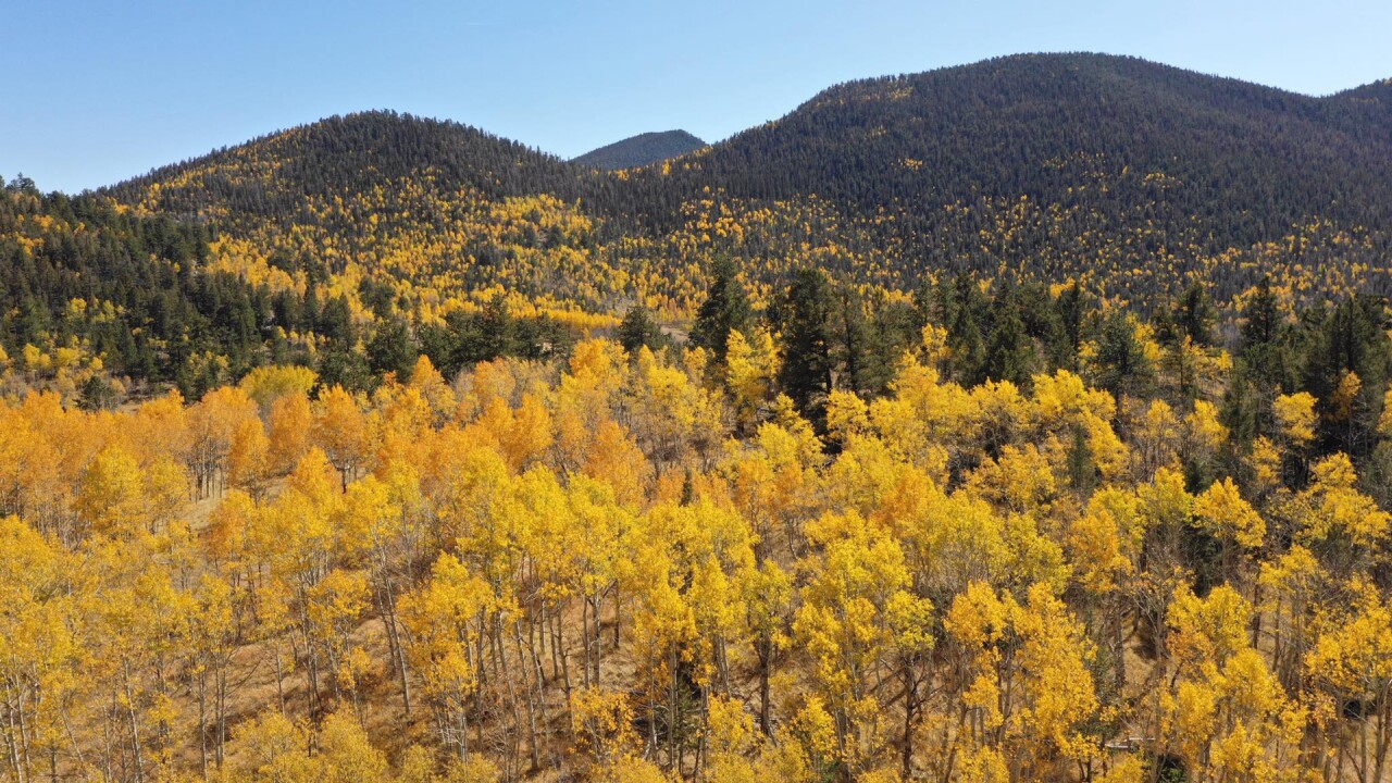
We're only a few weeks away from leaves starting to change color in the mountains!
Use this guide to see where and when Colorado's fall colors will peak.
When do the colors peak?
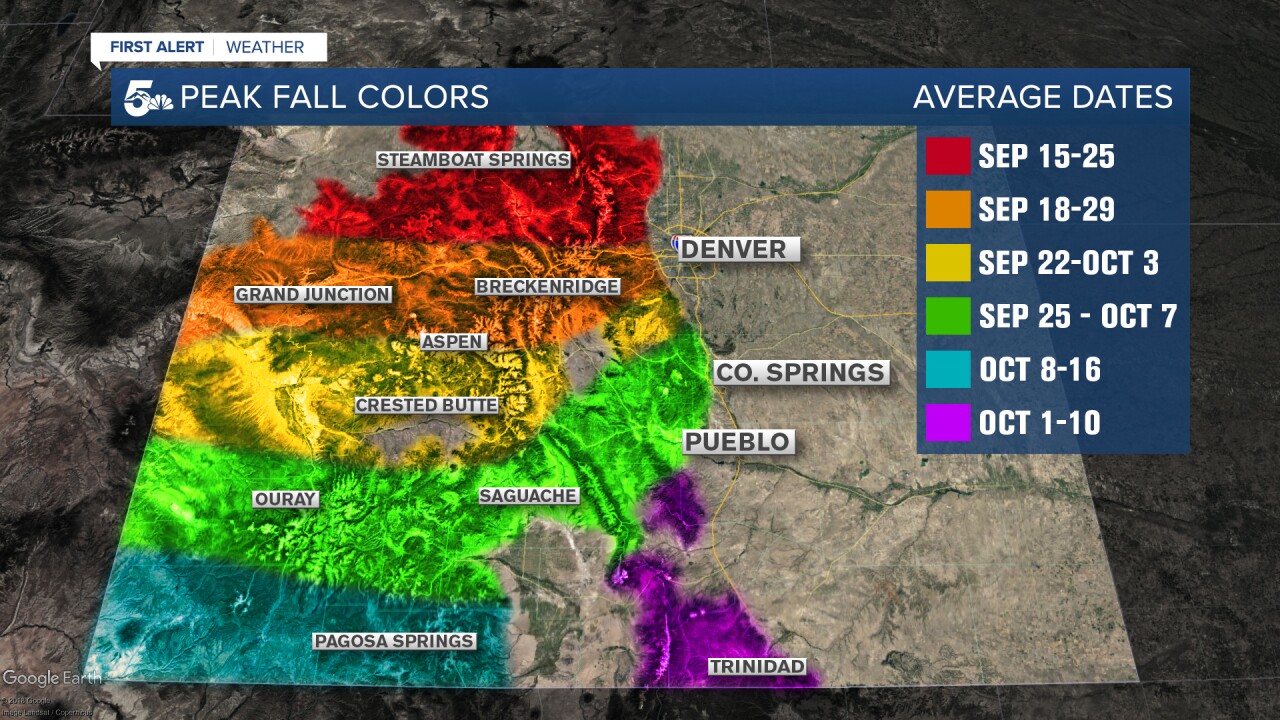
These are the average dates for peak fall colors in Colorado.
According to the Colorado Forest Service, the aspens are still green and it's too early to predict when the colors will peak this year.
In the past, drought and heat can stress the trees, making the leaves peak earlier than normal with weaker colors.
Sticking to the peak times on the map above should give you pretty good colors this year.
In general, the first two weeks of October have the best fall colors.
If you wait too long, wind and snow will knock the leaves down. Go too early, and you won't get the full vibrant yellow of the aspen groves.
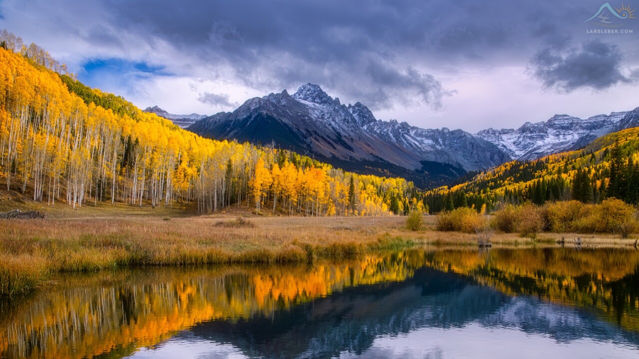
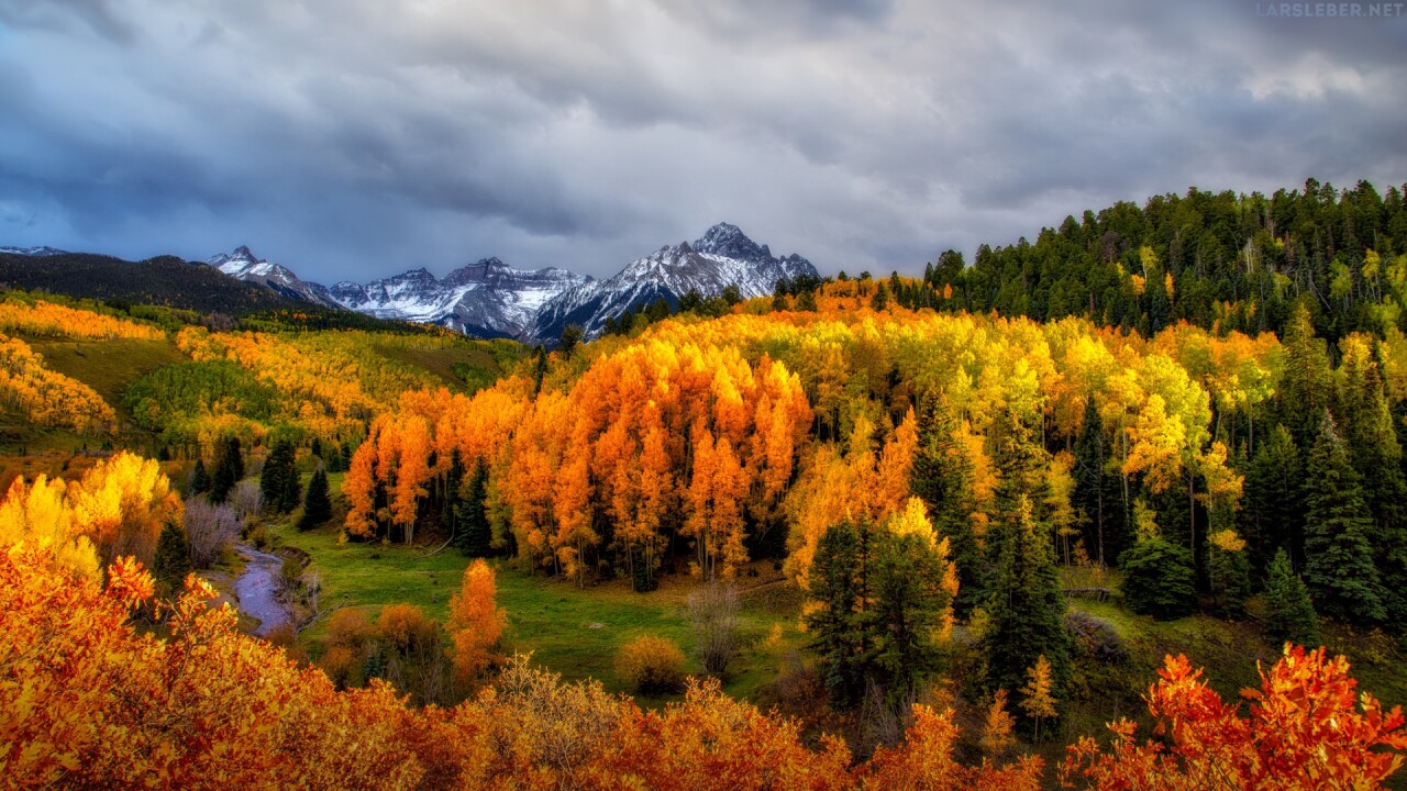
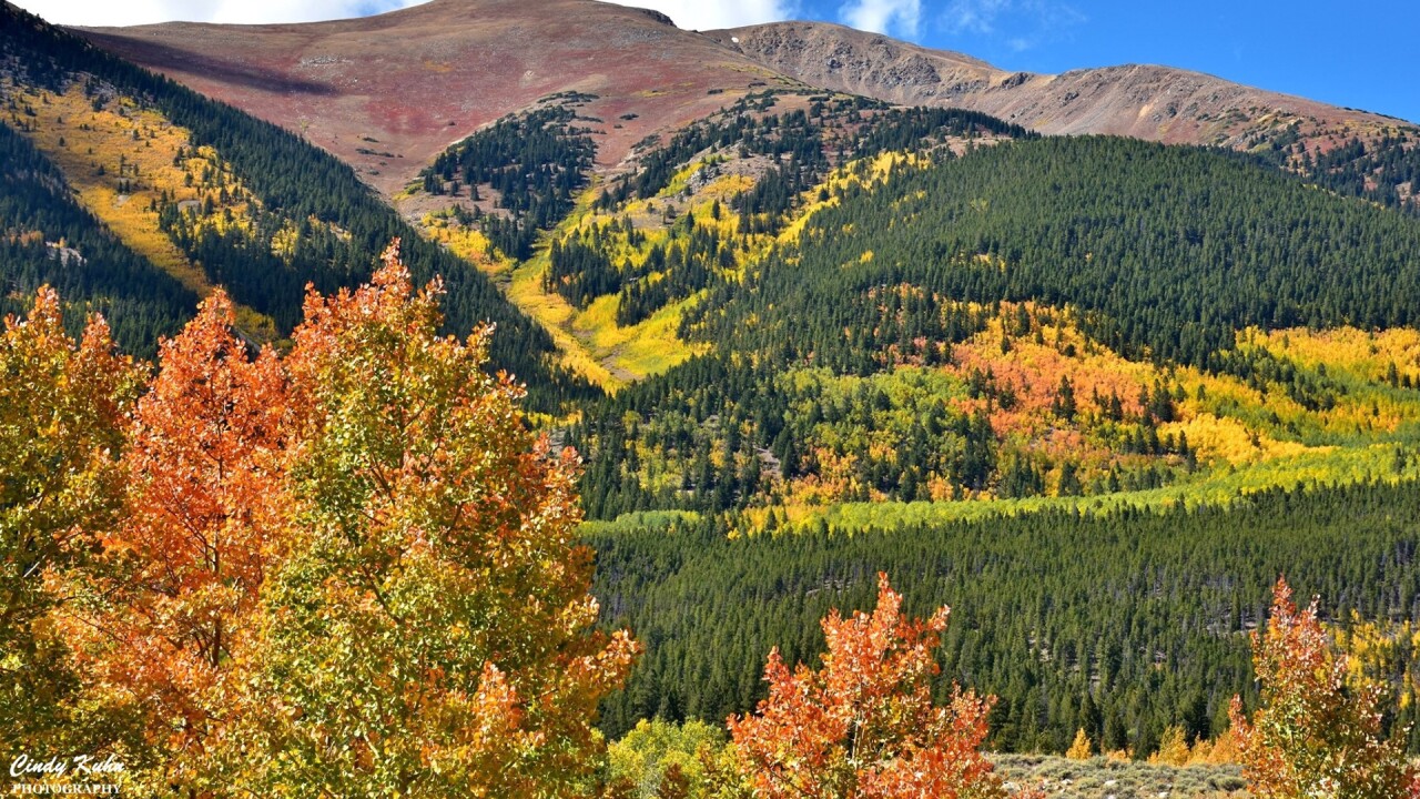
Fall Color Drives - Where should you go?
Here is a list of our most recommended fall color drives in Colorado!
Use our interactive map above and scroll through the story below for more pictures and information on each location.
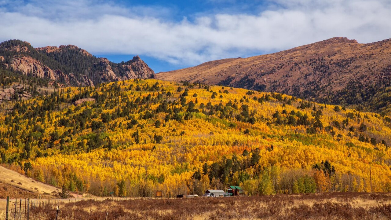
Southern Colorado Drives - Mueller State Park
If you're looking for a great spot to picnic, hike, and see fall colors, drive over to Mueller State Park!
With over 5,000 acres to explore, you'll see tons of yellow aspen trees, the west face of Pikes Peak, and hike-able scenic overlooks.
The park is located a few miles south of Divide on Highway 67 in Teller County.
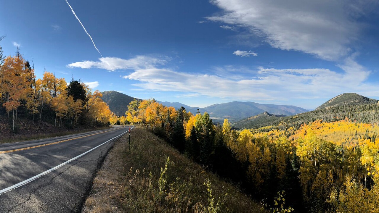
Southern Colorado Drives - Highway 67 from Divide to Cripple Creek
One of the best short drives for fall colors from Colorado Springs is on Highway 67 from Divide to Cripple Creek!
You'll see tons of yellow Aspen and Cottonwood trees as you follow the highway south through the hills.
There are several pull-off spots along the highway to snap a picture, and you can grab lunch or place a bet in Cripple Creek before you head home!
Southern Colorado Drives - Quail Lake
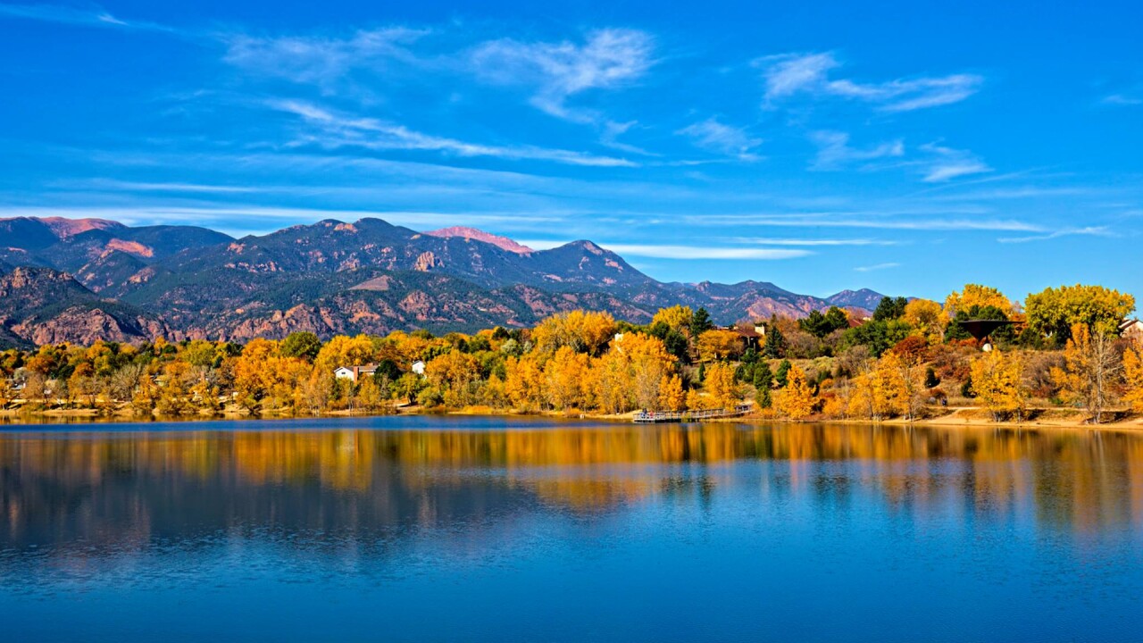
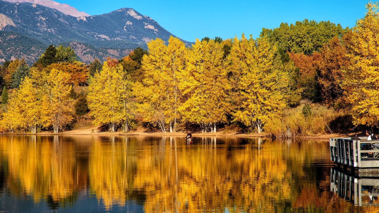
This is about the shortest and easiest drive you're going to get for fall foliage in southern Colorado. Quail Lake is located a few miles south of downtown and is surrounded by beautiful yellow and orange trees.
Quail Lake has a fantastic view of the southern edge of the Front Range leading right into Cheyenne Mountain. You can kayak, picnic, or simply take a walk on the nearly mile-long trail surrounding the lake.
The best view is along the waterfront on the east side of the lake.
Southern Colorado Drives - Gold Camp Road
You better have the right vehicle for this one. Formerly a railroad line from Colorado Springs to Cripple Creek, Gold Camp Road is now a free public road popular with bikers and hikers.
The road is very steep, rugged, and windy, but features several great views of Aspen and Cottonwood trees. The easiest way to get there is to drive through Cheyenne Canyon and follow the paved road until it turns into Gold Camp Road.
A word of caution, Gold Camp is a ROUGH road with steep grades, so a 4-wheel-drive vehicle with good brakes is highly recommended.
Garden of the Gods
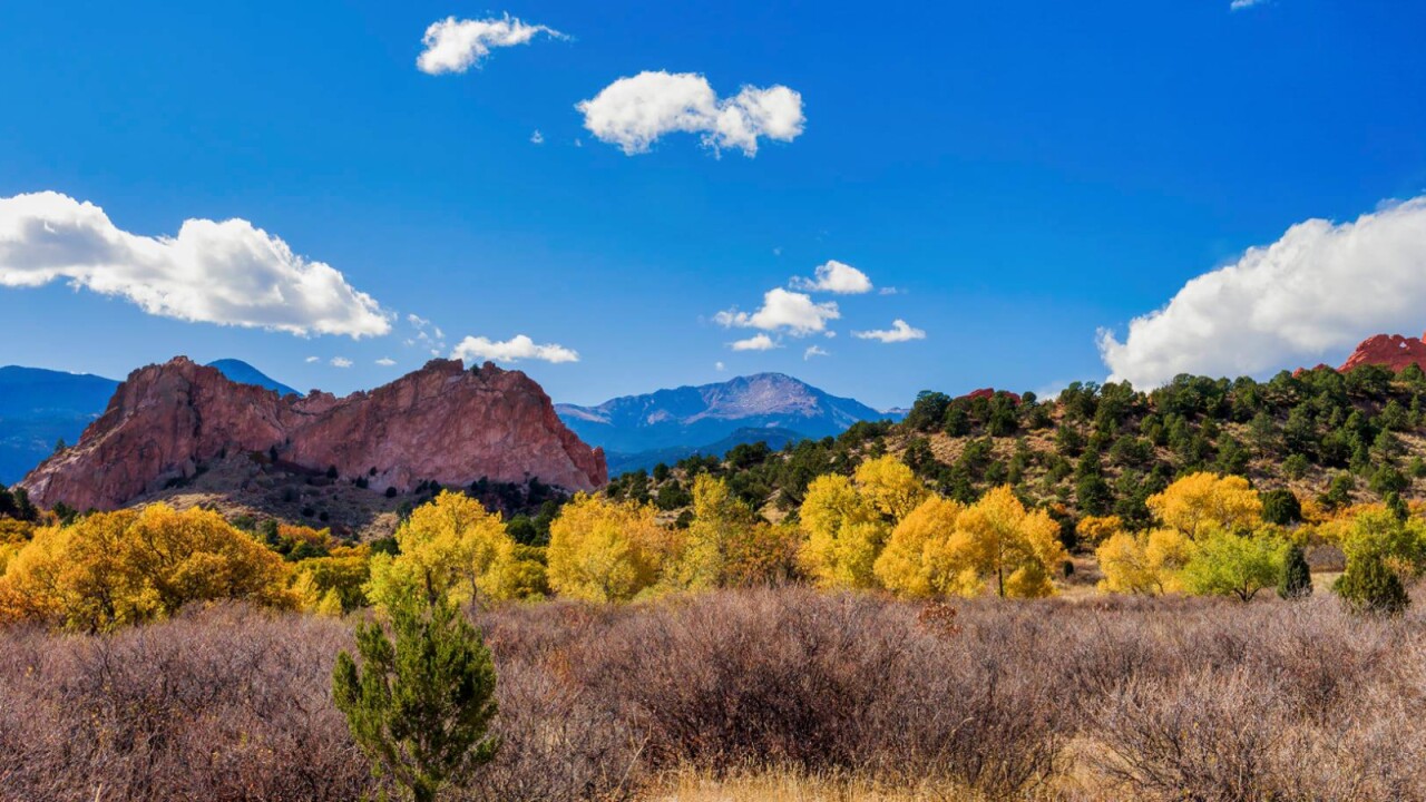
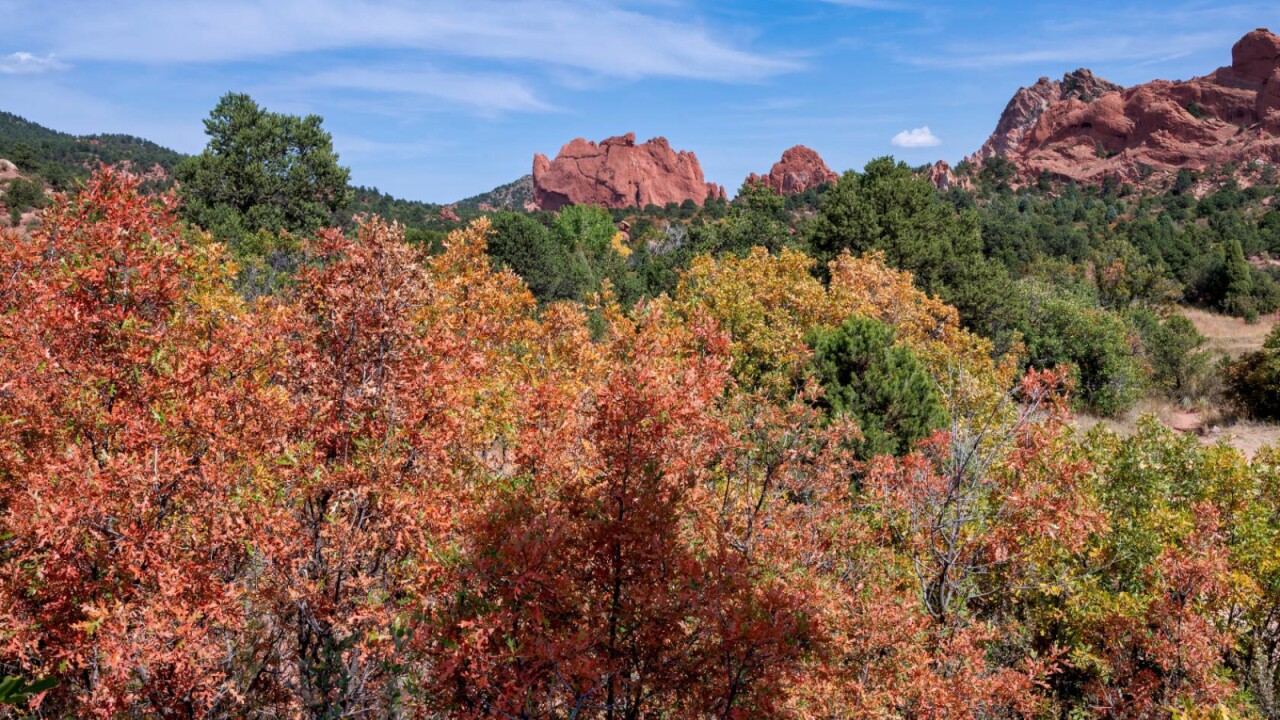
Fall colors... at Garden of the Gods?! Sure, you just have to know where to look!
Garden of the Gods, one of the most famous landmarks in Southern Colorado, is located on the west side of Colorado Springs. It's a free natural attraction that has been voted the best park in the county many times.
There really aren't any aspens in Garden of the Gods, but you can still find a few cottonwood trees and a variety of orange, red, and yellow scrub brush.
According to local photographer Larry Marr, "The Garden usually has some nice colors along foothills trail near the main entrance. I spend most of my time in the Scotsman trail area. There are spots of colors all over out there that people miss because they are too excited to enjoy the park."
Southern Colorado Drives - Highway 165 from Rye to San Isabel

A longtime favorite of lead forecaster Mike Daniels, this beautiful drive is great for those who live in Pueblo!
You'll see lots of aspen trees as you drive through the Wet Mountains, with plenty more fall colors around San Isabel Lake.
To get there, just navigate your GPS to Rye, and follow Highway 165 all the way to San Isabel. If you have the time, keep driving about ten minutes west of San Isabel and explore Bishop Castle!
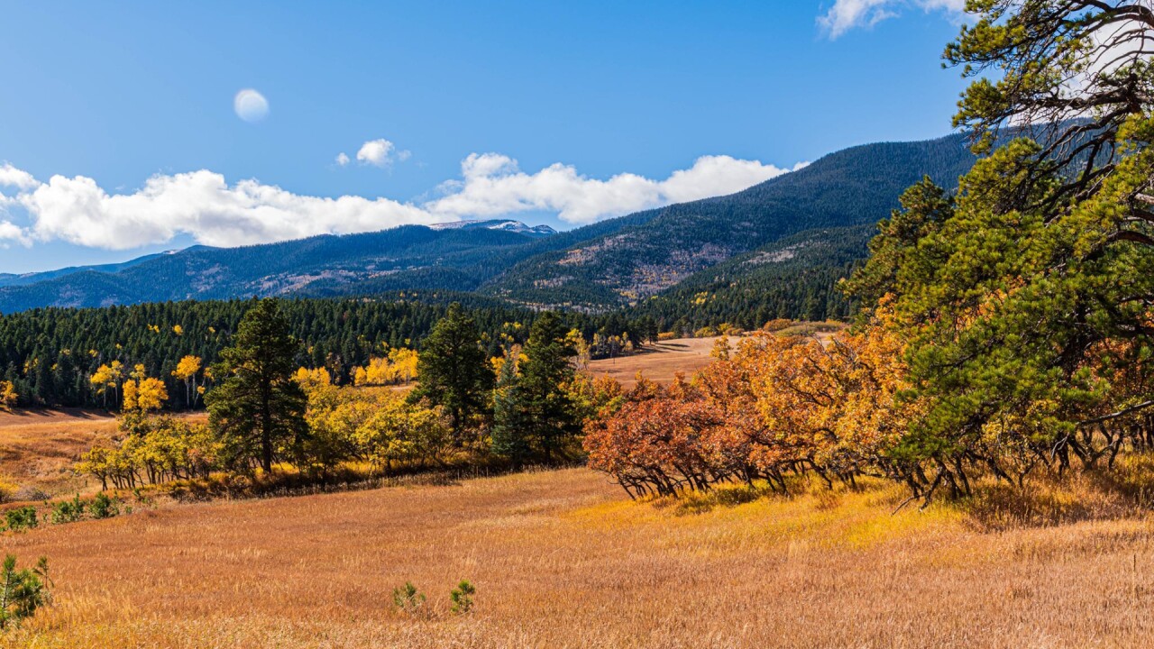
Southern Colorado Drives - Wilkerson Pass
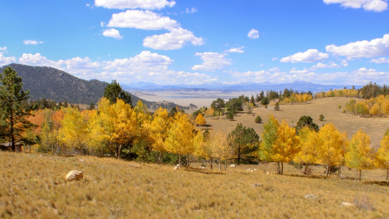
If you've driven out to Breckenridge or Buena Vista from Colorado Springs, you should know Wilkerson Pass well. The pass is a short, easy, and scenic drive about an hour west of Colorado Springs.
From the top of Wilkerson Pass, you'll get a beautiful, sweeping view of Park County. The mountains you'll see in the distance are part of the Sawatch and Mosquito range.
Our advice would be to park at the Wilkerson Pass Visitor Center and simply explore the area, especially southwest of the visitor center.
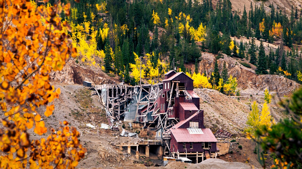
Monarch Pass & Madonna Mine
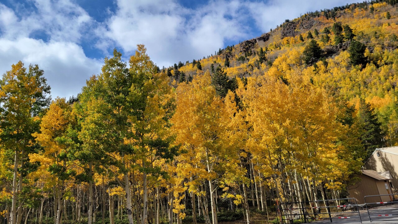
Monarch Pass is a well-traveled pass that connects Salida to Gunnison via Highway 50.
At the summit of the Pass is the famous southern Colorado ski area, Monarch Mountain.
You won't see as many aspens and cottonwoods here as you might at other mountain passes, but if you explore areas like Madonna Mine, you'll find plenty of fall colors.
Southern Colorado Drives - Cucharas Pass
If your schedule in September was packed and you missed a lot of the peak fall colors, drive south and give Cucharas Pass a shot!
The pass is located south of La Veta and usually peaks in late September to early October.
Cucharas Pass is not heavily traveled and gives you a beautiful view of the Spanish Peaks to the east, and the towering spines of the Sangre De Cristos to your west. The road is paved and pretty easy to drive for most vehicles.
Cordova Pass
Cordova Pass is one of the farthest south fall color recommendations in our region!
Located east of Cuchara and southwest of the Spanish Peaks, it pairs well with a day trip to Cuchara Pass!
Our suggestion would be to visit Apishapa Arch, which is just a few miles east of Cordova Pass Campground.
Maroon Bells
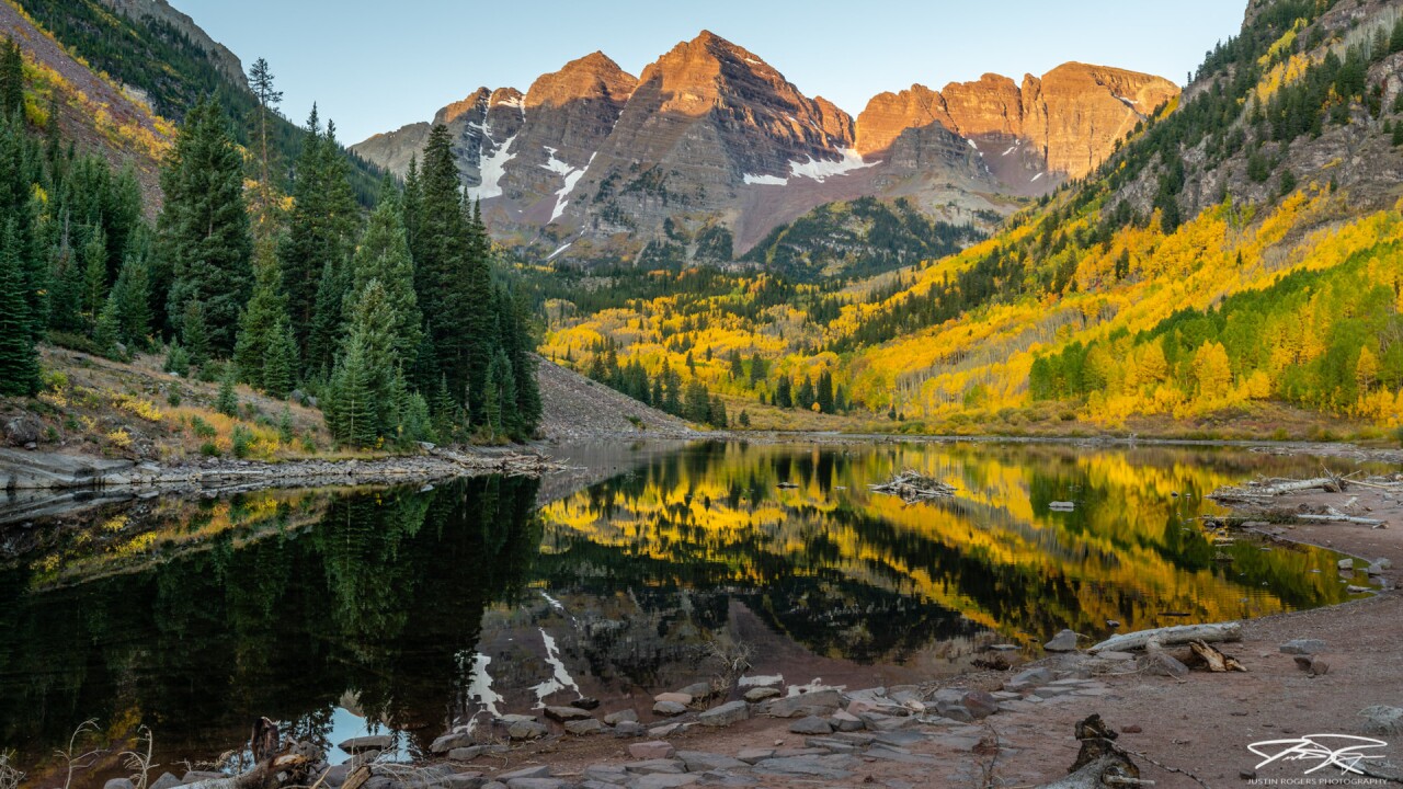

The Maroon Bells might be the top leaf-peeping spot in all of Colorado. Often regarded as the most photographed place in Colorado, the bells sit in front of a valley covered in aspen trees surrounding Maroon Lake.
Our advice is to do your research before visiting the bells (what you need to know).
Parking spaces at the Maroon Lake Trailhead are RESERVATION ONLY, and many spots are already taken. If you have a reservation, you can drive your personal car right up to your reserved parking spot.
There is a shuttle bus option to the base of the bells, but that also requires a reservation. Guests can arrive at Aspen Highlands and purchase their tickets in person, for a first come first serve basis, but the availability is not guaranteed.
Try to avoid going on weekends, especially Saturdays, as the bells are one of the most popular places to see fall foliage in the entire state.
Crystal Mill

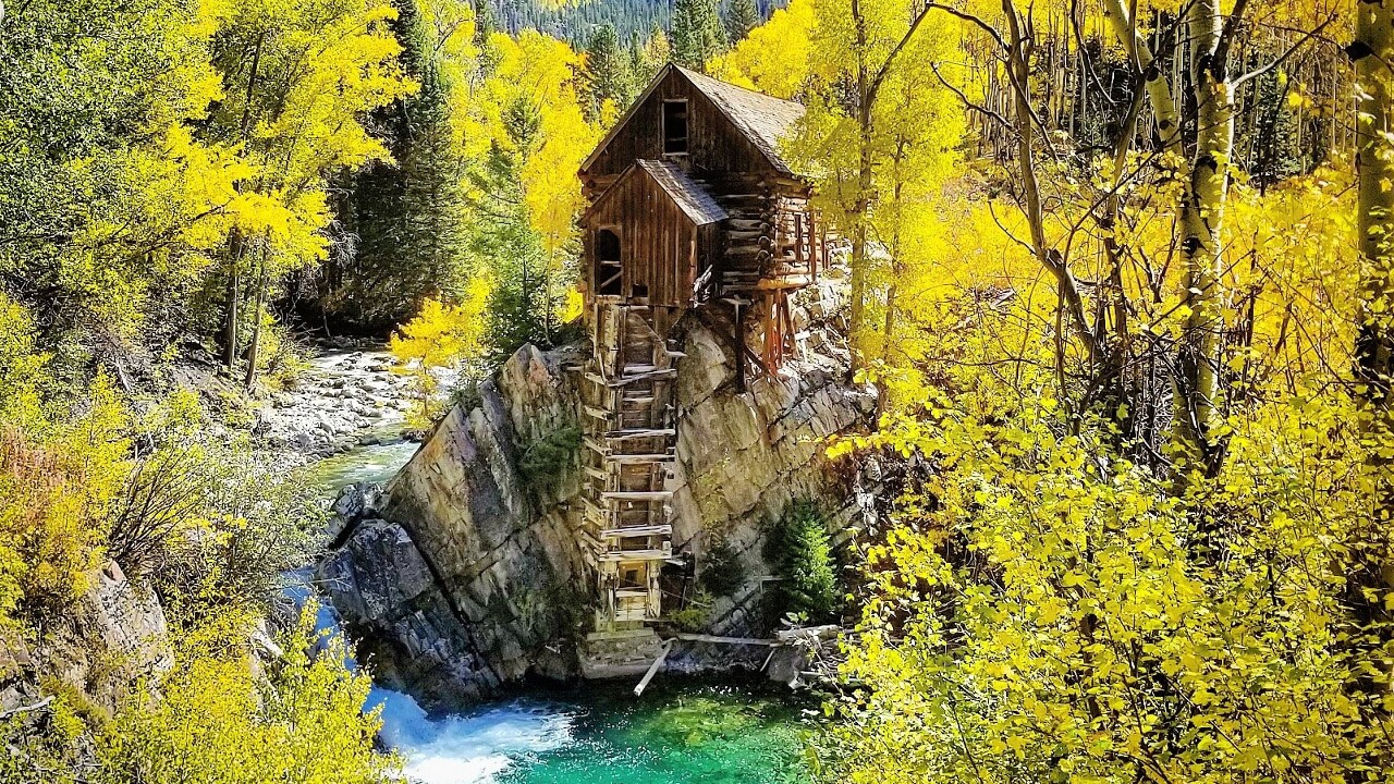
Crystal Mill is an old power station built back in 1893 located about 5.5 miles east of Marble. The mill sits on an outcrop above the Crystal River and has not been in use since 1917 when the Sheep Mountain Mine closed.
Crystal Mill is only accessible in the fall and summer by a rough, one-lane highway.
High clearance, 4-wheel-drive vehicles are recommended, but the mill can also be reached by foot, mountain bike, or guided jeep tour. Click here for more information on Crystal Mill.
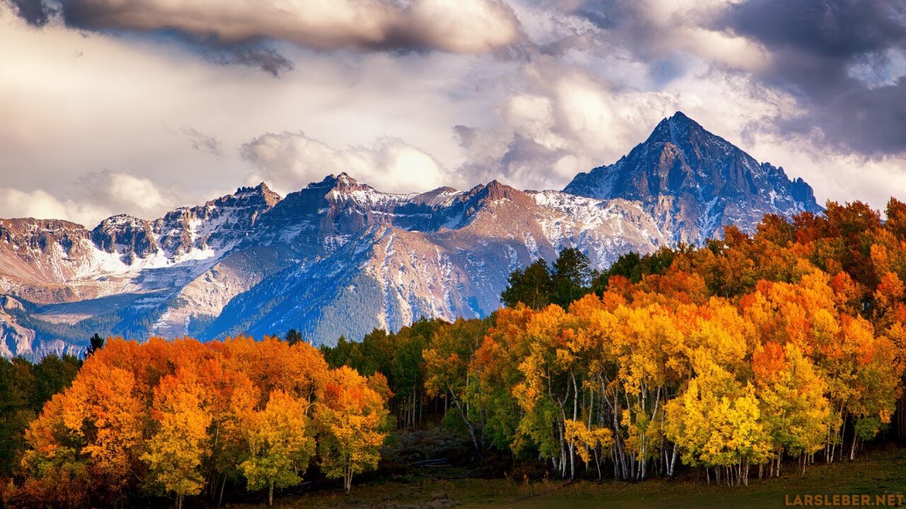
Mount Sneffels
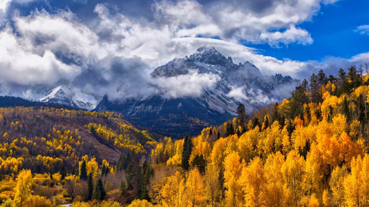
Mount Sneffels is arguably one of the most beautiful mountains in all of Colorado.
Tucked back in the San Juans in between Telluride and Ridgway, Mount Sneffels is a towering, jagged 14,150 foot peak with stunning panoramic views.
Our advice would be to drive out to Ridgway, and explore a few small highways south of town. There are plenty of viewing opportunities along county roads 5, 7, and 9.
Rocky Mountain National Park


Not only is it one of the most popular national parks in the entire country, but Rocky Mountain National Park also boasts amazing fall color views!
You'll see yellow aspens and fall foliage pretty much anywhere in the park, but we recommend Trail Ridge Road, Glacier George Trail, Bear Lake Road, and Grand Lake in particular.
Due to the popularity of the park, a timed reservation system is in place until October 19, 2022. More information can be found here.
Black Canyon of the Gunnison
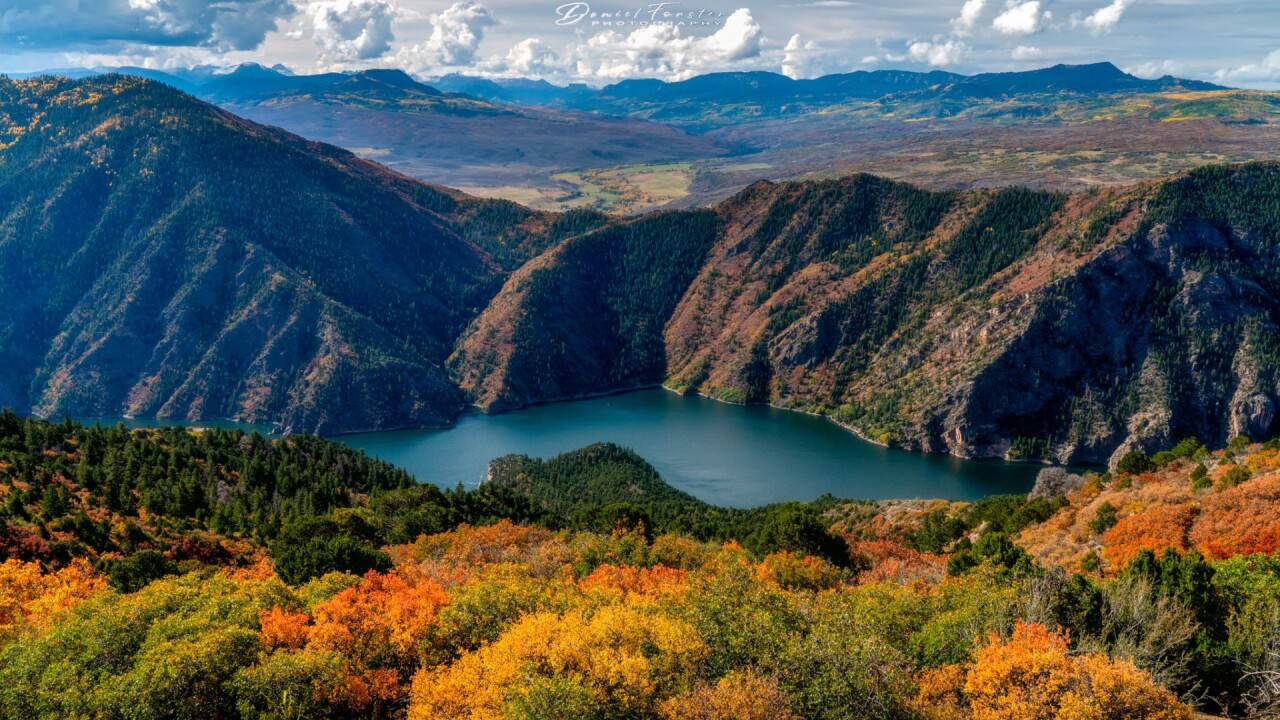
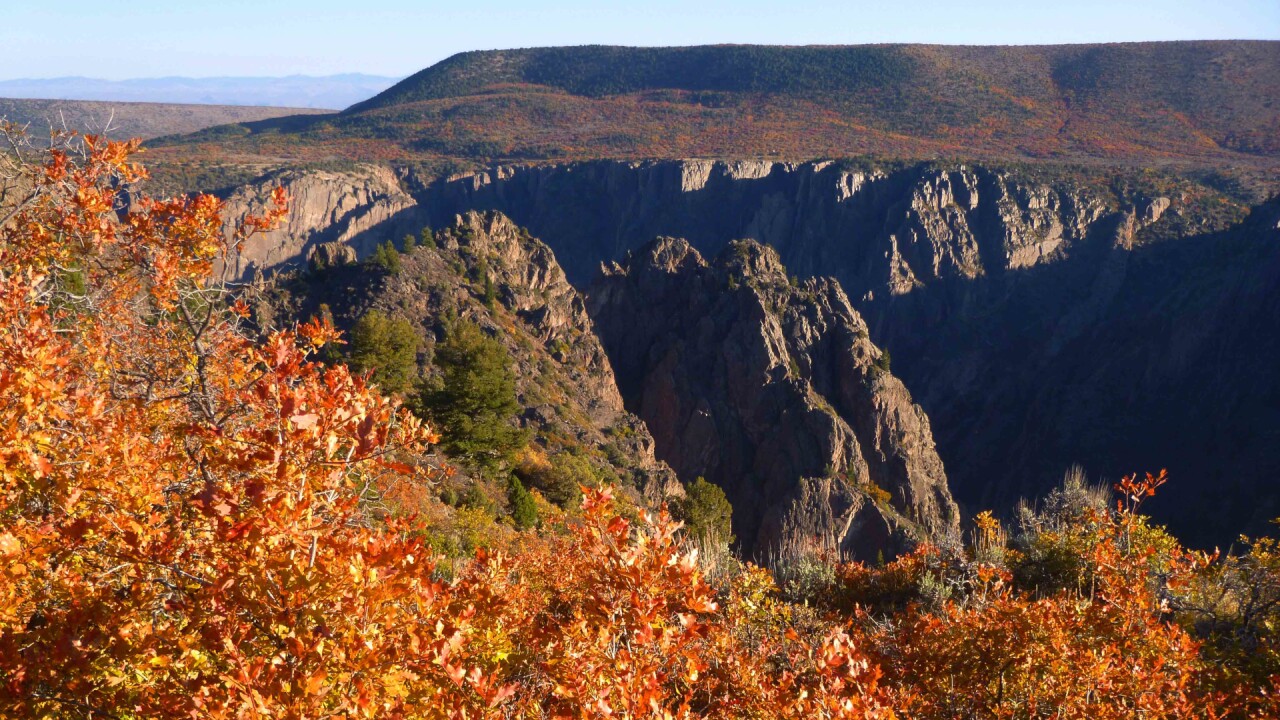
It's not exactly a place you'd expect to find a lot of fall color, but the proof lies in the picture!
Black Canyon of the Gunnison is one of Colorado's four national parks located about 4.5 hours west of downtown Colorado Springs.
The gorge is famous for dark, tall walls with striations and lines carved into the canyon walls.
Our advice is to navigate to the South Rim Visitor Center. From there you can drive along Rim Drive Road (closed Nov-Apr) to see lookout views like the Painted Wall View, and any foliage along the rim of the canyon.
Dallas Divide
Ready for a long road trip? If you're going west near Ridgway and Telluride, you should take a drive over the Dallas Divide!
The Dallas Divide is a mountain pass about 12 miles west of Ridgway. This pass is absolutely beautiful with scenic views of the rugged San Juan Mountains and tons of bright yellow aspen trees.
The road is paved and not very steep. It is an easy drive for all vehicle types.
Million Dollar Highway
Million Dollar Highway (US 550) is one of the most beautiful scenic byways in Colorado, connecting Silverton to Ouray.
The road winds through the San Juan mountains, fraught with hairpin turns, steep drop-offs, and rapidly changing mountain weather.
You'll hit three mountain passes offering amazing fall color views: Red Mountain Pass (arguably the best), Molas Pass, and Coal Bank Pass.
There isn't a clear answer to why the road is called "Million Dollar Highway". Theories range from the cost to build the road, to early travelers overcome by vertigo saying "I wouldn't travel on that road again even if you paid me one million dollars".
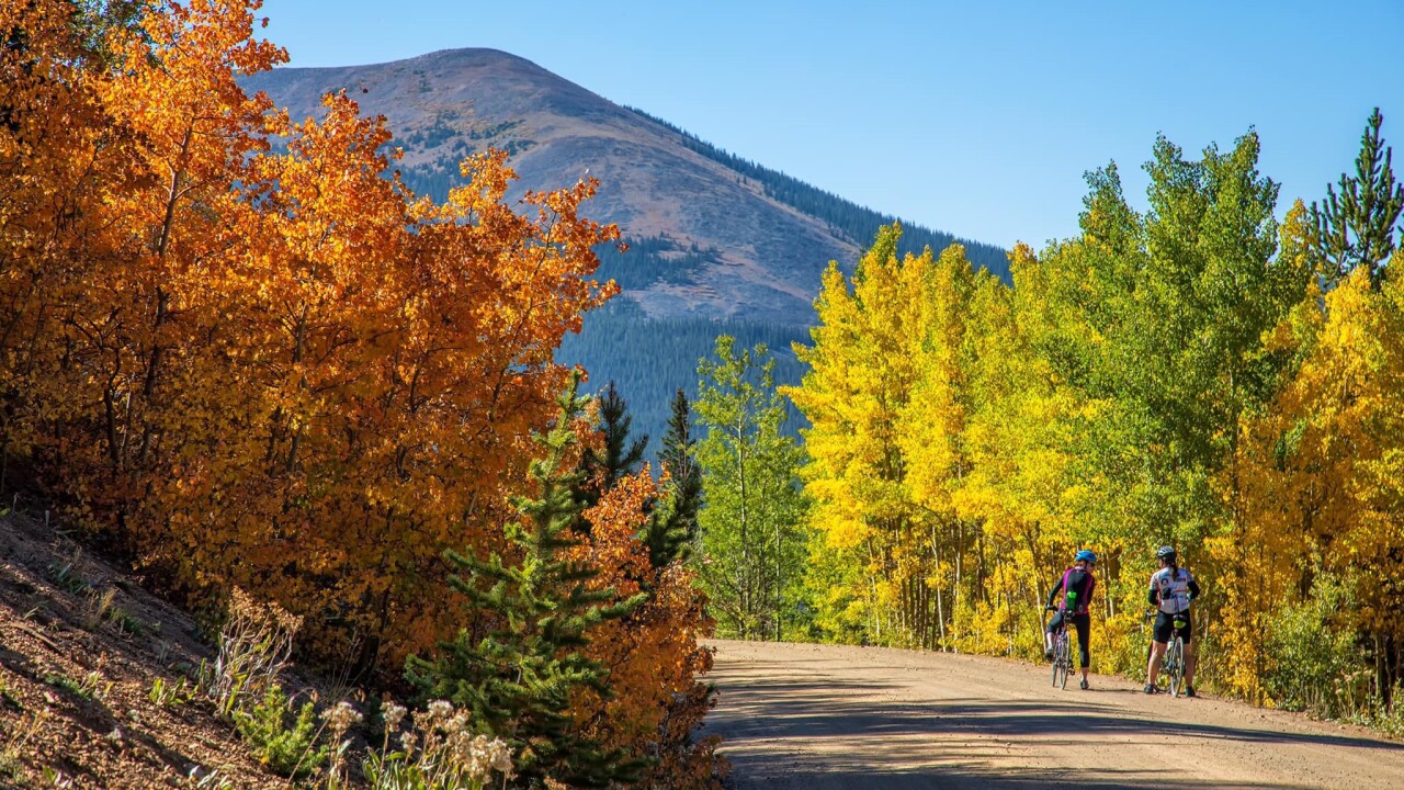
Cottonwood Pass
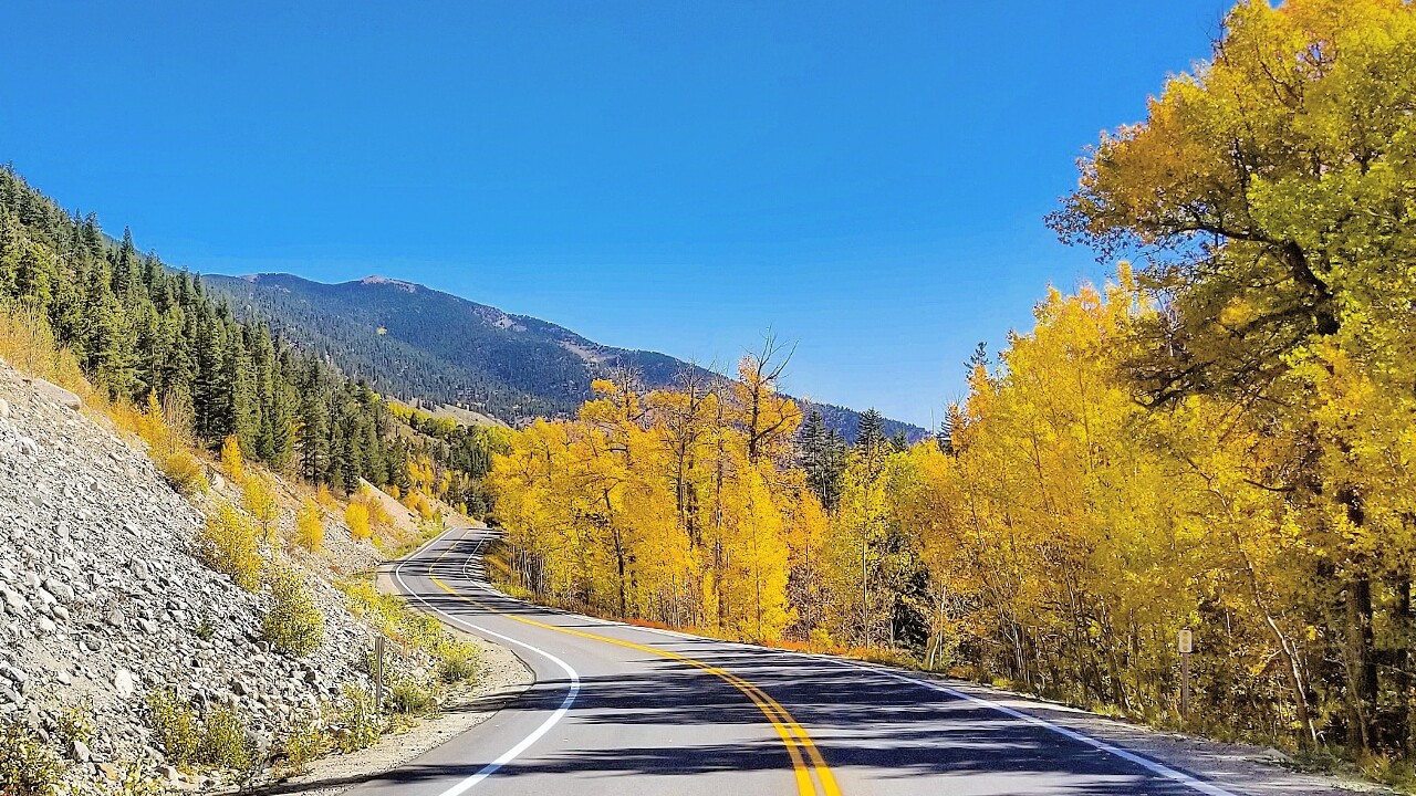
Cottonwood Pass, Colorado's highest paved mountain pass (12,126 feet at the summit), is located just west of Buena Vista.
The pass is filled with tons of aspen and cottonwood groves and will give you a nice mix of yellow, red, and orange fall colors. Drive up and down the Buena Vista side for the best fall foliage pictures.
The road heads over the Continental Divide and spits out at the tiny town of Almont near Crested Butte. Cottonwood Pass was recently paved and is an easy drive for any car, only getting steep near the summit.
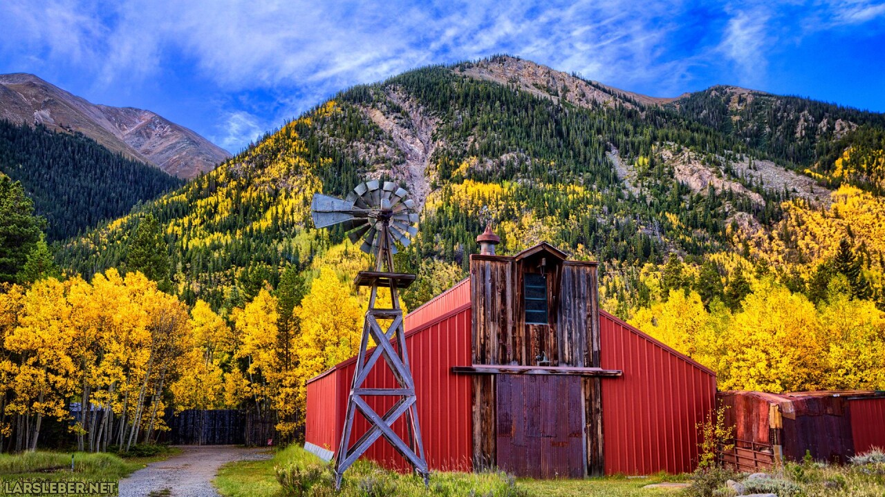
St. Elmo Ghost Town
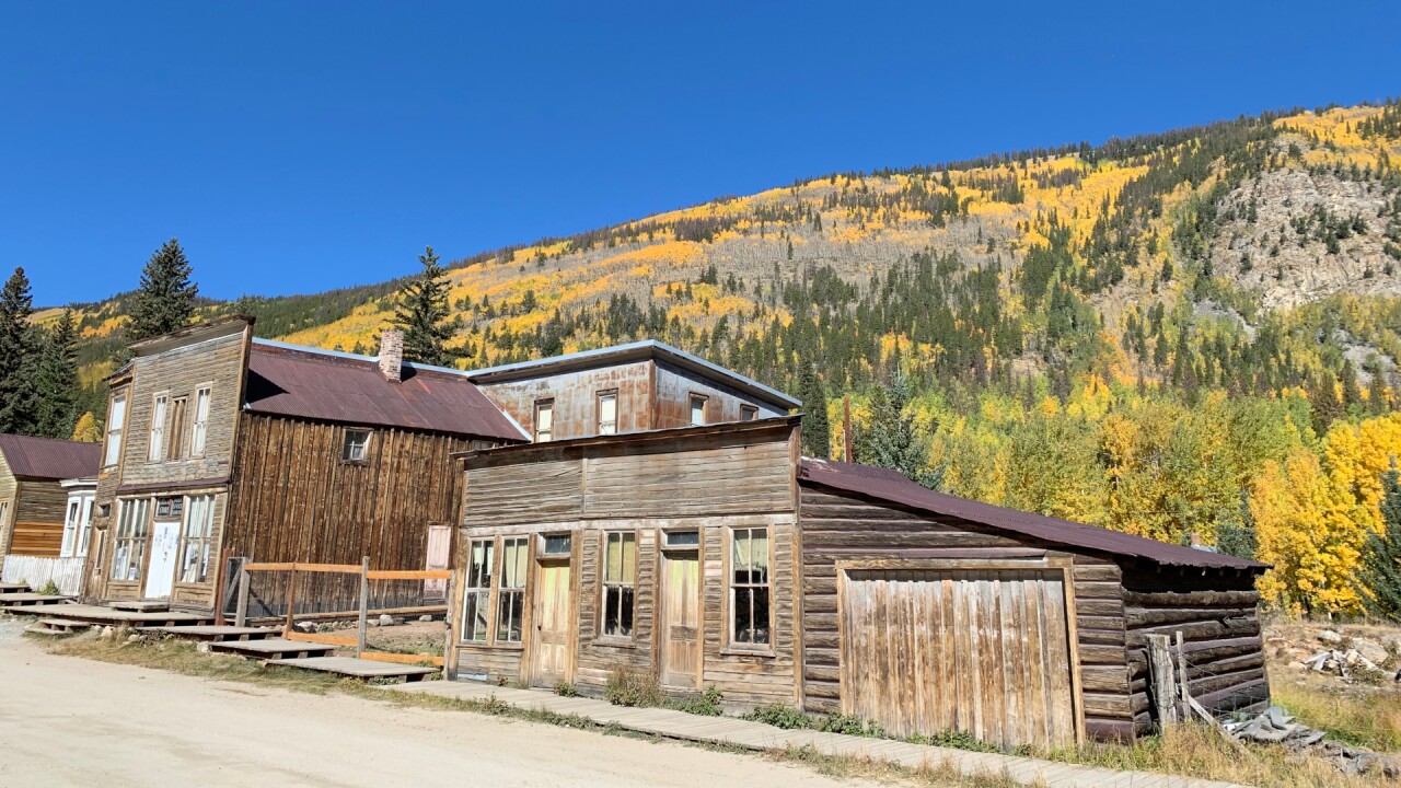

St. Elmo and Cottonwood Pass make an excellent two-part leaf-peeping trip if you have a full afternoon! St. Elmo is one of the best-preserved and easily accessible ghost towns in Colorado.
At its peak, the town had around 2,000 residents drawn in for gold and silver mining. Now only about 43 old and tattered buildings remain. You can still buy souvenirs and snacks at the general store, which is only open seasonally.
The ghost town is located about 11 miles west of Mt. Princeton Hot Springs on an easily accessible road to most vehicles. St. Elmo and Cottonwood Pass are only about one hour apart.
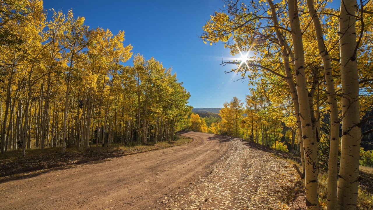
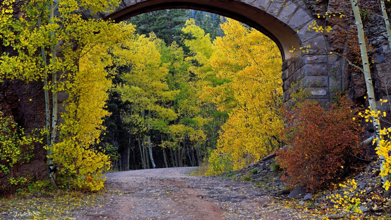
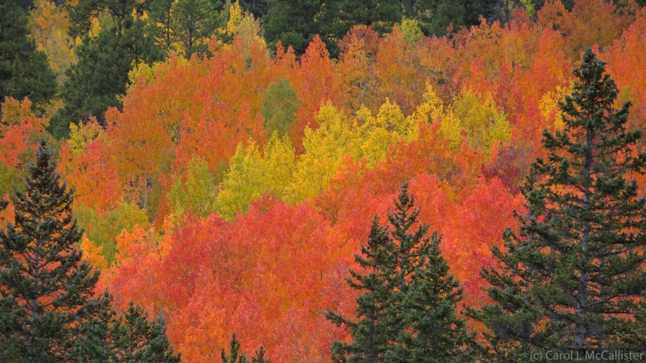
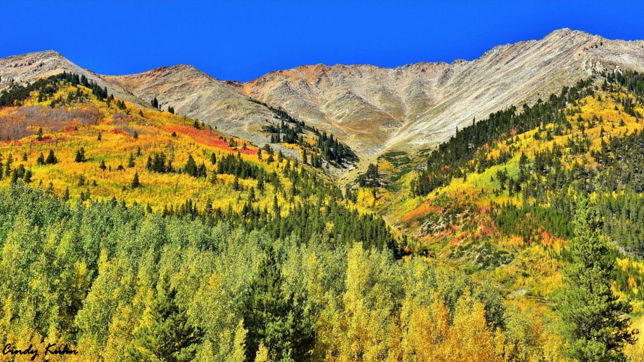
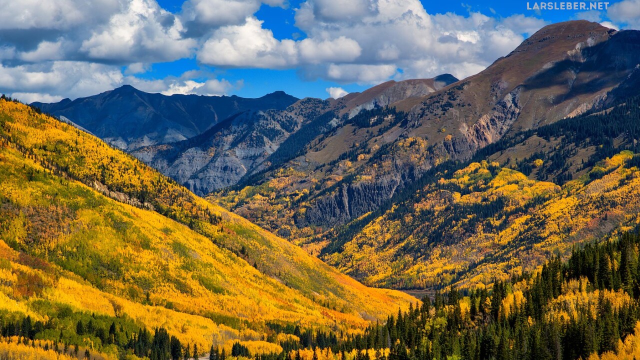
Kebler Pass
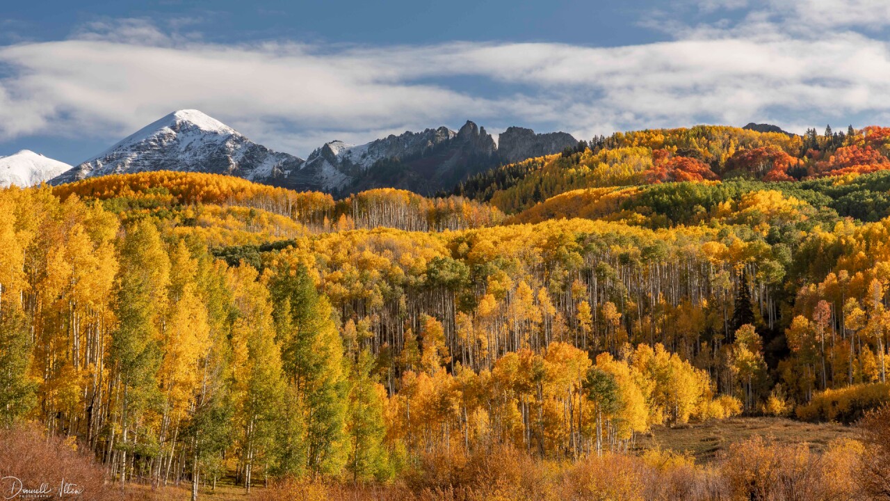

Kebler Pass is considered one of the best places in Colorado to see fall colors. Not only is it home to Colorado's biggest aspen grove, but it's also one of the largest in the entire country!
The easiest way to get to Kebler Pass is to drive to Crested Butte, and then take CO 12 west. CO 12 turns into Kebler Pass. Some of the road is paved, but there are large stretches where the pavement turns to dirt or gravel.
The pass summits at 10,007 feet, and despite the stretches of dirt/gravel, it's easy enough to drive for most vehicles.
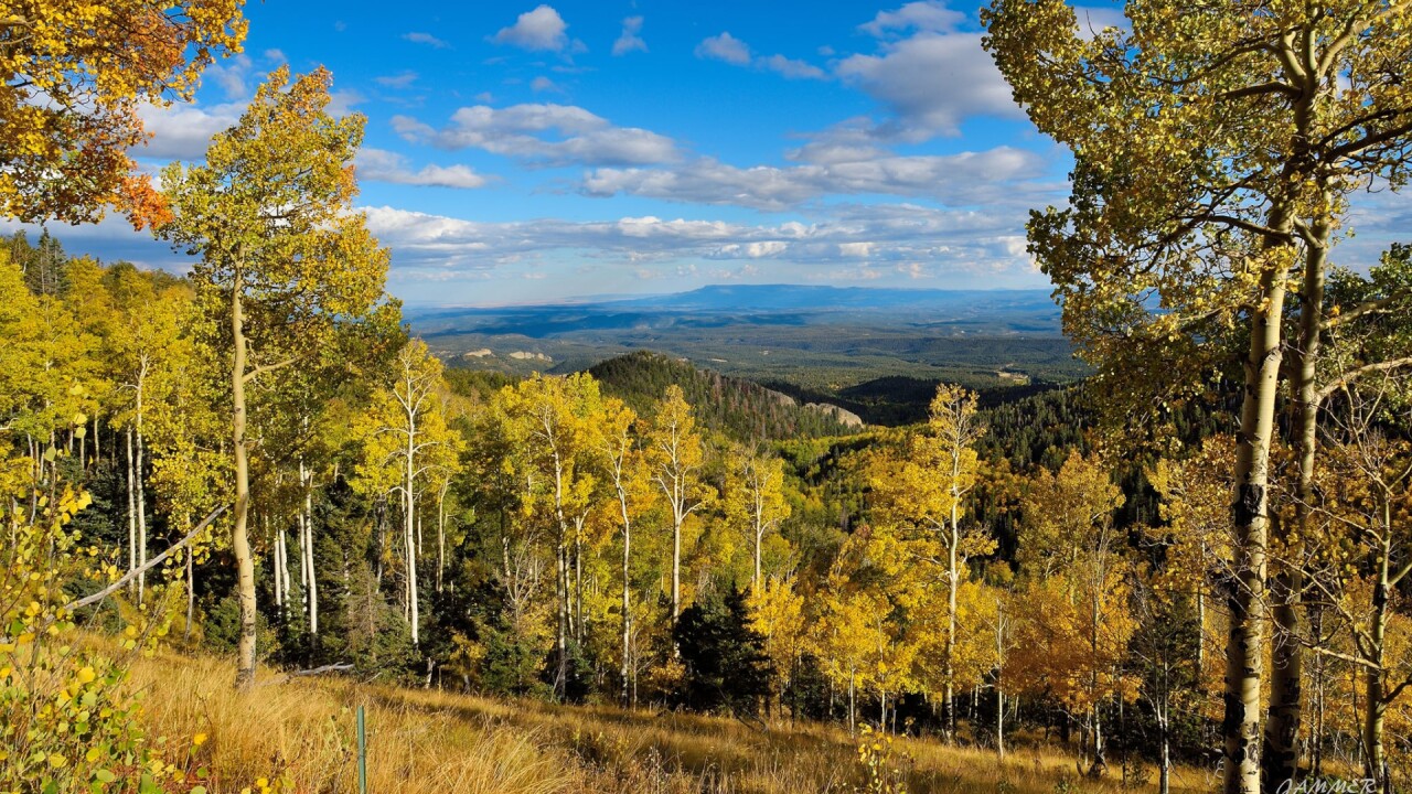
Ohio Pass


If you're already driving Kebler Pass, you might as well swing south to Ohio Pass!
Ohio Pass is known for having tons of aspen groves, and a unique rock feature called The Castles! The Castles, pictured above by Tom Kackley, is a unique rock formation with distinct, sharp towers.
To get to Ohio Pass, just turn south off of Kebler Pass onto CO 730 and follow it south. The pass is a dirt road and a bit more rugged than Kebler Pass, so a 4x4 vehicle is recommended.
Boreas Pass
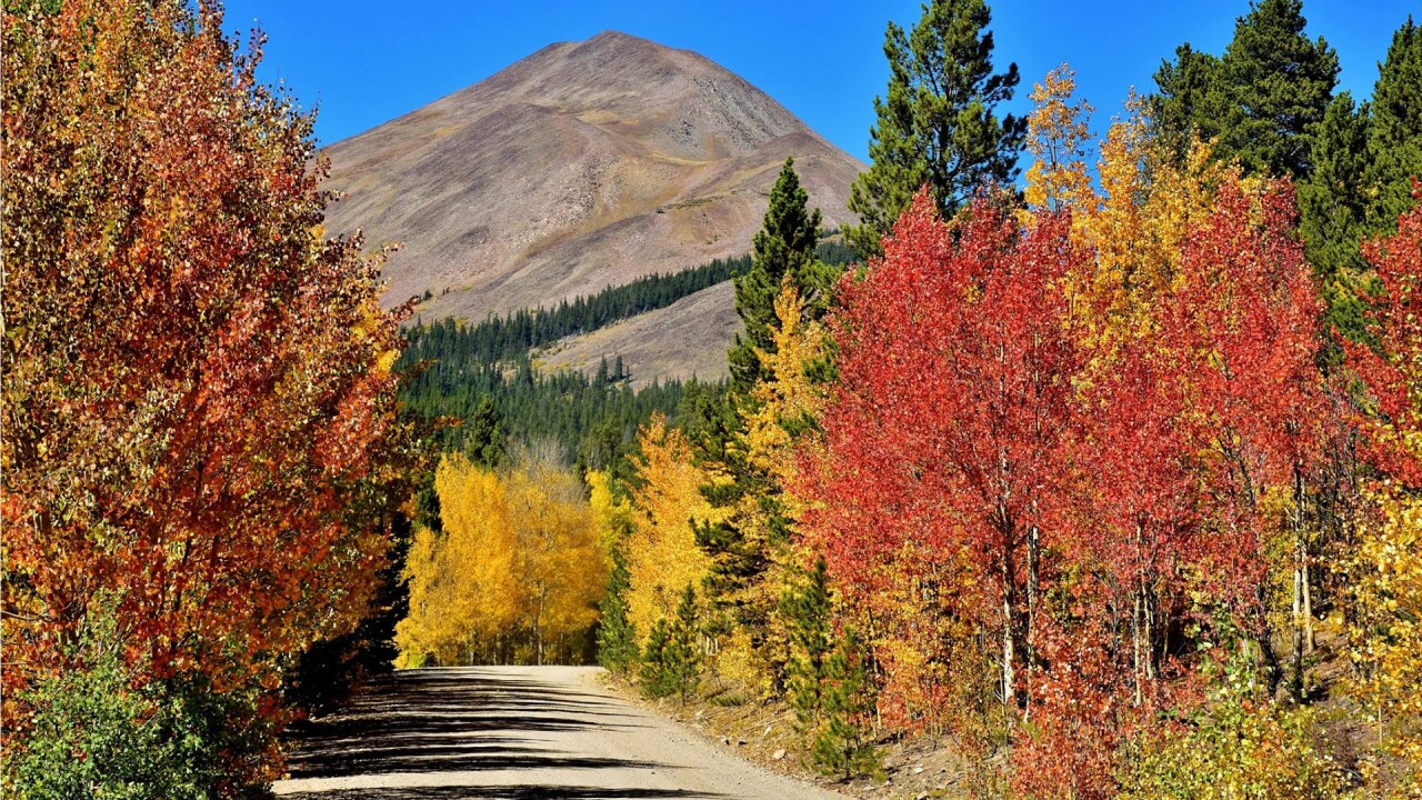
Boreas Pass is great if you're in the mood for a quick getaway to Breckenridge!
Once a gold mine route to Breckenridge, Boreas Pass was turned from a railroad route into a mountain pass in 1952. Boreas Pass will give you plenty of mountain views with dense yellow, orange, and red fall color clusters.
The pass is about 22 miles long, summits at 11,481 feet, and takes about an hour to drive. The gravel/dirt pass is smooth enough for most 2WD cars, but it does get bumpy in a few spots.
Kenosha Pass


Kenosha Pass is probably the closest mountain leaf-peeping getaway for anyone who lives in Denver.
Located about an hour south of Denver along Highway 285, the pass is easily accessible by all cars and boasts beautiful views of golden Aspen trees.
If you have the time, we highly recommend making this and Boreas Pass a double feature, as you can follow Highway 285 down to Como and take Boreas Pass right into Breckenridge.
Last Dollar Road
Last Dollar Road is a legendary fall color destination near Telluride.
Tucked away in the beautiful San Juan mountains between Ridgway and Telluride, Last Dollar Road is one of Colorado's most scenic fall color drives. The road actually has a little fame, as it was the shooting location for the opening and closing shots of John Wayne's film "True Grit".
Last Dollar Road is roughly a 2 to 3-hour drive and only requires slight off-roading by 4x4 vehicles.
The road (T60 on google maps) connects to Highway 145 in Telluride just past the roundabout. You can also navigate your GPS to the Alder Creek Trailhead, which is on Last Dollar Road.
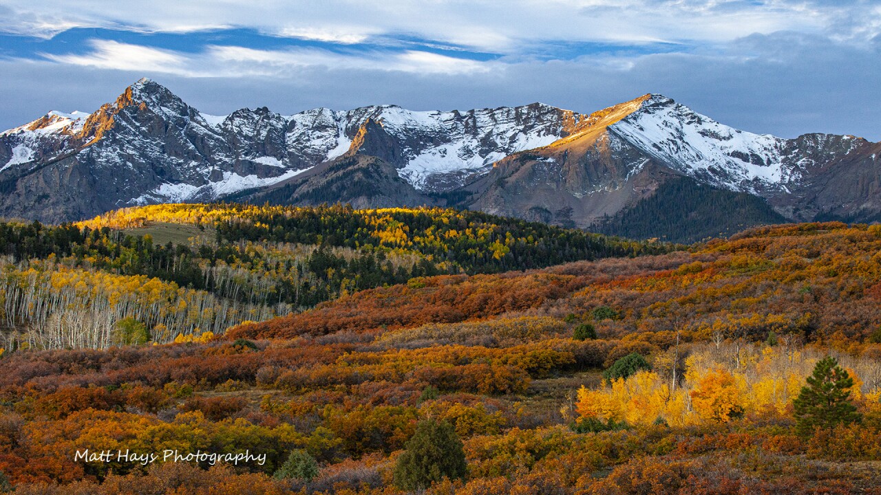
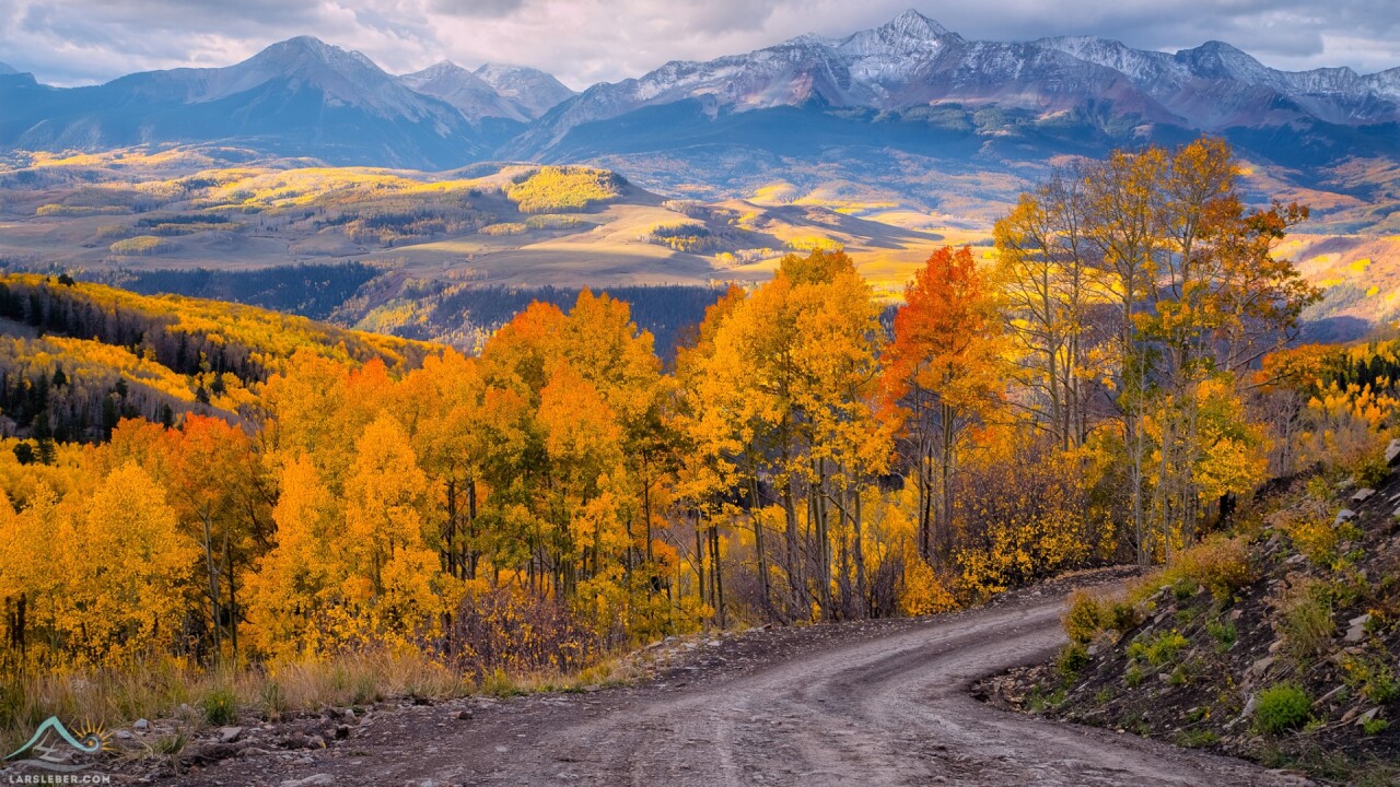
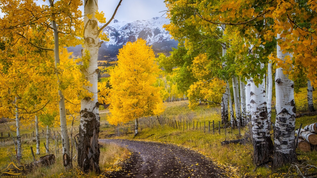
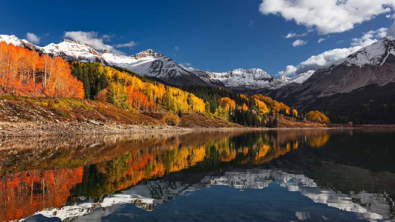
Ridgway Area
If you're driving out to Telluride, you might as well stop and see some fall colors at Ridgway!
The two photos above were taken by Lars Leber Photography on random county roads outside of Ridgway. It's a great spot to fuel up and grab food before you continue your journey to Telluride or Ouray.
We recommend just exploring around the area. Try looking for colors at Ridgway State Park or drive down county roads east and south of town.
Twin Lakes
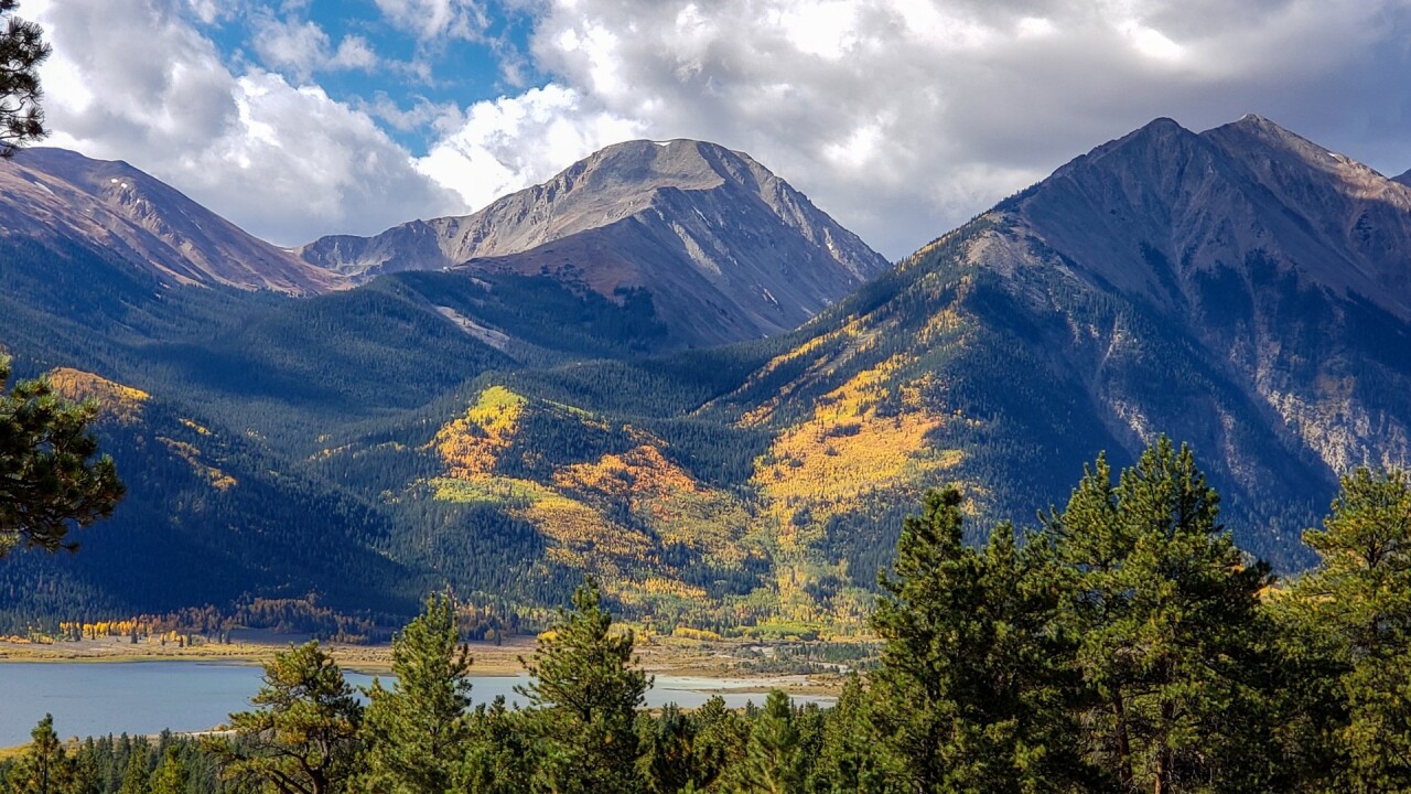
Twin Lakes is a legendary camping spot just north of the collegiate peaks outside of Buena Vista! It's right at the base of Mount Elbert, the tallest mountain in Colorado.
There are tons of aspen groves on the mountains surrounding the lake, but you'll also see red and orange leaves speckled throughout. Twin Lakes is home to a semi-ghost town and all the old, dilapidated buildings make unique framing for the surrounding fall colors.
A really great weekend trip would be to take Independence Pass, which is just 20 minutes west of the lakes, all the way down into Aspen.
Clear Creek Reservoir
Clear Creek Reservoir is kind of a hidden gem located between Buena Vista and Twin Lakes.
The reservoir is an extremely popular and reliable fishing spot with catch rates that exceed one catch per hour, according to Colorado Parks and Wildlife.
This would be a great location to pair with a leaf-peeping trip to Twin Lakes, Cottonwood Pass, or St. Elmo.
Independence Pass

If you're going to drive to Aspen, why not get there in style!
Independence Pass is the second-highest paved mountain pass (12,095 feet at the summit) that connects Twin Lakes to Aspen. Despite being paved, the pass is long, curvy, and steep at times with two VERY narrow sections near the end of the west side.
The whole pass has amazing mountain views, but the best aspen colors are on the west side of the pass. If you have a little time, stop see the famous cliff jumping spot, The Devils Punchbowl!
Guanella Pass
Guanella Pass makes a great daytime from Denver, especially if you want to explore Georgetown!
The pass climbs to 11,669 feet in 12 miles and is surrounded by aspen trees for most of the drive. The trail to Mount Bierstadt, considered one of the easiest 14ers to climb in Colorado, is accessible from the summit of Guanella Pass.
The pass is fairly easy to drive for all vehicle types and takes about an hour to drive. If you have extra time, book a ticket on the famous Georgetown Loop Railroad!
Owl Creek Pass

Owl Creek Pass is a gorgeous mountain pass located about 50 minutes east of Ridgway.
The pass is a stunning drive through the San Juan mountains filled with Aspen trees and unique rock structures. Several scenes from John Wayne's "True Grit" were shot in this mountain pass, including the famous face-off with Robert Duval.
Owl Creek Pass is fairly accessible to all vehicle types, but as with most mountain passes around the San Juans, a higher profile 4x4 vehicle is recommended.
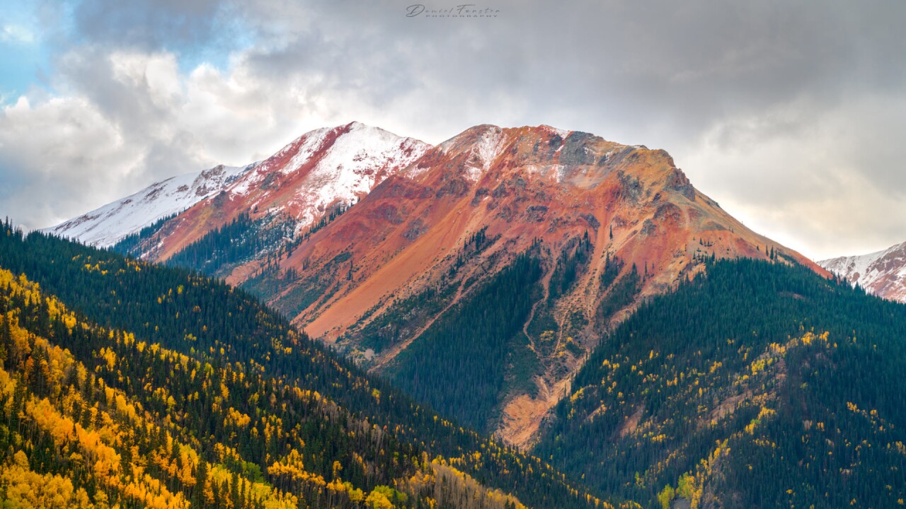
Red Mountain Pass
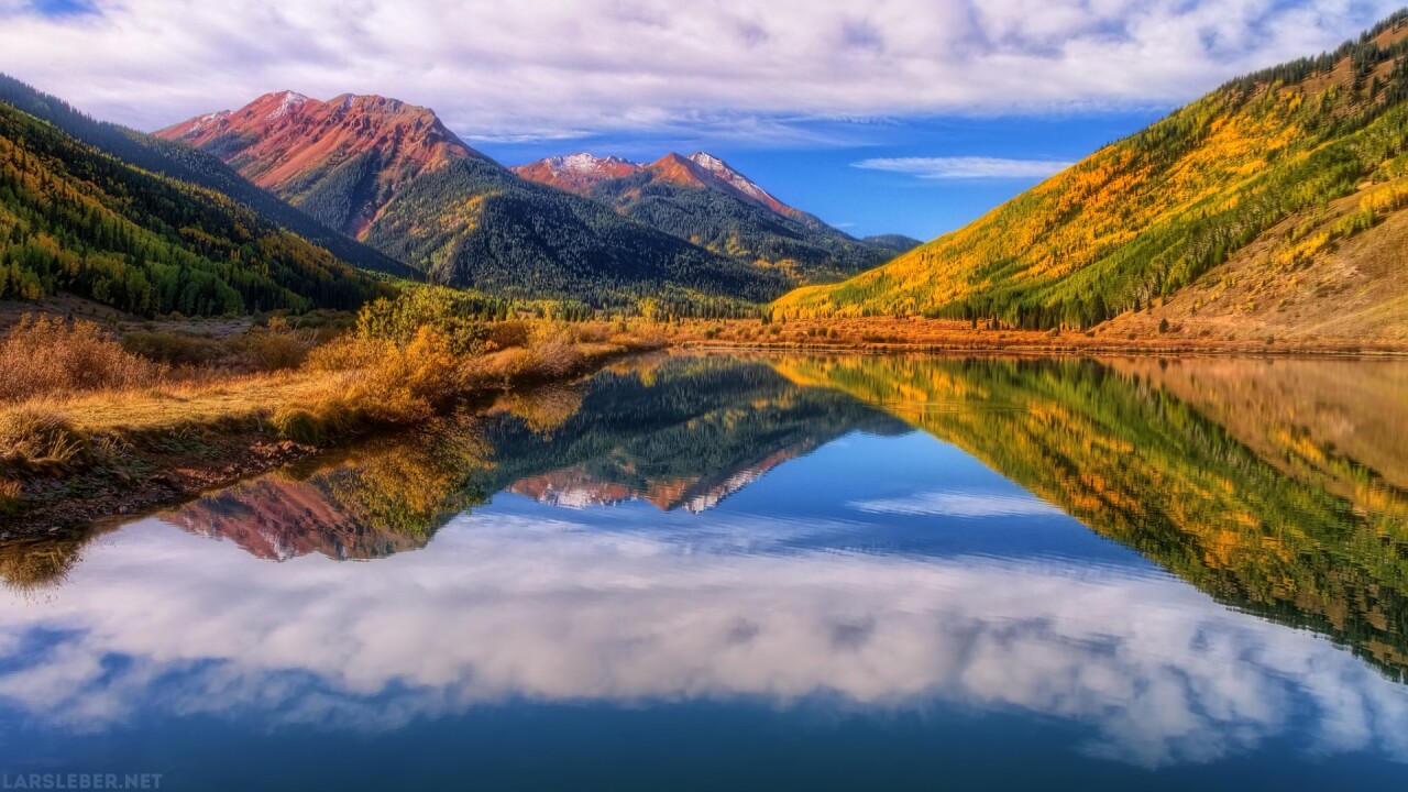
Red Mountain Pass is an amazing section of the Million Dollar Highway in southwest Colorado!
The pass is dangerous and intimidating, but brave and careful drivers are rewarded with amazing mountain and fall color views at the summit.
Driving to and from Red Mountain Pass contains stretches of road with steep cliffs, sharp turns, and 8% grades. Take your time, and pay strict attention to the road.
Trout Lake
Trout Lake is out in the San Juan Mountains, 15 minutes from Ophir and downtown Telluride.
It is a beautiful and easily accessible alpine lake, great for kayaking in the summer and snowshoeing in the winter.
Trout Lake is just off Highway 145 and is driveable for most vehicle types.
Need Inspiration? Check out the viewer photos from 2021!
We had so many viewer photos last year, we had to make three different slideshows!
Share your photos with us!
We would LOVE to see your photos and share them on-air and online!
Please post them to the KOAA Facebook Page or email them to weather@koaa.com and mypics@koaa.com
