


Call it a May Miracle, but the combination of rain, snow, sleet and hail over the past 5 days has brought a major source of relief to our drought stricken state.

This graphic which shows radar estimated rainfall tells the story quite well!
Beneficial moisture coming from mostly melted snow and rain since last Friday, with many areas scoring between 1-2" of water.
A big bullseye visible from the mountain valleys to the Arkansas River Valley and the southern I-25 corridor.
This product is great for the Plains, but doesn't map things out as successfully for the mountains. That's a limitation of radar based data.
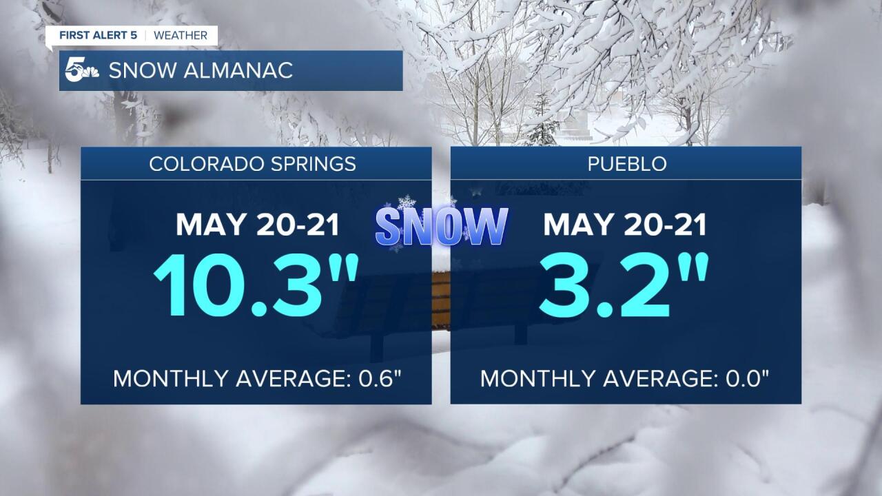
At the Colorado Springs Airport, most of the precipitation fell as snow for the first few days, with 10.3" from May 20-21.
While not the latest snow on record, that's a lot of pow pow for late May.
Pueblo's 3.2" of snow from last Friday to Saturday actually ties the record for the latest snow on record at the airport in a month that's typically dry.

Melted down, those 10.3" of snow equated to more than an inch of water in Colorado Springs, and a five day total that nearly matches our monthly average.
In Pueblo, the past five days produced over 1.7" of rain, and puts us above average precip wise for the first time since March.

Finally, all of this is good news for our state's snowpack!
Both the Arkansas and South Platte Basin's are now at or above 90%.
Our state's central and southern mountain ranges are still at critically low levels, with less than 10% snowpack for the San Juans. Yikes!
The final piece of the puzzle is going to be how much this moisture has helped out with the drought.
Stay tuned as the latest mapping from the U.S. Drought Monitor will be released on Thursday, May 26th.
Make sure to watch News 5 Today on Thursday morning as Meteorologist Sam Schreier will have that information.
