You’ve probably heard or seen this week that snow is possible on Sunday. There has been A LOT of uncertainty with this system and projected snow totals have bounced around all week.
Meteorologist Sam Schreier explains why this system is so complicated and what the newest snowfall predictions look like.
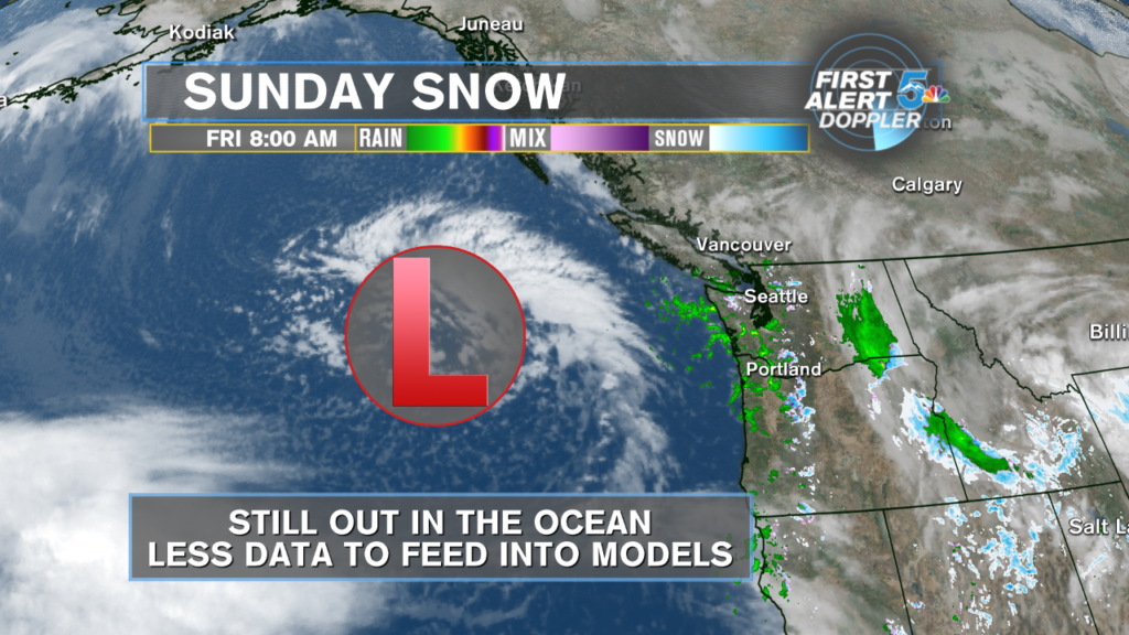
Why has this system changed around so much?
Usually, about 2 to 3 times a year at least, our weather models lock on to some system way out in the ocean 5 to 7 days out and start throwing around huge snow totals. Earlier this week, the GFS (American model) was showing Colorado springs getting at least 8 inches of snow or more, while the ECMWF (European model) had flurries at best!
The problem was, this system was out over the Pacific ocean, where there is very little data to feed into the modeling! Once this system gets to the west coast, we’ll be able to feed in temperature, rain and pressure data from sensors from California to Washington into the models, and they will have a much better idea of what this storm will do.
What are the models saying?
Here’s a comparison of two of our most reliable, long range models. Unlike earlier this week, both models are now showing snow through southern Colorado, but each still has their differences.
The ECMWF is colder and generates more snow through the Wet and Sangre De Cristo range, as well as the lower elevations. The GFS, however, comes in warmer with lighter snow across the mountains and lower elevations.
Because this system has not yet arrived to the west coast, it’s very likely that both models will see changes in their snowfall forecast from tonight through Saturday. With this particular system, we are probably not going to have great confidence until the Saturday afternoon model runs.
What does Sam think will happen?
I think we are going to see snow, but not as much as everyone probably is hoping for. I’m being cautious because I’ve seen this exact situation play out before. So many times, especially with systems spinning over the ocean, the models show moderate to heavy snow a few days before the storm, and then it hits with very weak or absent snow totals.
That being said, with the jet stream set up and the cold pool dropping down, I still think we’re going to at least see a little snow through the mountains and Pikes Peak area. The Wet and Sangre De Cristo ranges will likely see the biggest snow totals through Monday morning. Areas like Colorado Springs could easily see that 1 to 2 inch range, but likely on the north and west sides of the city.

