

Tonight's Forecast:
This evening will be very nice and temperatures will stay warm. There might be some stronger gusts, but as the evening goes on they will die down. Overnight lows will be on the warm side in the 40s and 50s.
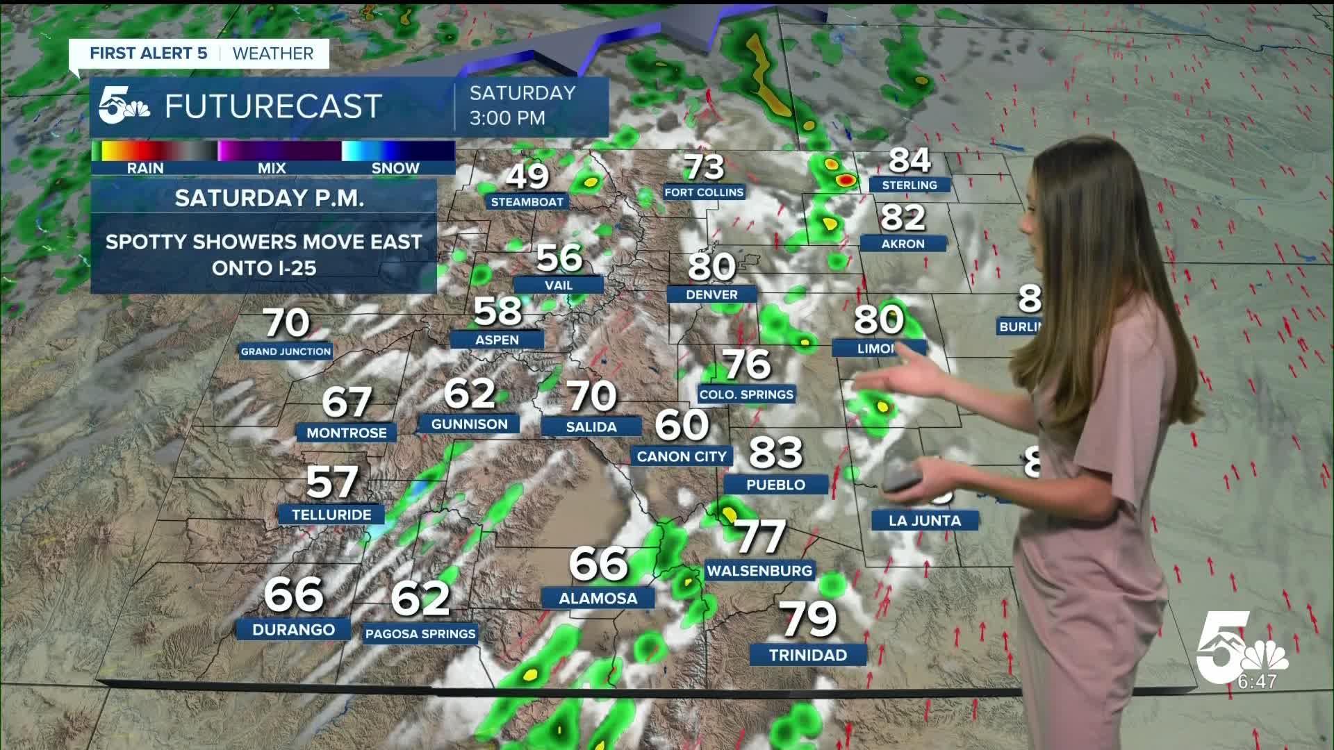
Tomorrow's Forecast:
Our next system will move into Colorado tomorrow with wind as the biggest impact. Gusts will be between 40 - 50 mph. The strongest gusts will be in the higher terrain and eastern plains. If you have any items outside that will potentially blow away, it would be a good idea to bring them indoors. There will be some showers that move into the I-25 corridor around 1:00PM.
Colorado Springs forecast: Low: 54; High: 78;
The Springs will wake up to temperatures in the lower-to-mid 50s. There will be clear conditions to start the day. More clouds will move in throughout the day. The biggest impact will be the wind. Gusts in Colorado Springs will get up to 40mph at times. Highs will be warm, but still cooler than Friday.
Pueblo forecast: Low: 55; High: 84;
Pueblo will have overnight lows tonight in the mid-50s. Winds will start to pick up tonight and will ramp up during the afternoon on Saturday. Afternoon highs will still be above average with temperatures reaching the mid-80s.
Canon City forecast: Low: 57; High: 79;
Canon City will have overnight lows tonight in the upper 50s. Windy conditions will pick up in the morning on Saturday, but really ramp up during the afternoon. Highs will be a few degrees cooler than Friday.
Woodland Park forecast: Low: 46; High: 66;
Woodland park will start Saturday morning with temperatures in the 40s. There will be some windy conditions in the morning, but ramp up in the afternoon. Highs will be in the mid-60s later on in the day.
Tri-Lakes forecast: Low: 54; High: 74;
Monument will start the day off with temperatures in the mid-50s. Morning lows won't be as cold as what they usually are this time of year. By the afternoon, these temperatures will be in the mid-70s. Winds will be gusty between 40-50mph at times.
Plains forecast: Low: 50s & 60s; High: 80s;
The plains will have some of the strongest winds across the area tomorrow. Temperatures will heat up again, but will be cooler than today. Some showers will move into the area around dinner time, but will clear out overnight.
Walsenburg and Trinidad forecast: Low: 53; High: 78/80;
The southern I-25 corridor will have morning lows in the lower 50s. By the afternoon, these temperatures will be in the upper 70s/lower 80s. Windy conditions will be at their strongest during the afternoon, and die down overnight into Sunday.
Mountains forecast: Low: 40s; High: 60s & 70s;
The mountains will have some of the strongest winds, especially closer to the peaks. If you plan on hiking, it would be best to stay below treeline. Highs across the mountains will be in the 60s and 70s.
Extended outlook forecast:
Throughout the rest of the weekend, conditions will calm and clouds will start to move out Sunday afternoon. There will be some lower level clouds on Sunday morning, especially closer to the Pikes Peak Region.
Looking ahead into the work week, rain chances will pick up Tuesday and Wednesday.
____
Curious about the First Alert 5 Weather Storm Impact Scale? Check out our cheatsheet explainer.
Watch KOAA News5 on your time, anytime with our free streaming app available for your Roku, FireTV, AppleTV and Android TV. Just search KOAA News5, download and start watching.
