

Tonight's Forecast:
Temperatures will be slow to cool tonight. By 10PM temperatures will still be in the 70s and 80s. Overnight lows will dip down into the 50s and 60s. There will be mostly clear conditions throughout the night and into tomorrow morning.
Colorado Springs forecast: Low: 61; High: 91;
Be prepared for another hot and windy day across the Springs. Afternoon highs will be in the lower 90s. Windy conditions will pick up around 10AM, and at times will reach 45mph. These winds will eventually calm after the sun sets.
Pueblo forecast: Low: 61; High: 98;
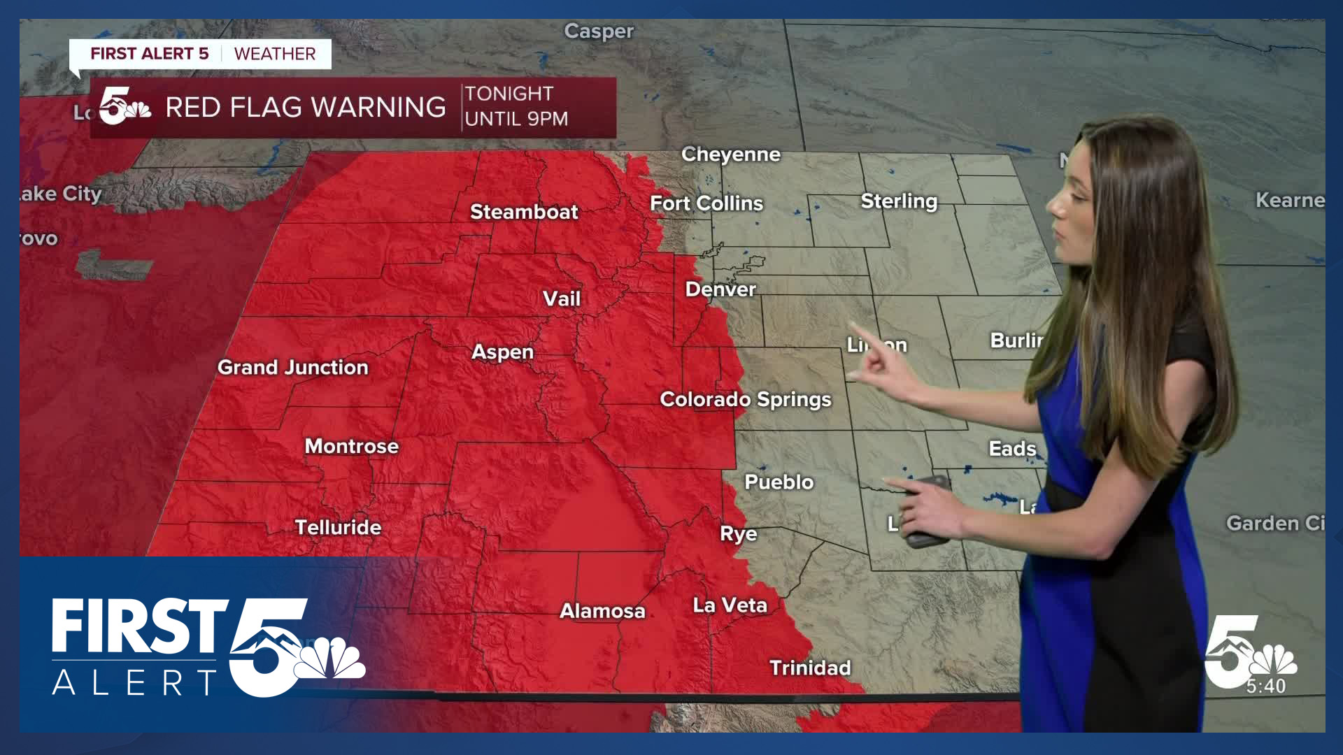
Pueblo will have morning temperatures in the lower 60s. Afternoon temperatures will still be hot with highs getting into the upper 90s. On top of this, winds will be strong. Gusts will be getting up to 45mph at times. This will calm around 9PM. Red flag warnings will be in place from 11AM until 9PM.
Canon City forecast: Low: 60; High: 94;
Canon City will have overnight lows in the lower 60s. Temperatures will warm up quickly and by 10AM they will be in the lower 80s. Temperatures won't stop there because by the afternoon highs will be in the mid-90s. Breezy conditions will be noticeable in the afternoon.
Woodland Park forecast: Low: 52; High: 80;
Woodland Park will also experience warmer temperatures with afternoon highs getting into the lower 80s. Conditions will also remain dry. Windy conditions pick up by the late morning and will last throughout the day.
Tri-Lakes forecast: Low: 57; High: 87;
Monument will have morning temperatures in the upper 50s. Southwesterly winds will gust to 40mph at times. By the later part of the day, highs will be in the upper 80s. Downsloping winds will be helping to warm us up a few degrees.
Plains forecast: Low: 60s; High: 90s & 100s;
The eastern plains will have overnight lows in the 60s. The hottest temperatures will be located along the Arkansas River. Lamar and Eads will be getting into the triple digits. Other areas will get very close, but will have highs in the upper 90s.
Walsenburg and Trinidad forecast: Low: 63; High: 91/96;
The southern I-25 corridor will have morning temperatures in the lower 60s. Things will heat up fast and by the afternoon temperatures will be in the mid-90s. Winds will be coming out of the southwest between 10-20mph. Gusts will be stronger up to 40mph.
Mountains forecast: Low: 50s; High: 80s;
The mountains have another day of fire danger and the National Weather Service has issued a red flag warning for the area.
Extended outlook forecast:
Temperatures won't be cooling down anytime soon. Throughout the week temperatures will be in the 80s and 90s. Towards the Fourth of July, temperatures will be even warmer. Luckily it looks like we won't have any rain and conditions look nice for evening fireworks.
____
Curious about the First Alert 5 Weather Storm Impact Scale? Check out our cheatsheet explainer.
Watch KOAA News5 on your time, anytime with our free streaming app available for your Roku, FireTV, AppleTV and Android TV. Just search KOAA News5, download and start watching.
