

EL PASO COUNTY, Colo. (KOAA) — Colorado experiences vastly different weather conditions, even on a single day. In El Paso county in particular it can bring bright and sunny conditions, but a few minutes later you may drive through a thunderstorm. The reason for this is due mainly to the topography.
From the top of Pikes Peak (14,115 feet) to the lowest point in the county (5,095 feet) this can play a major role in temperatures, winds, and even severe weather.
For example, on June 10th, this was a snapshot of temperatures across parts of El Paso county. Downtown Colorado Springs was hitting the mid-80s, while the airport was only in the mid-70s. Strong, downsloping winds heat up the air in downtown, but those winds didn't quite reach the airport yet.
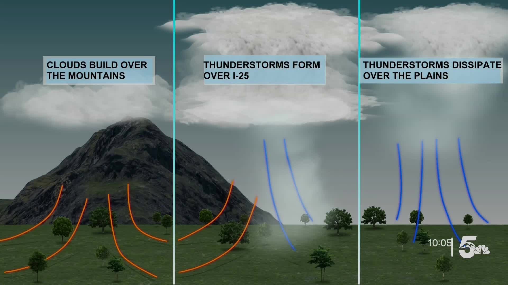
These mountains will also push air upwards on other days. This will create thunderstorms on the western side of the county. With drier air in eastern El Paso, it dries out these storms and they will die off.
Each day brings different weather conditions, and there's no day with the exact same forecast. The first alert weather team takes all of these conditions into mind to create the most accurate forecasts for our viewers.
____
Have a question or story idea you would like the First Alert 5 Weather team to consider? Email: weather@koaa.com
Watch KOAA News5 on your time, anytime with our free streaming app available for your Roku, FireTV, AppleTV and Android TV. Just search KOAA News5, download and start watching.
