

COLORADO (KOAA) — The past few days, temperatures have drastically cooled because of some lower level stratus clouds. This cloud layer has been quite stubborn to leave and it's due to a process called inversion.
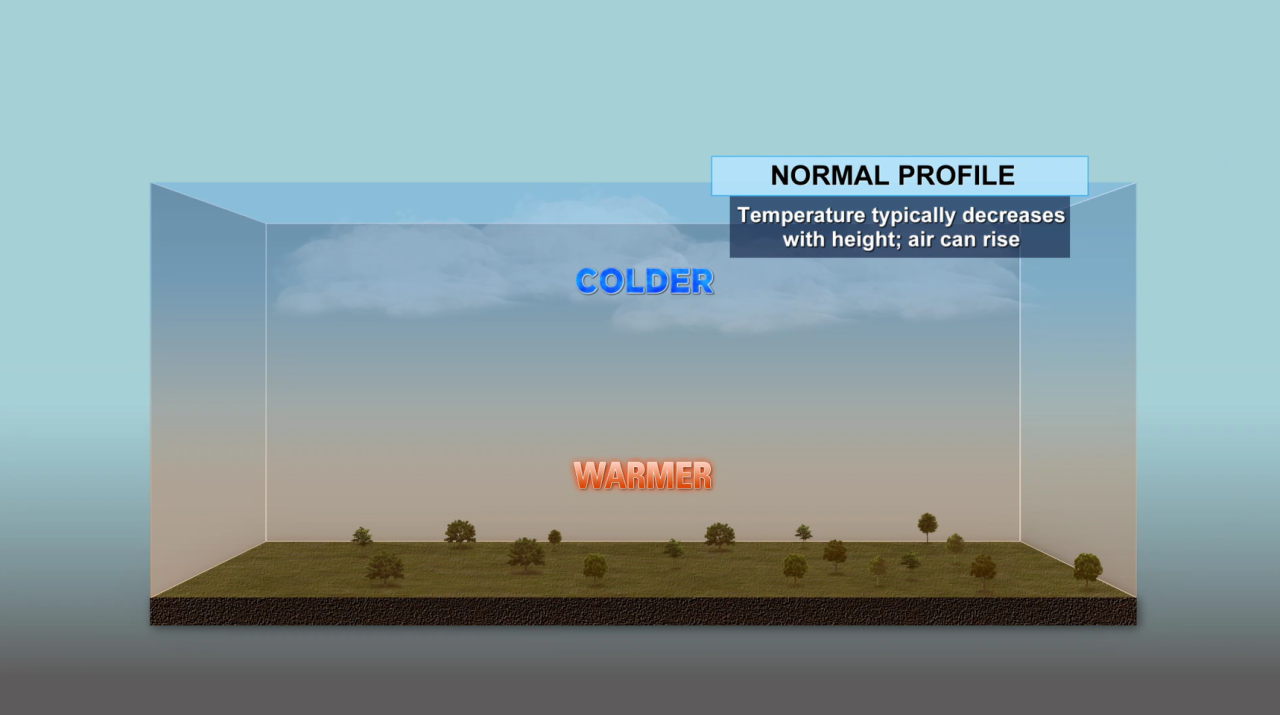
On a normal day, temperatures closer to the surface are much warmer than the air above us. This hasn't been the case over the past few days.
____
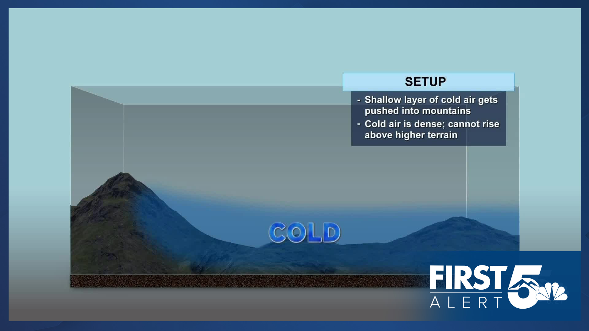
With this past storm system that moved through it brought with it much cooler temperatures. Cold air is much heavier than warmer air. This cold air ends up sinking and getting trapped up against the mountains.

With these storm systems that come through, they often bring more moisture to the area. With this moisture and warmer air above the colder air, a layer of clouds begin to form. This can often bring very gloomy and dreary conditions for those closer to the ground.
If you were to travel to the top of Pikes Peak, you would see plenty of sunshine and that blanket of clouds below.

Luckily, this won't last forever and these clouds are expected to exit the area. Winds will instead shift out of the south/southwest and won't push these clouds up against the mountains. Instead it will force these clouds to move out.
Have a question or story idea you would like the First Alert 5 Weather team to consider? Email: weather@koaa.com
Watch KOAA News5 on your time, anytime with our free streaming app available for your Roku, FireTV, AppleTV and Android TV. Just search KOAA News5, download and start watching.
