

Today’s Forecast:
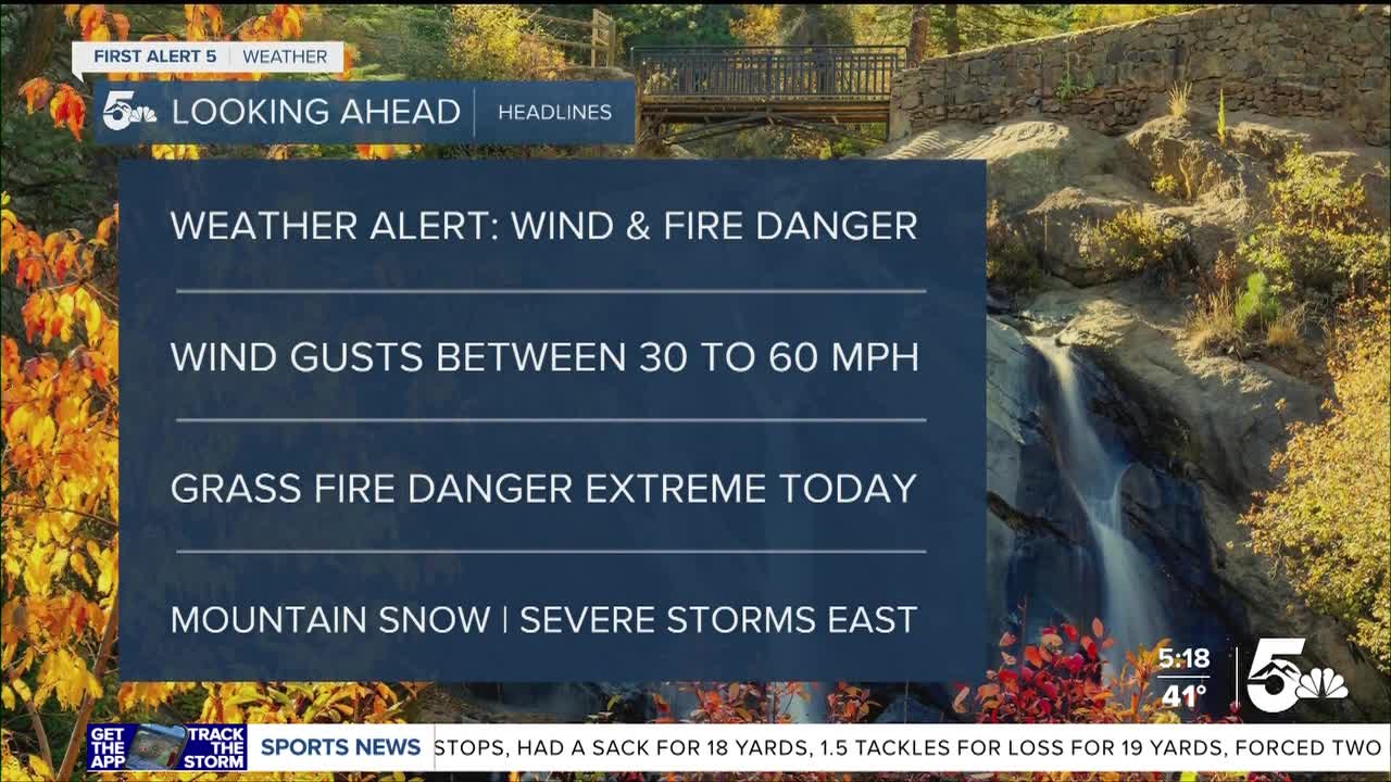
Weather alerts are in effect across the state today with rain and snow over the mountains, strong to damaging winds across the plains, and extreme fire danger along and east of I-25.
Rain and snow will mix together over the mountains today, but snow could fall as low as I-70 at times through the morning and early afternoon. Combined with the wind, central mountain and mountain pass travel could be very difficult at times. We will be dry in the mountains by the end of the day in most areas.
The winds and fire danger are the primary concerns across the I-25 corridor and plains. We'll see wind gusts up to 60 mph along and east of I-25, which could cause minor wind damage. Grass fire danger is very high today due to the low humidity and strong winds.
BLOW OUT SPRINKLERS TONIGHT! Temperatures tonight will be close enough to freezing across much of the region that we are recommending you blow out and winterize your sprinkler systems tonight. We'll either be at or below freezing the rest of the week.
COLORADO SPRINGS: High: 59; Low: 34. Increasing clouds today with a small chance for isolated showers or a brief thunderstorm around lunchtime. Dry and windy conditions will probably kill rain chances over much of the city today. The winds will be very strong, blowing around 30 to 40 mph during the day but we could see isolated wind gusts up to and over 50 mph at times. Fire danger is very high across the region.
PUEBLO: High: 66; Low: 35. Dry, mild, and very windy today with high fire danger through the afternoon. We'll see sustained winds in the 30 to 40 mph range with isolated gusts up to and possibly over 50 mph. Grass fire danger will be extremely high through the afternoon.
CANON CITY: High: 50; Low: 30. An isolated shower is possible today but the main story we'll see is strong winds and high fire danger. Wind gusts today could reach the 50 mph range with high grass fire danger through the end of the day.
WOODLAND PARK: High: 50; Low: 20. Isolated showers and even a bit of snow mixing down will be possible late this morning around lunchtime, but most of today will be dry and windy. Fire danger is elevated and wind gusts could be over 40 mph at times. If we did see brief snow, the ground would be too warm for any accumulation on the pavement.
TRI-LAKES: High: 40s; Low: 20s. Windy with a small chance for isolated showers and high fire danger. We'll see a chance for an isolated shower around lunchtime, but most of today should be dry. Fire danger will be high with dry air and strong winds with gusts up to and over 50 mph at times today.
PLAINS: High: 60s; Low: 20s. Most of the plains will be dry today with fire danger and strong winds as our two main threats. We'll see wind speeds in the 30 to 45 mph range today out of the southwest, with isolated gusts up to 60 mph. There is a chance for spotty and scattered storms across the far eastern plains late today, some of which could even be strong to severe along the Kansas border.
WALSENBURG/TRINIDAD: High: 60s; Low: 20s. Windy and dry today with high fire danger and possibly damaging wind gusts in the afternoon. High profile vehicles need to be careful today along I-25 as we could see gusts over 50 mph from lunch through the afternoon. We should stay dry along I-25 but rain to snow showers will be possible west of the region over the mountains and even over La Veta Pass.
MOUNTAINS: High: 40s; Low: 20s. Mountain travel could be difficult today with heavy snow over the San Juans and La Garitas, and challenging drives through the central mountains. We'll see the heaviest snow over the San Juans with areas getting up to and even over 12 inches. Snow totals will be lower in the central mountains, but several inches are still possible over most mountain passes. I-70 travel could be difficult today with blowing snow and minor snow accumulation in some areas. Rain to snow is expected in and around the Sangre De Cristos today, with rain to snow mixing down along La Veta Pass.
Extended Outlook:
Remember, tonight we'll see temperatures near or below freezing, so blow out and winterize your sprinkler systems.
Wednesday looks amazing during the day with breezy and sunny conditions. We'll see a colder freeze Wednesday night.
Quick moving rain to snow showers are likely Thursday night through early Friday morning. I don't think we'll see a lot of accumulating snow below 8,000 feet, but we could get cold enough where snow mixes in with rain down to Pueblo by early Friday morning. Areas like Woodland Park and the Monument area could see a couple inches collect in the grass Thursday night.
KOAA News5 on your time, streaming on your Roku, FireTV, AppleTV and AndroidTV.
News5 App | First Alert 5 Weather App | Youtube | Facebook | Instagram | Twitter
