



Today’s Forecast:
We have a rinse and repeat forecast for today with highs getting right back into those 60s. Clear and calm conditions will continue throughout the day today. Evening temperatures will dip into those 40s. Overnight and into Friday morning will have temperatures back in the 30s.
Colorado Springs forecast: High: 65; Low: 36.
Morning temperatures are sitting in the 30s, but will rise over the next several hours. Clear conditions will continue today. Afternoon highs will be in the 60s. Winds will be coming out of the north between 5-10mph.
Pueblo forecast: High: 68; Low: 35.
Pueblo will start the day with temperatures in the lower 30s. There will still be a significant increase in temperatures and highs will get back into the upper 60s. Calm and clear conditions will also continue into the afternoon. The evening will bring temperatures in the 40s, and overnight temperatures into Friday will drop into the mid-30s.
Canon City forecast: High: 66; Low: 41.
Canon City has lows this morning in the 40s. Lows will continue to dip into the lower 40s each morning. In terms of this afternoon, we have a very similar forecast to yesterday with highs getting back into the 60s.
Woodland Park forecast: High: 57; Low: 33.
Woodland Park has lows this morning in the lower 30s. Clear conditions are helping temperatures to remain cool. By the afternoon, though, highs will still be above average getting into the upper 50s.
Tri-Lakes forecast: High: 61; Low: 35.
The Monument area and northern El Paso county has temperatures this morning in the 30s. Calm and clear conditions continue today and into Friday. Afternoon highs today will get back into the lower 60s. Evening temperatures today will dip into the 40s. Overnight lows headed into Friday will get into the 30s.
Plains forecast: High: 60s; Low: 30s.
The eastern plains don't have much change today with calm and clear conditions returning. Winds will be calm out of the north. Highs will be right back in the 60s by the afternoon.
Walsenburg and Trinidad forecast: High: 62/66; Low: 35/36.
The southern I-25 corridor will have temperatures in the 30s this morning. Calm and clear conditions continue as this high-pressure system works its way over Colorado. Afternoon highs will be in the 60s.
Mountains forecast: High: 50s & 60s; Low: 20s & 30s.
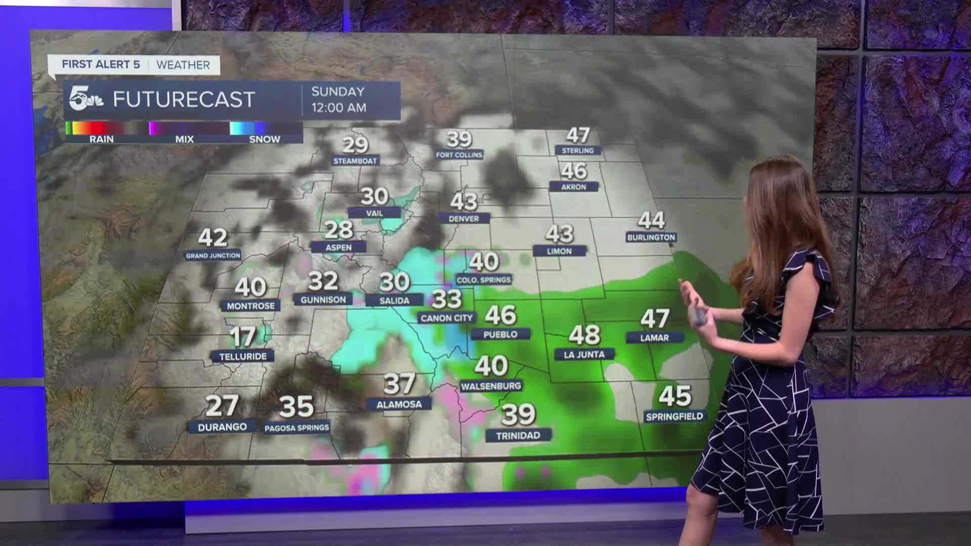
The mountains will be chilly this morning with lows in the 20s and 30s. Chilly morning temperatures will continue into the weekend. There will be some snow in the forecast for the southwestern and central mountains over the weekend.
Extended outlook forecast:
We finally have a shake up in the forecast headed our way with snow and rain arriving later in the day on Saturday. Afternoon highs will be in the 50s along I-25. Snow is not likely for I-25, but looking ahead to the middle/end of next week we have the potential for some cooler and wetter conditions.
____
Curious about the First Alert 5 Weather Storm Impact Scale? Check out our cheatsheet explainer.
Watch KOAA News5 on your time, anytime with our free streaming app available for your Roku, FireTV, AppleTV and Android TV. Just search KOAA News5, download and start watching.
