


Today’s Forecast:
Very active weather is expected over the next 48 hours with warm and windy conditions leading to high fire danger today, and a winter storm arriving tomorrow. We're going to start with lighter winds and sunshine today, before cloud cover and stronger winds in the afternoon. Temperatures will bump into the 60s and 70s this afternoon, with the strongest winds expected in the southern I-25 corridor and out to Otero County.
Fire danger is high in the plains today from gusty afternoon winds and low humidity. A fire could catch easily and spread quickly today pic.twitter.com/rIlfOzDZOZ
— Sam Schreier (@SamASchreier) March 18, 2020
COLORADO SPRINGS: High: 66; Low: 38. Sunny in the morning before clouds in the afternoon with gusty winds and elevated fire danger.
PUEBLO: High: 73; Low: 40. Mostly sunny and very warm with elevated fire danger as the winds increase through the afternoon.
CANON CITY: High: 70; Low: 43. Sunny in the morning and warm today with more clouds and a stronger breeze in the afternoon.
WOODLAND PARK: High: 57; Low: 32. Sunny in the morning and mild with clouds and stronger winds in the afternoon.
TRI-LAKES: High: 50s; Low: 30s. Sunny in the morning before clouds in the afternoon with gusty winds and elevated fire danger.
PLAINS: High: 70s; Low:40s. Mostly sunny with a few clouds in the afternoon. We'll be warm today with strong, gusty winds through the afternoon, leading to very high fire danger through the plains, especially in Otero County.
WALSENBURG/TRINIDAD: High: 60s; Low: 30s. Increasing clouds and wind in the afternoon with warm daytime temperatures and very high fire danger in Las Animas County, especially east of I-25.
Winter Storm Tomorrow:
There's a lot to unpack with our winter storm tomorrow. See the snow maps below for a broken down forecast.
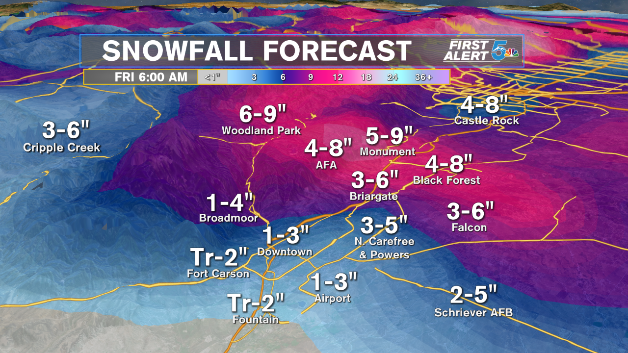
We're going to get the brunt of this winter storm in the Pikes Peak Region. The snow totals will be higher in Teller County, but the winds will be stronger in El Paso County. Travel to and from Woodland Park will be very rough in the afternoon. The winds will gust easily into the 40 to 50 mph range through central and eastern El Paso County, leading to white out conditions with heavy snow.

Snowfall south of El Paso county will mainly collect in the Wet Mountains and west to the Wet Mountain Valley. Pueblo and Canon City will see strong, gusty winds, but mostly with rain showers. Any snow that falls in Pueblo or Canon City in the evening would likely not stick to the ground.
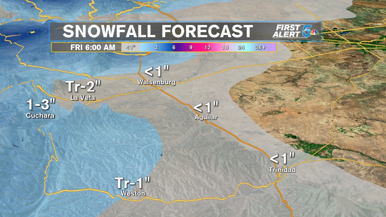
Like Pueblo and Canon City, not much snow is expected out of the mountains for the soutehrn I-25 corridor. We'll see a few inches out towards La Veta and Cuchara, but we're forecasting mainly scattered rain showers from Walsenburg to Trinidad.
