

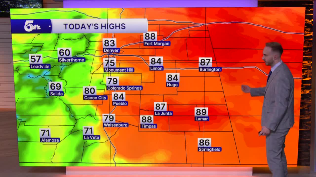

Today’s Forecast: It will be a warm and sunny start to the weekend across southern Colorado. Temperatures will be above the seasonal average once again. Highs will top out in the 70s, 80s, and near 90 in the eastern Plains. They will top out near 80 degrees in Colorado Springs and mid-to-upper 80s in Pueblo, while the high valleys reach the 60s to lower 70s. Southwest flow aloft is helping to draw in Pacific moisture. This could lead to a few showers and storms over the high country and mountains this afternoon/evening. East of the I-25 corridor could see a few clouds in the afternoon but should remain dry.
Extended outlook forecast: Warm temperatures will continue through Monday. Highs will still be in the 70s and 80s. There will be continued showers and storms over the San Juans and the high country. The rest of the region should see plenty of sunshine. By Tuesday a cold front moves through the region as a large system shifts into the area. Exact timing of the front is still in question as it depends on the speed of the overall system. Temperatures drop into the 70s region wide. Winds and isolated shower chances return by Tuesday evening. Snow could start to fall across the higher elevations. For the rest of the week, temperatures will finally feel like fall and where they should for October. Highs will drop into the 50 and 60s for the region. High valleys could see their first freeze Wednesday night!
____
Curious about the First Alert 5 Weather Storm Impact Scale? Check out our cheatsheet explainer.
Watch KOAA News5 on your time, anytime with our free streaming app available for your Roku, FireTV, AppleTV and Android TV. Just search KOAA News5, download and start watching.
