

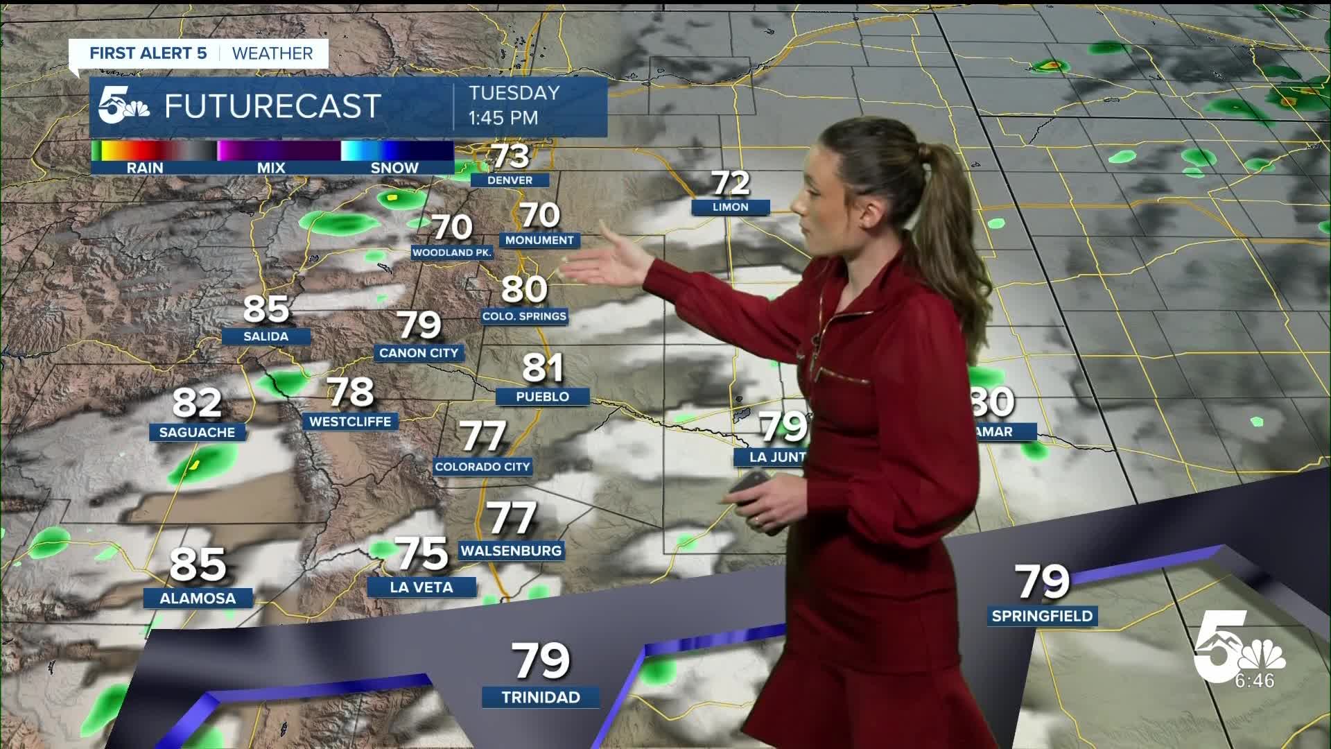


Tonight's Forecast:
An overnight cold front will bring some changes to southern Colorado. It will bring in some more smoke to the area overnight. Air quality alerts will be in place until 9AM on Tuesday.
Colorado Springs forecast: Low: 60; High: 81;
Colorado Springs will have morning temperatures in the 60s. Smoke will still be prevalent across the area tomorrow. This overnight cold front will bring some much cooler temperatures. Afternoon highs will be in the lower 80s.
Pueblo forecast: Low: 65; High: 85;
Pueblo will have overnight lows dip into the mid-60s. This will be an impactful cold front that moves through and highs will only get into the mid-80s. The last time that Pueblo saw 80 degree temperatures was back in June. Conditions will gradually warm as we go throughout the week.
Canon City forecast: Low: 65; High: 84;
Canon City will have lows in the mid-60s overnight. There will still be some smoke in the area, especially tomorrow morning. Afternoon highs will not be as hot as Monday only getting into the mid-80s. There is a chance for some passing storms tomorrow afternoon.
Woodland Park forecast: Low: 48; High: 75;
Woodland Park will have lows in the upper 40s overnight. This cold front will bring some moisture and help to cool down our temperatures. Afternoon highs will reach the mid-70s. Showers and storms will pop up around 1-2PM and continue through the afternoon.
Tri-Lakes forecast: Low: 53; High: 77;
Monument is also going to stay hazy headed into Tuesday. Morning lows will dip into the lower 50s. Temperatures will be much cooler on Tuesday with highs only getting into the upper 70s. There will be a chance for some showers and storms in the afternoon.
Plains forecast: Low: 50s & 60s; High: 80s;
The eastern plains finally have some relief on the way with temperatures. Highs will only get into the 80s. There will be a chance for some afternoon thunderstorms.
Walsenburg and Trinidad forecast: Low: 61/60; High: 81/85;
The southern I-25 corridor will have morning temperatures in the lower 60s. This cold front will bring some more moisture to the area and increase shower and thunderstorm chances. Highs will get into the 80s.
Mountains forecast: Low: 50s; High: 70s & 80s;
The mountains will have a layer of smoke during the overnight hours and into tomorrow. Temperatures will be cooler than Monday with highs only in the 70s and 80s. Showers and thunderstorms will pop up in the afternoon.
Extended outlook forecast:
This high pressure system will take hold of the area again, and will raise our temperatures each day. Smoke will likely continue across the area as well. There will be mostly clear skies towards the end of the week.
____
Curious about the First Alert 5 Weather Storm Impact Scale? Check out our cheatsheet explainer.
Watch KOAA News5 on your time, anytime with our free streaming app available for your Roku, FireTV, AppleTV and Android TV. Just search KOAA News5, download and start watching.
