



Tonight's Forecast:
Tonight, temperatures will be slow to cool, and clouds will clear out overnight. Overnight lows will dip into the 50s and 60s. It will be a calm night with winds coming out of the east at 5-10mph.
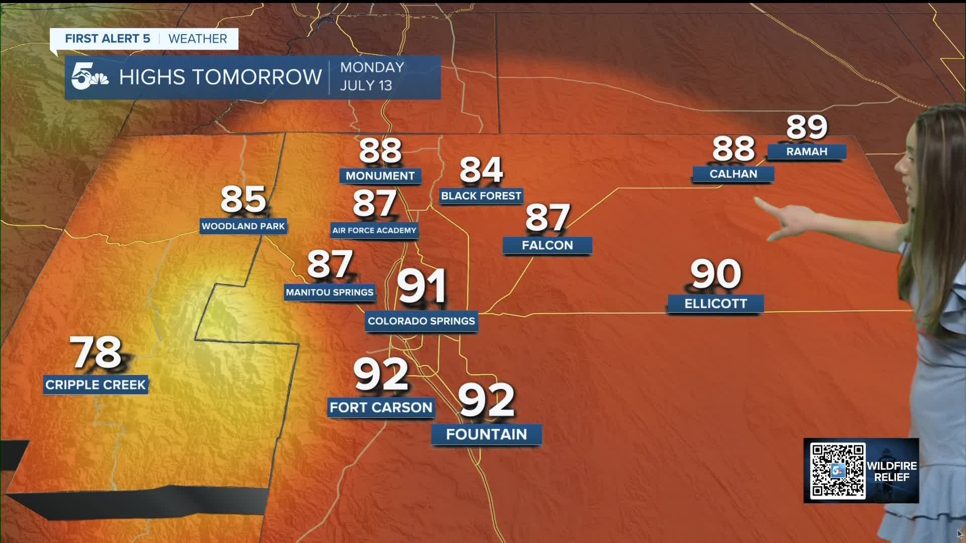
Colorado Springs forecast: Low: 59; High: 91;
Colorado Springs will continue with the warm and above average temperatures. Afternoon highs will reach the lower-90s. Winds will be breezy with gusts reaching 25mph at times. No rain is expected with this high-pressure system in place.
Pueblo forecast: Low: 63; High: 95;
Pueblo will have overnight lows in the lower-60s. Once the sun rises temperatures will skyrocket and highs will top out in the mid-90s. There will be mostly clear conditions during the day with a few clouds over the mountains. Winds will be coming out of the southeast between 5-15mph.
Canon City forecast: Low: 63; High: 95;
Canon City will start their morning off with lows in the lower 60s. Temperatures will warm quickly, and afternoon highs will reach the mid-90s. There will only be a few passing clouds during the day. Winds will be coming out of the southeast between 5-15mph.
Woodland Park forecast: Low: 53; High: 85;
Woodland Park will have overnight lows reach the lower 50s. Sunny conditions in the morning will help temperatures to eventually reach the mid-80s by the afternoon. Winds will be coming out of the east around 5-15mph. There will be a few more clouds in the afternoon, but conditions will still be mostly sunny.
Tri-Lakes forecast: Low: 55; High: 88;
The Monument area will have lows reach the mid-50s overnight. There will be mostly clear conditions during the day and the afternoon will bring a few clouds. Afternoon temperatures will be warm again, reaching the upper 80s.
Plains forecast: Low: 60s; High: 90s;
The eastern plains will have some of the hottest temperatures tomorrow. La Junta will have highs in the mid-to-upper 90s. There won't be much cloud cover to offer any shade. Breezy conditions will pick up in the afternoon up to 15mph.
Walsenburg and Trinidad forecast: Low: 57/62; High: 91/94;
The southern I-25 corridor will have morning temperatures in the 50s and 60s. The warmest temperatures will be closer to Trinidad. Afternoon highs will be in the lower-to-mid 90s. If clouds form they will be closer to the mountains. Winds will be coming out of the south between 5-10mph.
Mountains forecast: Low: 50s; High: 80s;
The mountains will not escape the heat tomorrow with highs reaching the 80s. There will be some clouds in the afternoon, but not enough to cool temperatures down. If there are any storms that form it will be closer to the centrak mountains. The sun will be quite intense with the UV reaching an 11.
Extended outlook forecast:
This heat dome isn't leaving anytime soon. There's not another weather system that moves in and helps to break down this high. 90s will return pretty much each day with the warmest temperatures in the eastern plains. There's no rain in the forecast right now with this high in place.
____
Curious about the First Alert 5 Weather Storm Impact Scale? Check out our cheatsheet explainer.
Watch KOAA News5 on your time, anytime with our free streaming app available for your Roku, FireTV, AppleTV and Android TV. Just search KOAA News5, download and start watching.
