



Tonight's Forecast:
Tonight, we won't get much relief with our temperatures. Overnight lows will only get into the 60s and 70s for the lower elevations. Places in the mountains will have lows in the 50s. Heat advisories are back by 10AM on Sunday.
Colorado Springs forecast: Low: 66; High: 96;
Colorado Springs will have lows dip into the mid-60s, and temperatures will warm fast from there. Heat advisories will be in place for El Paso county from 10AM until 9PM. Highs will have a chance of getting into the mid-90s. There is a chance to also break a record with that current one at 97 degrees.
Pueblo forecast: Low: 69; High: 103;
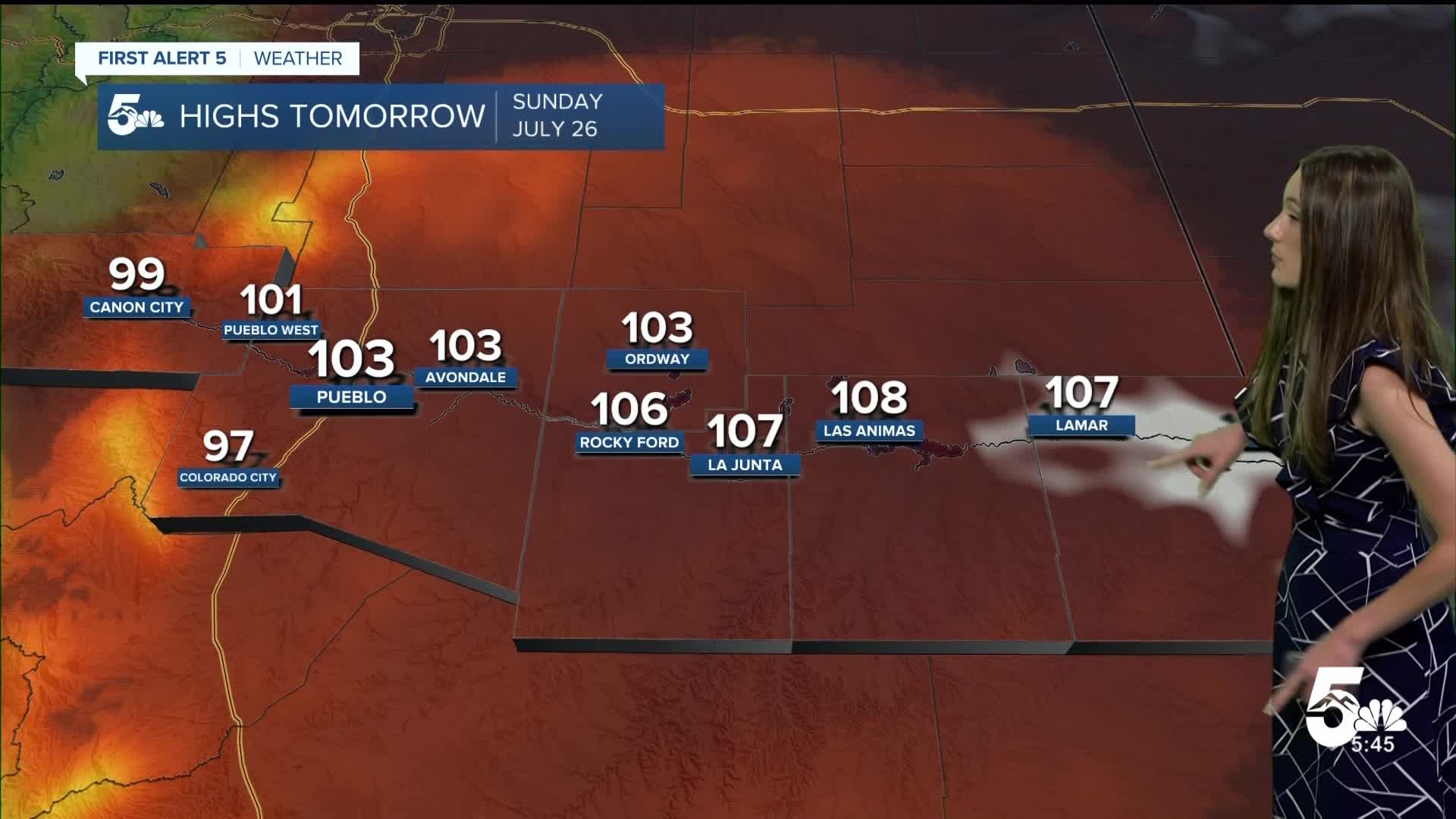
Pueblo will have morning temperatures in the 70s. Afternoon highs will reach the lower 100s. Heat advisories will be in effect starting at 10AM. Limit your time outdoors because this heat can cause heat related illnesses. There will be some more cloud cover in the afternoon.
Canon City forecast: Low: 69; High: 99;
Canon City will dip into the upper 60s overnight. We have another day of hot conditions, and with highs getting into the upper 90s there will be heat advisories that will be in effect. There is a small chance for an isolated shower in the afternoon. Not everyone will see this though.
Woodland Park forecast: Low: 58; High: 85;
Woodland Park will have some cooler temperatures arrive overnight with lows reaching the upper 50s. Once the sun rises, temperatures will warm quickly. Afternoon highs will reach the mid-80s. There is a small chance of an isolated shower in the afternoon.
Tri-Lakes forecast: Low: 61; High: 91;
Monument will get into the lower 60s overnight. There will be a few clouds throughout the day and winds will be coming out of the east between 5-10mph. Heat advisories will begin at 10AM and last until 9PM. Highs will get into the lower 90s.
Plains forecast: Low: 60s & 70s; High: 100s;
The eastern plains will be cooking tomorrow with highs getting well into the triple digits. Some areas have the chance of getting to 108 degrees along the Arkansas River. Heat advisories will be in place due to these temperatures.
Walsenburg and Trinidad forecast: Low: 67; High: 96/102;
The southern I-25 corridor will have overnight temperatures get down into the upper 60s. There won't be much relief overnight in terms of us cooling down. Highs tomorrow will be hot again getting into the triple digits near Trinidad. There will be a few more clouds in the afternoon and a small chance of some rain.
Mountains forecast: Low: 60s; High: 80s & 90s;
The mountains will have overnight lows in the 60s. Temperatures by the afternoon on Sunday will get into the 80s and 90s. It just depends on your elevation. Showers and thunderstorms will pop up in the afternoon. This could create some lightning, heavy rain, and gusty winds.
Extended outlook forecast:
Temperatures won't start to cool until Tuesday, and even then highs will still be hot. Monsoonal moisture will continue to give us the chance for daily afternoon thunderstorms. If you need to get anything done outside, it would be best to do it in the morning. Conditions don't look to dry off until Saturday.
____
Curious about the First Alert 5 Weather Storm Impact Scale? Check out our cheatsheet explainer.
Watch KOAA News5 on your time, anytime with our free streaming app available for your Roku, FireTV, AppleTV and Android TV. Just search KOAA News5, download and start watching.
