

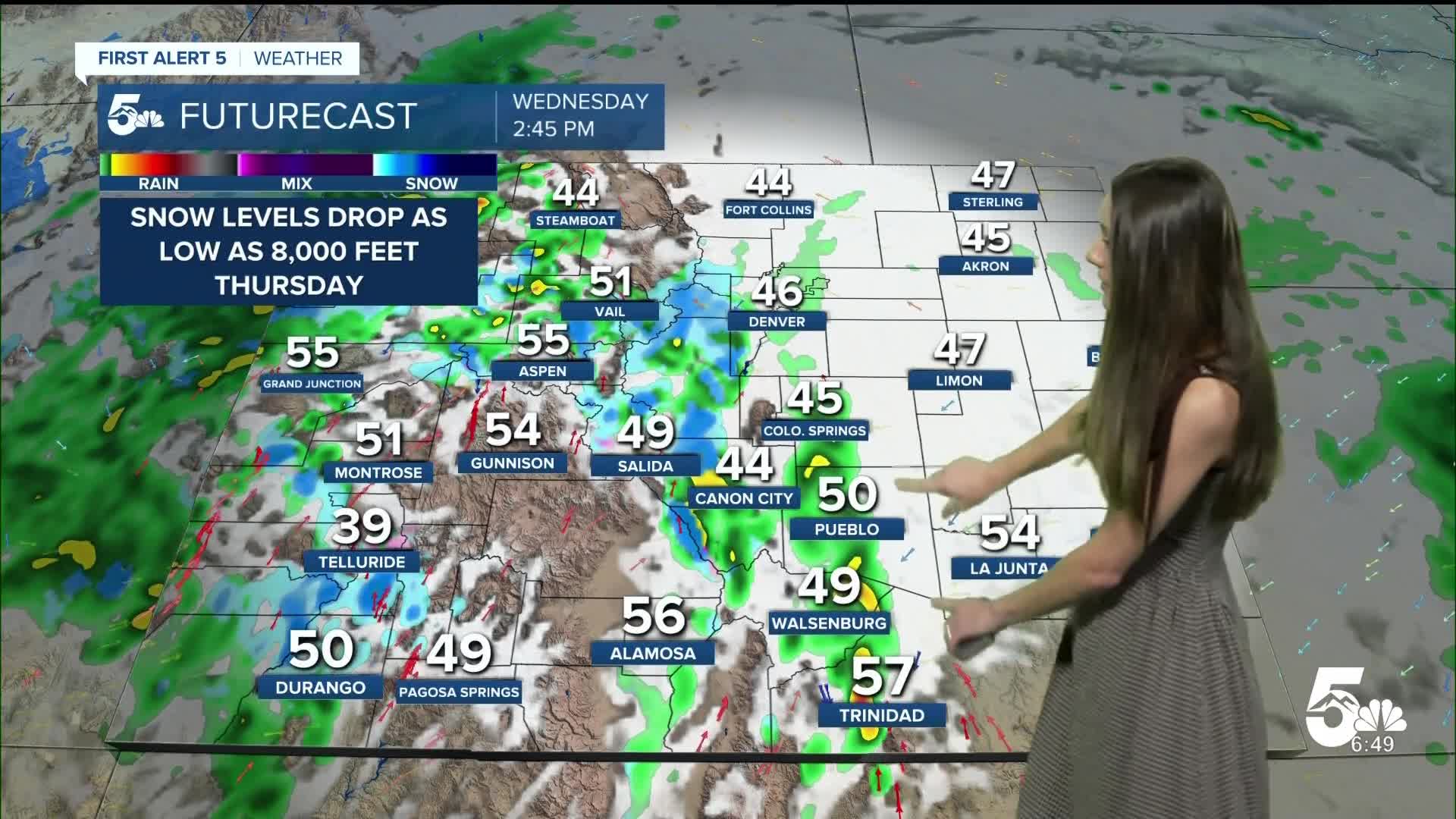


Today’s Forecast:
Fog will be possible this morning and it will be misty in the Pikes Peak Region. Temperatures won't rise much today with highs in the 40s and 50s. Heavy rain will be possible in the afternoon as this low-pressure system pushes eastward. Overnight lows into Thursday morning will drop into the 30s and 40s.
Colorado Springs forecast: High: 47; Low: 38.
Colorado Springs will have temperatures this morning in the upper 40s. There will be some fog that also sticks around through the morning. Winds will eventually shift out of the south to help push some of that fog out around 5-15mph. Afternoon highs will be on the cooler side getting into the upper 40s. Rain will also move in during the afternoon.
Pueblo forecast: High: 52; Low: 40.
Pueblo is waking up to some fog this morning and that will last until the afternoon. Temperatures won't warm up too much with highs only reaching the lower 50s. This will be the coolest day over the next 7 days. Rain moves in during the afternoon. Winds will be coming out of the south between 5-15mph. Thunderstorms may increase those winds.
Canon City forecast: High: 50; Low: 41.
Canon City will wake up to temperatures in the lower 40s. Fog is already starting to let up, and will clear out by the afternoon. Afternoon temperatures will be on the cooler side today only getting into the lower 50s. Rain will be possible in the afternoon.
Woodland Park forecast: High: 42; Low: 31.
Woodland Park is chilly this morning with temperatures in the lower 40s. We aren't expecting a big jump in temperatures. You will want to make sure you grab a waterproof jacket as you head out the door. Rain will be possible this afternoon. As this moisture continues to move in and temperatures drop, there will be some flurries Thursday morning. Not expecting much for accumulations, and just a dusting over grassy surfaces.
Tri-Lakes forecast: High: 45; Low: 34.
The Monument area will have temperatures in the 40s today. There won't be much of a warm up throughout the day. Rain also moves in during the afternoon hours. Winds will be coming out of the south between 5-10mph. Lows going into Thursday morning will be in the 30s.
Plains forecast: High: 50s; Low: 40s.
The eastern plains has a little bit of fog this morning and that will clear out before noon. Winds will eventually shift out of the south and thunderstorms will move in by the afternoon. Some heavy rain is possible with a few of these storms. Highs will be on the cooler side today in the 50s.
Walsenburg and Trinidad forecast: High: 49/58; Low: 40/38.
The southern portion of I-25 will have some fog this morning, but will clear out before the afternoon. Temperatures won't warm much with this cold front that has moved through. Highs will only reach the upper 40s and lower 50s. Rain will move in during the afternoon.
Mountains forecast: High: 40s; Low: 20s.
The mountains have winter weather advisories in place through Thursday morning. Visibility may be reduced along mountain passes. Highs today will be in the 40s. Snow levels will eventually drop to around 8,000 feet early Thursday morning.
Extended outlook forecast:
These cold temperatures won't stick around because by the time we get into Friday highs will ready be back in the 60s. We aren't stopping there, highs will eventually get into the 70s by Sunday. Early next week looks calm with plenty of sunshine.
____
Curious about the First Alert 5 Weather Storm Impact Scale? Check out our cheatsheet explainer.
Watch KOAA News5 on your time, anytime with our free streaming app available for your Roku, FireTV, AppleTV and Android TV. Just search KOAA News5, download and start watching.
