

Tonight's Forecast:
Tonight, temperatures will steadily drop into the 20s. Clouds will continue to clear going into tomorrow morning. It will be a cold morning ahead, so if you have an early start grab the jacket!
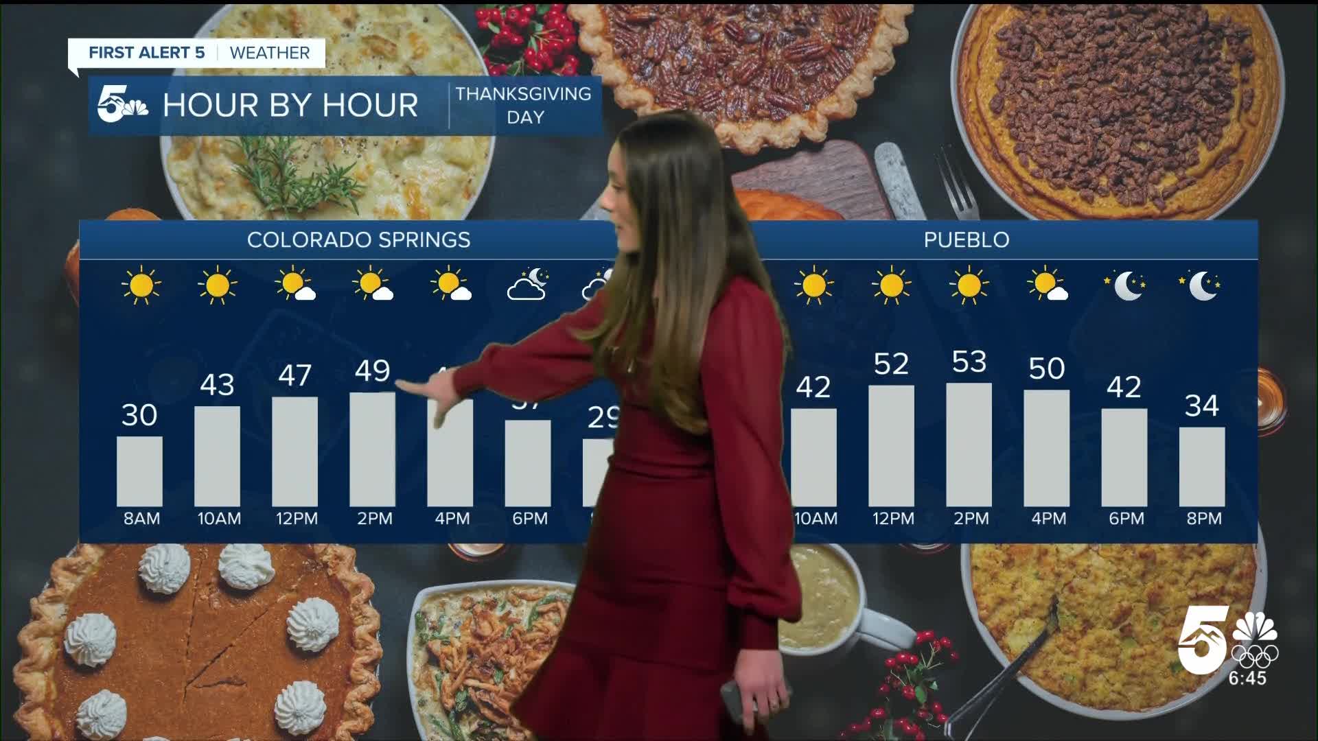
Colorado Springs forecast: Low: 28; High: 49;
Clouds will stay out of the area and temperatures will feel a little more seasonable. Highs will reach the upper 40s. If you head outside, a jacket will still be needed even though there will be sunshine.
Pueblo forecast: Low: 21; High: 53;
Pueblo will have a chilly start to Thanksgiving Day with morning lows in the 20s. There will be some sunshine to help temperatures get into the lower 50s. If you have any outdoor activities, you will need a jacket.
Canon City forecast: Low: 28; High: 54;
The morning will be chilly with lows in the upper 20s. Canon City will also have a nice day tomorrow with temperatures in the mid-50s. Any clouds that move in will be upper level clouds.
Woodland Park forecast: Low: 24; High: 50;
Woodland Park will get into the 20s tomorrow morning. Temperatures will slowly warm throughout the day, eventually getting into the 50s by the afternoon. Some upper level clouds will push into the area, but there will still be plenty of sunshine.
Tri-Lakes forecast: Low: 25; High: 49;
Monument will be calm overnight and with no clouds temperatures will drop into the 20s. Sunshine will continue into Thanksgiving Day tomorrow, but temperatures will still be chilly. Highs will make it into the upper 40s.
Plains forecast: Low: 20s; High: 50s;
The Plains will be calm and quiet overnight with a few passing clouds. Temperatures will drop into the 20s throughout the area. By the mid-morning temperatures will be in the 30s, but highs will reach the 50s.
Walsenburg and Trinidad forecast: Low: 29; High: 56;
The southern I-25 corridor will have winds calm down overnight. Temperatures will reach the upper 20s by the early morning hours of Thanksgiving Day. Highs will be in the mid-50s by the afternoon. Winds will also be calmer tomorrow.
Mountains forecast: Low: 20s; High: 50s;
The mountains will get into the 20s overnight. There will mainly be upper-level clouds in the area. Afternoon temperatures will be in the 50s.
Extended outlook forecast:
A high-pressure system will move into the four corners region and highs will reach the 60s in some areas. If you need to do some black Friday shopping, the weather will be nice for it.
Going into the weekend things will change. We will have some weather whiplash with highs dropping into the 30s and 40s. Some light snow showers are possible along the Palmer Divide, but snow totals will be very limited. We aren't out of the woods yet because going into Sunday a storm system moves in from the northwest and bring snow along with it. Widespread snow will begin in the mountains, and by the evening will move onto the I-25 corridor. Some of the models are still in disagreement about this system.
____
Curious about the First Alert 5 Weather Storm Impact Scale? Check out our cheatsheet explainer.
Watch KOAA News5 on your time, anytime with our free streaming app available for your Roku, FireTV, AppleTV and Android TV. Just search KOAA News5, download and start watching.
