



Today’s Forecast:
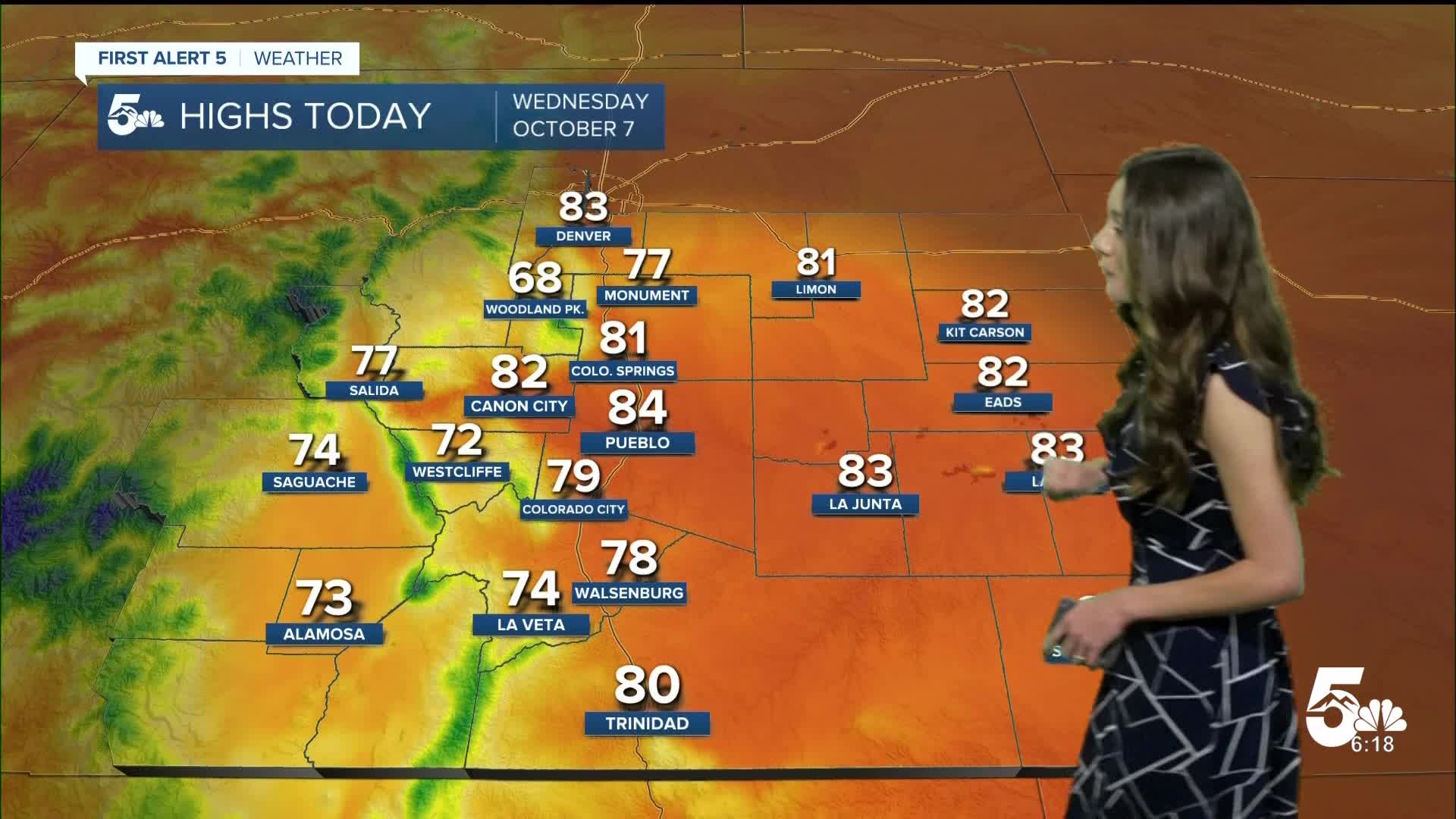
Temperatures this morning will start off in the 40s and 50s. Mostly sunny conditions are sticking around from this high-pressure system parked over the region. Afternoon highs will break back into the upper 70s and lower 80s. These temperatures are a few degrees cooler than yesterday.
Colorado Springs forecast: High: 81; Low: 53.
Colorado Springs will have temperatures this morning in the lower 50s. Once the sun rises, our temperatures will warm quickly. Afternoon highs will get into the lower 80s. We are just tracking a few clouds throughout the day and light winds.
Pueblo forecast: High: 84; Low: 52.
Pueblo will have temperatures this morning in the lower 50s. Still tracking bright and sunny conditions this Wednesday and winds will be remaining light. Heading into the evening those temperatures will cool into the 50s and 60s.
Canon City forecast: High: 82; Low: 54.
Canon City has temperatures this morning in the mid-50s. Across Fremont county, there will be mostly clear conditions and winds are going to remain light. This high-pressure system is still in place and is the main driver for these warmer temperatures.
Woodland Park forecast: High: 68; Low: 46.
Woodland Park will get getting down into the 40s this morning. Temperatures will warm quickly though with afternoon highs eventually getting into the upper 60s. Conditions will stay nice throughout the day with just a few clouds in the afternoon.
Tri-Lakes forecast: High: 70s; Low: 40s/50s.
Monument will start the day today with lows in the 50s. Conditions throughout the day will remain nice and calm. Winds will be coming out of the southeast between 5-10mph. Afternoon highs will make it into the 70s.
Plains forecast: High: 80s; Low: 50s.
The eastern plains will have some of the warmest temperatures across the area with afternoon highs getting into the 80s. These temperatures will be a few degrees cooler than what we experienced yesterday. Bright and sunny conditions will last throughout the day.
Walsenburg and Trinidad forecast: High: 78/80; Low: 50/49.
The southern portion of I-25 will have temperatures this morning in the upper 40s and lower 50s. Conditions will stay nice and calm with the help from this high-pressure system over the region. Highs will make it into the upper 70s and lower 80s.
Mountains forecast: High: 70s; Low: 40s.
The mountains will have a few clouds throughout the afternoon and an isolated shower or two. Winds will remain light and afternoon highs will break into the 70s.
Extended outlook forecast:
The forecast will be remaining calm over the next few days. The potential changes will arrive once we get into the back half of the weekend and into early next week. There are still some details to iron out like the timing, track, and strength of this system. It has the possibility of bringing wetter and windier conditions to southern Colorado.
____
Curious about the First Alert 5 Weather Storm Impact Scale? Check out our cheatsheet explainer.
Watch KOAA News5 on your time, anytime with our free streaming app available for your Roku, FireTV, AppleTV and Android TV. Just search KOAA News5, download and start watching.
