
Tonight's Forecast:
We are on a roll! Another perfect day in Colorado today with sunshine and very pleasant temperatures. Highs reached the 70's and 80's this afternoon after morning lows in the 40's and 50's. Tonight will be mostly clear with lows dropping back into the 40's along I-25. Tomorrow will be another impressive day with mostly sunshine and above normal temperatures. It will become a bit breezy during the afternoon. Downslope breezes from 10 to 20 mph at times.
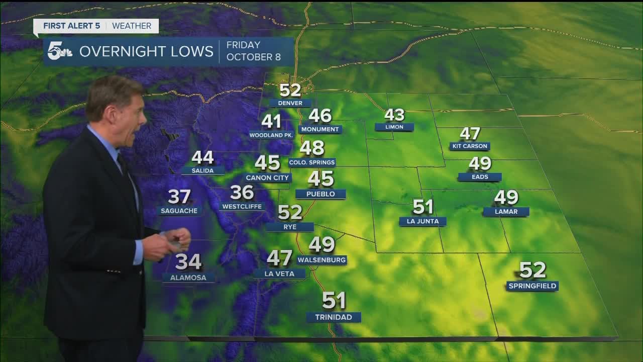
COLORADO SPRINGS: Low: 48; High: 79
PUEBLO: Low: 45; High: 85.
CANON CITY: Low: 45; High: 82
WOODLAND PARK: Low: 41; High: 70.
TRI-LAKES: Low: 40s; High: 70s.
PLAINS: Low: 40s; High: 80s.
WALSENBURG/TRINIDAD: Low: 40s; High: 80.
MOUNTAINS: Low: 30s; High: 70s
Extended Outlook:
Saturday the wind gets stronger. In Colorado Springs and Pueblo gusts up to around 40 mph will be possible during the late morning and afternoon. A cold front blows in late Saturday with highs on Sunday about 20 degrees cooler than Saturday. A brief light shower is possible but most of the rain will be south of Pueblo. Lows Sunday morning will be in the 40's with 30's in the mountains.
Lows on Monday morning will be around 39 for Colorado Springs and Pueblo. A nice day Monday before a strong storm rolls into the Rockies late Tuesday. This one looks to drop some beneficial snow on the mountains. Lower elevations will be windy Tuesday and cooler with possible late showers. The main energy will track too far north to bring much moisture to southern colorado but a few rain and even snow showers are possible late Tuesday into Wednesday. Lows Wednesday and Thursday morning will drop below freezing for the first time this season.
KOAA News5 on your time, streaming on your Roku, FireTV, AppleTV and AndroidTV.
News5 App | First Alert 5 Weather App | Youtube | Facebook | Instagram | Twitter
