
Today’s Forecast:
We still have some snow up in the high mountain passes like Monarch Pass early this morning, and there is lingering snow on the west half of I-70 through Colorado.
Most of today will be dry with strong winds through the first half of the day. The winds will be strongest in and out of the mountains early this morning, with a sunny and breezy afternoon.
We will stay dry today, but quick-moving rain and snow showers are likely Thursday night.
COLORADO SPRINGS: High: 63; Low: 32. High winds are expected through the early morning across Colorado springs, mainly on the west sides of town with 30 to 50 mph gusts running down the Rampart Range. The rest of the day will be breezy, dry, and sunny with comfortable temperatures.
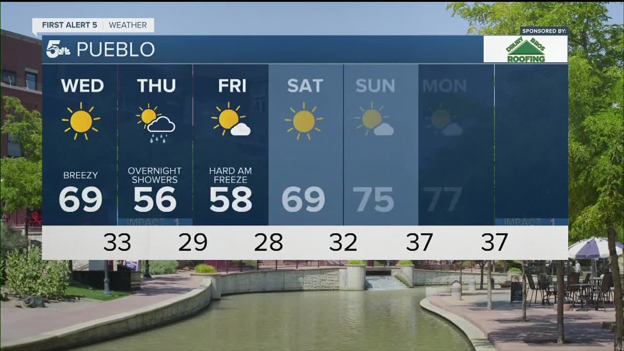
PUEBLO: High: 69; Low: 33. Breezy conditions are expected today with fall temperatures and sunny skies. The winds will be stronger early this morning west out near the Arkansas River Valley and the Wet Mountains.
CANON CITY: High: 65; Low: 32. Windy in and around Canon City and the Arkansas River Valley early this morning with a breezy and dry afternoon.
WOODLAND PARK: High: 54; Low: 26. Windy and very cold early this morning with dry skies and breezy conditions in the afternoon. Expect a chilly day and a very cold night.
TRI-LAKES: High: 50s; Low: 20s. Chilly and very windy in the morning with cool daytime temperatures and a lighter afternoon breeze.
PLAINS: High: 70s; Low: 30s. Breezy winds today and comfortable, fall temperatures in the afternoon. We'll see very cold temps tonight with dry skies.
WALSENBURG/TRINIDAD: High: 60s; Low: 30s. Very windy through the morning from La Veta Pass out into the I-25 corridor. We'll see much lighter winds in the afternoon with dry skies.
MOUNTAINS: High: 50s; Low: 20s. Lingering early morning snow is expected up over high mountain passes and stretches of I-70 today, but most of the mountains will stay dry and windy. The winds will be strongest in the Wets, Sangres, and Rampart Range early this morning.
Extended Outlook:
A quick shot of rain and snow is expected Thursday night through early Friday morning!

We're not expecting much snow accumulation from this system due in part to warm road temperatures and how quick it'll move through the region. If we do see any snow accumulation, it's likely at or above 7,000 feet in the Pikes Peak Region, and over some of the Wet Mountains. Teller County could cool the roads quickly enough to make travel a little slick Thursday evening, but if snow totals stay under 2 inches, it's likely most travel would be fine. Black Forest and the Tri-Lakes area would probably see the best chance at one to two inches of snow Thursday night, but the pavement would likely not hold much of that. Colorado Springs could see a little snow in the grass on the north end of town, but no pavement accumulation is expected south of the Briargate area.
A hard freeze is expected Thursday and Friday night across the region.
KOAA News5 on your time, streaming on your Roku, FireTV, AppleTV and AndroidTV.
News5 App | First Alert 5 Weather App | Youtube | Facebook | Instagram | Twitter
