

Today’s Forecast:
This morning will start off with clear conditions, and more clouds will move into the area by the late morning. Storms will start in the higher terrain and then push east. Some of these storms will be strong to severe. The main threats will be hail the size of ping pong balls, winds up to 70mph, and some localized flooding.
Storms will wrap up for the I-25 corridor around 8PM, but for the plains this will be closer to 10PM. Highs across the area will be cooler than yesterday in the 80s and 90s. Leftover moisture from today's storms will create more storms for Thursday.
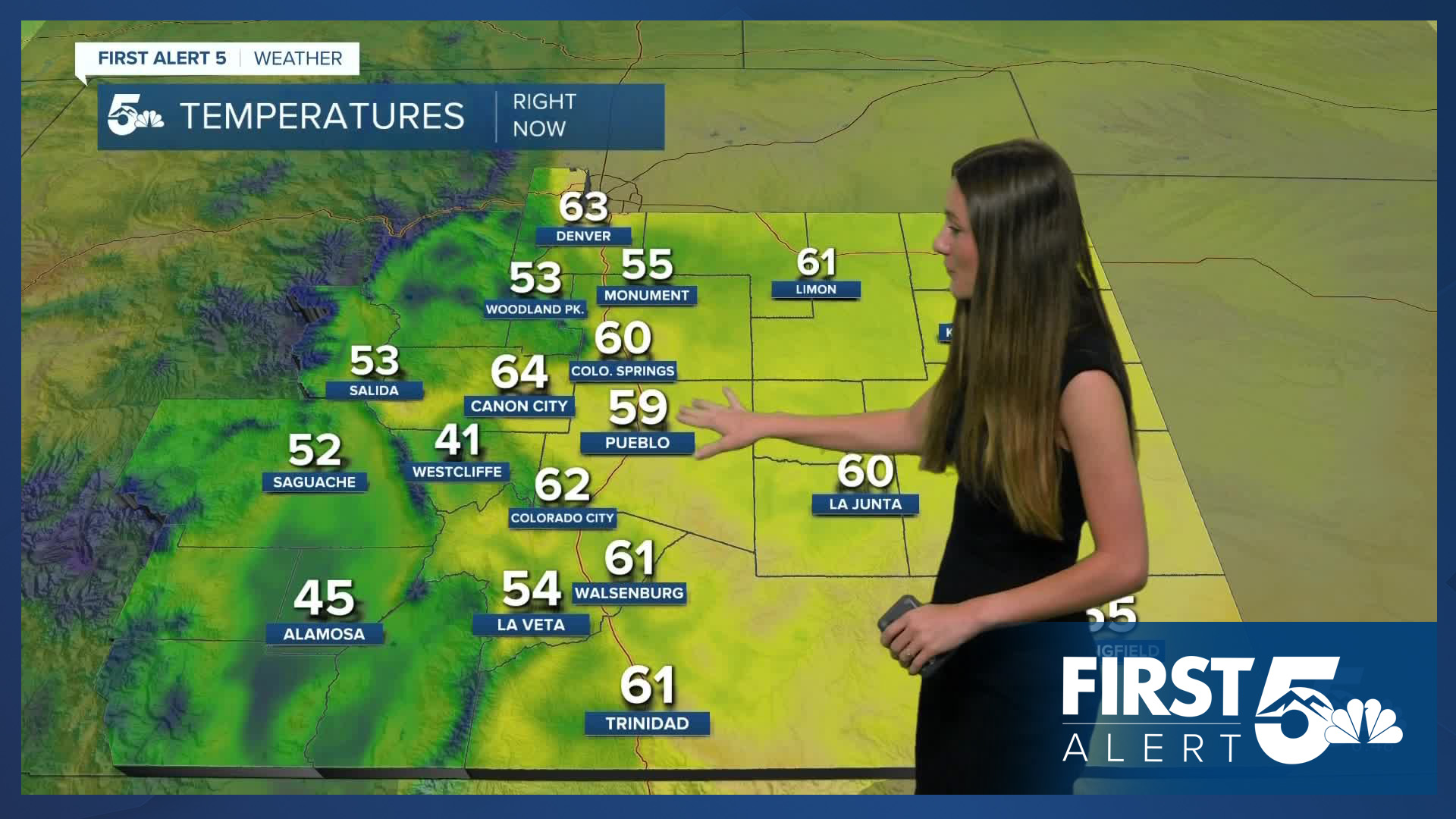
Colorado Springs forecast: High: 85; Low: 56.
Colorado Springs will have mostly clear conditions through 11AM. Storms will start to fire up around noon and become more severe closer to the late afternoon.
Pueblo forecast: High: 92; Low: 59.
Pueblo will start the day with temperatures in the 60s and mostly clear conditions. This forecast will shift pretty dramatically once we hit the afternoon. Strong to severe storms will be possible starting around 12:00PM to 1:00PM. Highs will be in the lower 90s, so cooler than yesterday. We will continue that cool down into Thursday.
Canon City forecast: High: 90; Low: 61.
Canon City will start the morning with temperatures in the mid-to-lower 60s. By the afternoon, storms will be moving into Fremont county and some of these storms have the potential to be severe. Storms will start to calm down around 8PM this evening. Highs today will be in the lower 90s.
Woodland Park forecast: High: 78; Low: 47.
Woodland Park will start the day off with temperatures in the 40s. By the late-morning these temperatures will rise into the 70s. Storms will begin around 12PM. Highs will top off in the upper 70s.
Tri-Lakes forecast: High: 81; Low: 53.
Monument will start off with mostly clear skies and light winds around 5 to 10mph. Highs will reach the lower 80s for today. Storms will be possible from 12PM to 8PM. Some of these storms will have the possibility to be severe. Overnight lows will drop into the lower 50s.
Plains forecast: High: 80s & 90s; Low: 50s & 60s.
The plains will likely see most of the severe threat for today. Ping pong ball sized hail and winds up to 70mph will be possible with a few of these storms. Storms will move towards the eastern side of Colorado closer to the afternoon and later on in the evening. Temperatures today will rise into the 80s and 90s across the area.
Walsenburg and Trinidad forecast: High: 88/89; Low: 56.
The southern I-25 corridor will have heavy rain and thunderstorms by the afternoon. Some of these storms will likely become severe. Storms will be possible from 12PM to 8PM. Highs will be in the upper 80s and overnight lows will be in the mid-50s.
Mountains forecast: High: 80s; Low: 50s.
The mountains will have storms popping up around mid-morning. They will start off spotty and become more widespread by the afternoon. The severe threat is not as high for the mountains, but lightning and gusty winds will still be possible.
Extended outlook forecast:
That cold front will drop highs to below average going into Thursday. This will give many of us a brief break from the heat. Temperatures will warm back up going into Friday. Storm chances will return on Thursday from the leftover moisture from storms on Wednesday.
The back half of the week will have the possibility for isolated storms. Monsoonal moisture will keep these storm chances through the weekend.
____
Curious about the First Alert 5 Weather Storm Impact Scale? Check out our cheatsheet explainer.
Watch KOAA News5 on your time, anytime with our free streaming app available for your Roku, FireTV, AppleTV and Android TV. Just search KOAA News5, download and start watching.
