

Tonight's Forecast:
A few storms will be possible this evening, but as these storms push east they will slowly lose their strength. Overnight lows will drop into the 50s and 60s across southern Colorado.
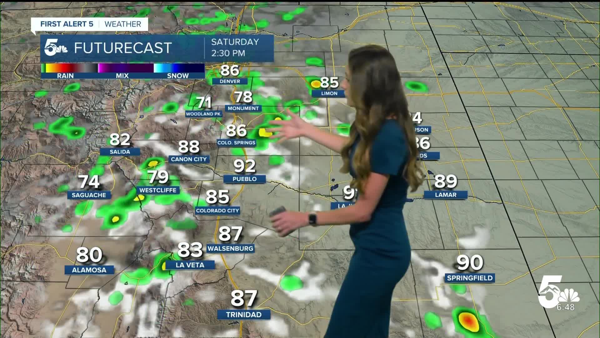
Some of this smoke and haze will stick around on Saturday, especially in the morning. Showers and thunderstorms will move onto the I-25 corridor by the afternoon. Some of these storms have the potential to be severe, and flash flooding still remains a concern.
Colorado Springs forecast: Low: 54; High: 86;
Colorado Springs will have the haze and smoke stick around through Saturday. Some showers and storms will make their way off the higher terrain and onto I-25 by the afternoon. Some of these storms will have the potential to be severe. Highs will be in the mid-80s.
Pueblo forecast: Low: 57; High: 93;
Morning lows will be in the upper 50s. Saturday will have some afternoon storms across the area and will end around sunset. Temperatures will continue to stay in the 90s. Drier air will move in on Sunday and give us a good stretch of dry conditions.
Canon City forecast: Low: 59; High: 90;
Storms and clouds will clear out overnight and lows will dip into the upper 50s. Canon City will have another warm day on Saturday with temperatures in the lower 90s. A few showers and thunderstorms will be possible in the area starting in the afternoon.
Woodland Park forecast: Low: 48; High: 79;
Woodland Park will have enough moisture leftover for some afternoon thunderstorms going into Saturday afternoon. Smoke and haze will be in the area, so if you have any respiratory issues it would be best to stay inside. Warmer conditions will move into the area starting on Sunday.
Tri-Lakes forecast: Low: 53; High: 83;
Monument will continue to clear out overnight and make way for mostly sunny conditions on Saturday morning. The smoke and haze will stay put throughout the day, and showers and thunderstorms will pick up in the afternoon. Highs will be in the lower 80s.
Plains forecast: Low: 50s & 60s; High: 80s & 90s;
The plains will have the potential for some severe storms on Saturday evening. These storms could produce gusty winds, heavy rainfall, hail, and cloud to ground lightning. Highs will be in the 80s and 90s in the area.
Walsenburg and Trinidad forecast: Low: 56/55; High: 88/89;
The southern I-25 corridor will have storms continue to push east, but there is still a concern for some flash flooding going into Saturday. Storms will fire up in the afternoon and a few of these storms may become severe. Highs will be in the upper 80s.
Mountains forecast: Low: 40s & 50s; High: 70s & 80s;
The mountains will have showers and thunderstorms in the area starting in the late morning and lasting through the afternoon. Some of these storms have the potential to produce some flash flooding and heavy rainfall. Temperatures will be in the 70s and 80s.
Extended outlook forecast:
We are tracking some drier air that will move into the area along with warmer temperatures. Things will really heat up on Tuesday with highs getting into the 90s for Colorado Springs and 100s for Pueblo. This will last throughout the work week.
____
Curious about the First Alert 5 Weather Storm Impact Scale? Check out our cheatsheet explainer.
Watch KOAA News5 on your time, anytime with our free streaming app available for your Roku, FireTV, AppleTV and Android TV. Just search KOAA News5, download and start watching.
