

Today’s Forecast:
A winter storm is coming to the mountains and lighter snow will blow through southern Colorado today and tonight. We'll see the most snow in and around the Continental Divide, but several areas in southern Colorado, like the Sangre De Cristos and Wet Mountain Valley, could see large snow totals. Those in the plains from Pueblo east shouldn't see much snow, but ice on the roadways could become an issue tonight.
High Impact Mountain Snow:
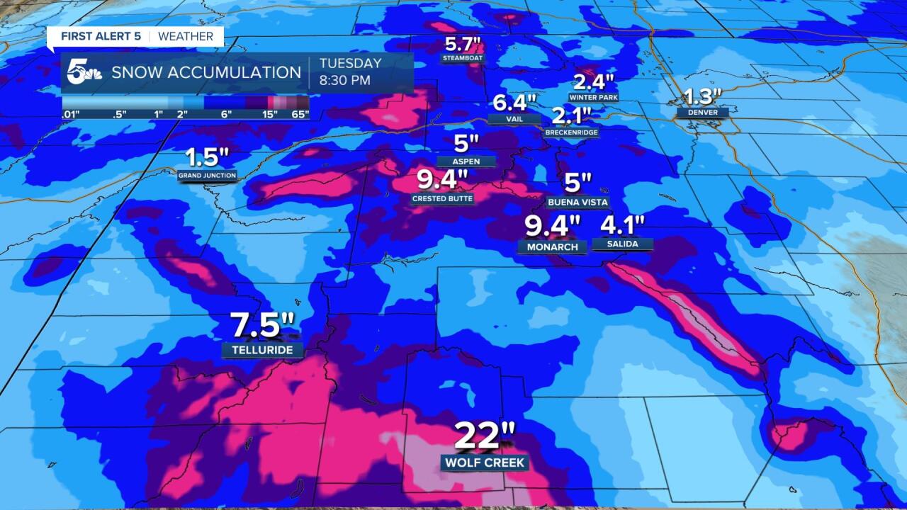
The heaviest snow in the region should fall in the mountains, especially the San Juans and the ski towns near the Continental Divide. Snow started falling Sunday night, so any drive west you do over the next 24 hours will be slick and slow.
Uncertainly in the Pikes Peak Region:
We know snow is likely in the Pikes Peak Region due to the easterly upslope winds that will develop later today, but we still have low confidence in this system.
A moderate snow band is probably going to form in El Paso or Teller County, but knowing exactly where is the reason for our uncertainly. Snow bands are usually only a few miles wide, but it could easily lead to 3 or 4 inches locally within that bad.
Regardless, most of the snow in the Pikes Peak Region will fall from the late afternoon through the overnight hours, meaning the late evening and overnight commutes will be slick and slow.
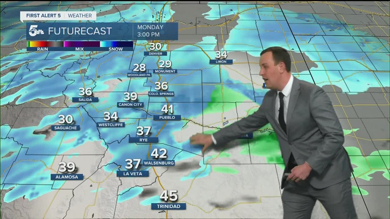
COLORADO SPRINGS: High: 34; Low: 21. Flurries are possible in the first half of the day but the real accumulating snow should start late today and overnight. We think a snow band could form in El Paso County, so while most of the city should see somewhere between 1 to 4 inches of snow (higher totals generally west of I-25 and north of Garden of the Gods Road), there could be a rogue 5-mile wide band were at least 4 inches falls. Overnight and early Tuesday commutes will be the slickest commutes.
PUEBLO: High: 38; Low: 22. We'll be cold and cloudy today with light blowing snow late today and tonight. There could be some slick and icy spots from wet pavement freezing overnight, but snow totals for Pueblo look to stay below an inch. Just be careful tonight and tomorrow morning in case we develop areas of black ice.
CANON CITY: High: 39; Low: 28. Flurries are possible in the morning and early afternoon but the bulk of our accumulating snow will fall late today and tonight. Snow will probably be heavier west of Canon City and south near the Wet Mountains, but even an inch of snow could cause a slippery Tuesday morning commute.
WOODLAND PARK: High: 30; Low: 18. Light snow is possible during the morning but most of the accumulating snow will fall from late today through the overnight hours. We think heavier snow will stay west of Teller County, but a general 2 to 4 inches is expected for most towns. If a snow band makes it over Pikes Peak, we could see local snow totals greater than 4 inches, but Pikes Peak is usually a pretty good block for snow bands.
TRI-LAKES: High: 30s; Low: 10s. Flurries are possible in the first half of the day but the real accumulating snow should start late today and overnight. A snow band is possible this evening and that could help push snow totals over the 3 inch mark. Travel in town and over Monument Hill on I-25 will be really slow and slick tonight and early Tuesday morning.
PLAINS: High: 30/40s; Low: 20s. We won't see much snow at all through the plains, but the best accumulations later today and tonight will be north of Highway 50. There is the chance for freezing drizzle Tuesday morning along the CO/KS border, so be careful if your drives take you farther east Tuesday morning.
WALSENBURG/TRINIDAD: High: 30/40s; Low: 20s. Light snow is possible today and tonight, but the bulk of the accumulating snow is expected to stay west of I-25 near Cuchara, La Veta, and La Veta Pass. Even with less than an inch of snow expected at this time, that light bit of moisture on cold roads tonight could lead to a few icy spots.
MOUNTAINS: High: 30s; Low: 20s. The biggest snow accumulation will occur along the Continental Divide, especially in the San Juans and La Garitas. The Wet Mountain Valley and Sangre De Cristos should see several inches of snow today and tonight, and there could be another wave of 1 to 3 inches that passes through that area tomorrow afternoon. The Wet Mountains should only get a few inches today and tonight, but slick drives should be expected.
Extended Outlook:
Tuesday morning could be slick from leftover snow tonight, but we shouldn't get much more snow later in the day Tuesady. Wednesday and Thursday both look dry, but light snow and flurries are possible Friday afternoon and evening.
